| Birth | : | 1 Oct 1852 Van Buren County, Iowa, USA |
| Death | : | 25 Dec 1923 Milton, Van Buren County, Iowa, USA |
| Burial | : | Refuge Baptist Church Cemetery, Dana, Henderson County, USA |
| Coordinate | : | 35.3288002, -82.3751984 |
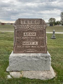
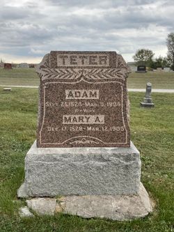
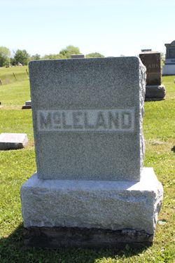
| Description | : | Christena Isabella McLeland was born near Upton, Van Buren county, Iowa, Oct. 1, 1852, and died at her home in Milton, Iowa, at five o'clock Christmas morning, December 25, 1923 at the age of seventy-one years, two months and twenty-four days. She was a daughter of Adam and Mary A. Teter and was united in marriage to William E. McLeland, Oct. 26, 1872. To this union were born eight children, seven sons and one daughter. She was bereft of her husband, who passed away Feb. [13th or 18th], 1918, and a few months after the death of the husband her... Read More |
frequently asked questions (FAQ):
-
Where is Isabel Teter McLeland's memorial?
Isabel Teter McLeland's memorial is located at: Refuge Baptist Church Cemetery, Dana, Henderson County, USA.
-
When did Isabel Teter McLeland death?
Isabel Teter McLeland death on 25 Dec 1923 in Milton, Van Buren County, Iowa, USA
-
Where are the coordinates of the Isabel Teter McLeland's memorial?
Latitude: 35.3288002
Longitude: -82.3751984
Family Members:
Parent
Spouse
Siblings
Children
Flowers:
Nearby Cemetories:
1. Refuge Baptist Church Cemetery
Dana, Henderson County, USA
Coordinate: 35.3288002, -82.3751984
2. Dana United Methodist Church Cemetery
Dana, Henderson County, USA
Coordinate: 35.3367271, -82.3744049
3. Dana Baptist Church Cemetery
Dana, Henderson County, USA
Coordinate: 35.3395300, -82.3729300
4. Basiewicz Family Cemetery
Dana, Henderson County, USA
Coordinate: 35.3343700, -82.3603700
5. Hill Family Cemetery
Dana, Henderson County, USA
Coordinate: 35.3416300, -82.3652940
6. Hammett Family Cemetery
Upward, Henderson County, USA
Coordinate: 35.3090400, -82.3868630
7. Stepp Cemetery
Hendersonville, Henderson County, USA
Coordinate: 35.3365000, -82.3464000
8. Stepp Round Hill Cemetery
Hendersonville, Henderson County, USA
Coordinate: 35.3367483, -82.3464429
9. Jones Family Cemetery at Upward
Upward, Henderson County, USA
Coordinate: 35.3022003, -82.3855972
10. Tracy Grove Baptist Church
Henderson County, USA
Coordinate: 35.3142014, -82.4045029
11. Bethel Wesleyan Church Cemetery
Henderson County, USA
Coordinate: 35.3157234, -82.4103165
12. Union Hill Holiness Baptist Church Cemetery
Hendersonville, Henderson County, USA
Coordinate: 35.3522000, -82.3395000
13. Reese Bradley Cemetery
Dana, Henderson County, USA
Coordinate: 35.3386500, -82.3294800
14. Fair Haven Baptist Church Cemetery
Hendersonville, Henderson County, USA
Coordinate: 35.3447800, -82.4203100
15. Kings Grove Church Cemetery
Henderson County, USA
Coordinate: 35.3716740, -82.3685470
16. Gilbert-Justus Family Cemetery
Upward, Henderson County, USA
Coordinate: 35.2861000, -82.3894380
17. Forest Lawn Memorial Park
Henderson County, USA
Coordinate: 35.3225403, -82.4362411
18. Moores Grove Methodist Cemetery
Henderson County, USA
Coordinate: 35.3488007, -82.4318008
19. Ebenezer Baptist Church Cemetery
Hendersonville, Henderson County, USA
Coordinate: 35.3498001, -82.4326019
20. Jones Cemetery at Sugarloaf
Henderson County, USA
Coordinate: 35.3669014, -82.3321991
21. Seagle Cemetery
Henderson County, USA
Coordinate: 35.3553009, -82.4300003
22. Mills Cemetery
Henderson County, USA
Coordinate: 35.3863860, -82.3652670
23. Fruitland Cemetery
Henderson County, USA
Coordinate: 35.3833008, -82.4019012
24. Oak Grove Baptist Church Cemetery
East Flat Rock, Henderson County, USA
Coordinate: 35.2729000, -82.4031580

