


James Edward Porter
| Birth | : | 24 Jan 1854 Stark County, Illinois, USA |
| Death | : | 14 Sep 1866 Cass County, Iowa, USA |
| Burial | : | Pukekohe Public Cemetery, Pukekohe, Auckland Council, New Zealand |
| Coordinate | : | -37.2106400, 174.8974900 |
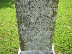
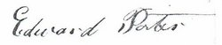
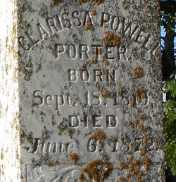
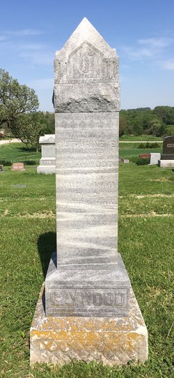
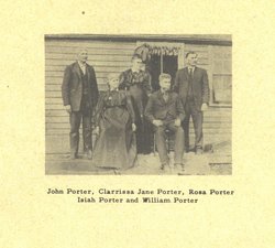
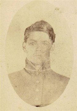
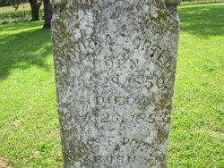
| Description | : | "JAMES" EDWARD PORTER (1854-1866) was the *SON* of Edward Porter (1813-1892), and Clarissa Richardson Powell (1819-1872). James was born 24 January 1854, in Stark County, Illinois, and "died as the result of a fever" on 14 on September 1866, near Reno, Cass County, Iowa. James Edward Porter is buried in the Reno Methodist Cemetery, Edna Township, Cass County, Iowa. His parents and many other Porter kinfolk are also buried in the Reno cemetery. END. [DATE OF CONTRIBUTION: "Biographical information" posted on 02 June 2010, by Cathy Porter-Maynard, great great granddaughter of Edward Porter and Clarissa Richardson (Powell) Porter. (SOURCE:... Read More |
frequently asked questions (FAQ):
-
Where is James Edward Porter's memorial?
James Edward Porter's memorial is located at: Pukekohe Public Cemetery, Pukekohe, Auckland Council, New Zealand.
-
When did James Edward Porter death?
James Edward Porter death on 14 Sep 1866 in Cass County, Iowa, USA
-
Where are the coordinates of the James Edward Porter's memorial?
Latitude: -37.2106400
Longitude: 174.8974900
Family Members:
Parent
Siblings


Nearby Cemetories:
1. Pukekohe Public Cemetery
Pukekohe, Auckland Council, New Zealand
Coordinate: -37.2106400, 174.8974900
2. Pukekohe Catholic Cemetery
Pukekohe, Auckland Council, New Zealand
Coordinate: -37.1951510, 174.9014640
3. Heights Park Cemetery
Paerata, Auckland Council, New Zealand
Coordinate: -37.1781928, 174.8938836
4. Pukekohe East Cemetery
Pukekohe East, Auckland Council, New Zealand
Coordinate: -37.1883500, 174.9459000
5. St Brides Church of England Cemetery
Mauku, Auckland Council, New Zealand
Coordinate: -37.2011260, 174.8120370
6. Mauku Cemetery
Mauku, Auckland Council, New Zealand
Coordinate: -37.2011420, 174.8109100
7. Bombay Presbyterian Church Cemetery
Bombay, Auckland Council, New Zealand
Coordinate: -37.1790700, 174.9826900
8. St. Peter's in the Forest Anglican Cemetery
Bombay, Auckland Council, New Zealand
Coordinate: -37.1869100, 174.9914100
9. Alexandra Redoubt Cemetery
Tuakau, Waikato District, New Zealand
Coordinate: -37.2858200, 174.9419600
10. Tuakau Cemetery
Tuakau, Waikato District, New Zealand
Coordinate: -37.2844420, 174.9465660
11. Mauku Historical Cemetery
Mauku, Auckland Council, New Zealand
Coordinate: -37.1743690, 174.7951870
12. Pokeno Old Soldiers Cemetery
Pokeno, Waikato District, New Zealand
Coordinate: -37.2386120, 175.0094760
13. Pratt's Road Catholic Cemetery
Ramarama, Auckland Council, New Zealand
Coordinate: -37.1425500, 174.9871300
14. Pokeno Cemetery
Pokeno, Waikato District, New Zealand
Coordinate: -37.2364600, 175.0215400
15. Onewhero Cemetery
Onewhero, Waikato District, New Zealand
Coordinate: -37.3158900, 174.9104900
16. St John's Anglican Cemetery Drury
Drury, Auckland Council, New Zealand
Coordinate: -37.1033710, 174.9506070
17. Drury-Runciman War Memorial
Drury, Auckland Council, New Zealand
Coordinate: -37.1025480, 174.9528240
18. Drury Presbyterian Cemetery
Drury, Auckland Council, New Zealand
Coordinate: -37.0991270, 174.9497870
19. Ararimu Schoolhouse Cemetery
Ararimu, Auckland Council, New Zealand
Coordinate: -37.1448376, 175.0359288
20. Papakura South Cemetery
Papakura, Auckland Council, New Zealand
Coordinate: -37.0877300, 174.9464700
21. Waiau Pa Cemetery
Waiau Pa, Auckland Council, New Zealand
Coordinate: -37.1327190, 174.7573970
22. Manutahi Urupā
Port Waikato, Waikato District, New Zealand
Coordinate: -37.3337939, 174.8210091
23. Waiuku Cemetery
Waiuku, Auckland Council, New Zealand
Coordinate: -37.2612630, 174.7346520
24. Tekohanga Urupā
Port Waikato, Waikato District, New Zealand
Coordinate: -37.3314940, 174.8085230