
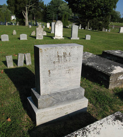
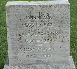
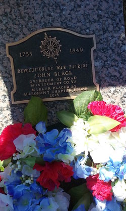
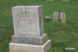

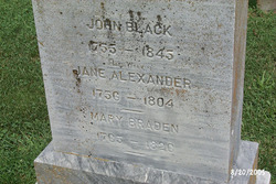
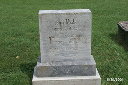
John Black
| Birth | : | 21 Dec 1755 Albemarle County, Virginia, USA |
| Death | : | 14 Jul 1849 Blacksburg, Montgomery County, Virginia, USA |
| Burial | : | Sylvan Cemetery, Citrus Heights, Sacramento County, USA |
| Coordinate | : | 38.7001534, -121.2904587 |
| Description | : | Served in the American Revolutionary War. John Black, son of Samuel Black and Jane Porter, was born 21 December 1755. He married Jane Alexander 12 August 1777 in Augusta County, Virginia. His gravestone says he died in 1845, but many say he died in 1849. John Black, was one of the founders of Blacksburg, Virginia. When John’s father Samuel Black died in 1792, the land was evenly divided into two sections by his sons. The road now known as Draper Road is the dividing line between the sections. John Black's property was later developed... Read More |
frequently asked questions (FAQ):
-
Where is John Black's memorial?
John Black's memorial is located at: Sylvan Cemetery, Citrus Heights, Sacramento County, USA.
-
When did John Black death?
John Black death on 14 Jul 1849 in Blacksburg, Montgomery County, Virginia, USA
-
Where are the coordinates of the John Black's memorial?
Latitude: 38.7001534
Longitude: -121.2904587
Family Members:
Parent
Spouse
Siblings
Children

Flowers:


Nearby Cemetories:
1. Sylvan Cemetery
Citrus Heights, Sacramento County, USA
Coordinate: 38.7001534, -121.2904587
2. Calvary Catholic Cemetery and Mausoleum
Sacramento, Sacramento County, USA
Coordinate: 38.6937180, -121.3233109
3. Mount Vernon Memorial Park
Fair Oaks, Sacramento County, USA
Coordinate: 38.6800003, -121.2566986
4. Sierra Hills Memorial Park
Sacramento, Sacramento County, USA
Coordinate: 38.6843987, -121.3281021
5. Sierra Hills Pet Cemetery
Sacramento, Sacramento County, USA
Coordinate: 38.6863500, -121.3305300
6. Fair Oaks Cemetery
Fair Oaks, Sacramento County, USA
Coordinate: 38.6501167, -121.2792000
7. Boothill Cemetery
Roseville, Placer County, USA
Coordinate: 38.7598730, -121.2712130
8. Fair Oaks United Methodist Church Memorial Garden
Fair Oaks, Sacramento County, USA
Coordinate: 38.6396300, -121.2744600
9. Roseville Public Cemetery District
Roseville, Placer County, USA
Coordinate: 38.7606010, -121.2707977
10. Union Cemetery
Roseville, Placer County, USA
Coordinate: 38.7302600, -121.3924200
11. China Mission-Chung Wah Chinese Cemetery
Folsom, Sacramento County, USA
Coordinate: 38.6698410, -121.1851790
12. Young Wo Cemetery
Folsom, Sacramento County, USA
Coordinate: 38.6733400, -121.1835000
13. Lakeside Memorial Lawn Cemetery
Folsom, Sacramento County, USA
Coordinate: 38.6715300, -121.1841000
14. Carmichael Presbyterian Church Columbarium
Carmichael, Sacramento County, USA
Coordinate: 38.6179500, -121.3324500
15. Saint John the Baptist Catholic Church Cemetery
Folsom, Sacramento County, USA
Coordinate: 38.6721900, -121.1803000
16. F.O.E. 929 Cemetery
Folsom, Sacramento County, USA
Coordinate: 38.6717010, -121.1801010
17. Rocklin Cemetery
Rocklin, Placer County, USA
Coordinate: 38.7827670, -121.2337980
18. Folsom Prison Cemetery
Folsom, Sacramento County, USA
Coordinate: 38.6952860, -121.1636690
19. School House Park Cemetery
Roseville, Placer County, USA
Coordinate: 38.7893180, -121.3578670
20. Kilgore Cemetery
Rancho Cordova, Sacramento County, USA
Coordinate: 38.5978012, -121.2683029
21. Saint Michaels Episcopal Church Columbarium
Carmichael, Sacramento County, USA
Coordinate: 38.6042800, -121.3547200
22. Saint Marks Methodist Church Memorial Tree
Sacramento, Sacramento County, USA
Coordinate: 38.6076500, -121.3750680
23. Shepherd of the Sierra Memorial Garden
Loomis, Placer County, USA
Coordinate: 38.7890800, -121.1944200
24. Sunset Lawn Chapel of the Chimes Memorial Park
Sacramento, Sacramento County, USA
Coordinate: 38.6514816, -121.4384842