

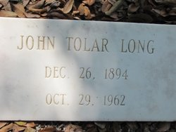
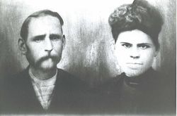
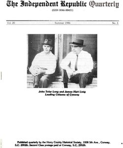
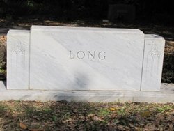
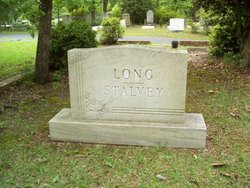
John Tolar Long
| Birth | : | 26 Dec 1894 |
| Death | : | 29 Oct 1962 |
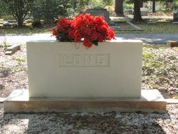
| Burial | : | Ottawa River Cemetery, Rimer, Putnam County, USA |
| Coordinate | : | 40.9061012, -84.2080994 |
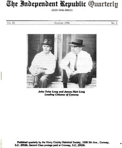
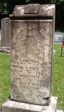
| Description | : | John T. Long Retired Banker of Conway John Tolar Long, 67, retired banking executive of 1102 Oak St., Conway, died October 29, 1962. Mr. Long was born in the Greenwood section of Horry County, Dec. 26, 1894, a son of the late Lorenzo Dow and Bettie McMillan Long. He was a member of the First Baptist Church and a member of the Annex Bible Class, a veteran of World War I, a charter member of Post 111 of the American Legion of Conway, a member of Conway Lodge No. 65 AFM. Mr. Long was associated with the old Farmers Bank of... Read More |
frequently asked questions (FAQ):
-
Where is John Tolar Long's memorial?
John Tolar Long's memorial is located at: Ottawa River Cemetery, Rimer, Putnam County, USA.
-
When did John Tolar Long death?
John Tolar Long death on 29 Oct 1962 in
-
Where are the coordinates of the John Tolar Long's memorial?
Latitude: 40.9061012
Longitude: -84.2080994
Family Members:
Parent
Spouse
Siblings

Flowers:


Nearby Cemetories:
1. Ottawa River Cemetery
Rimer, Putnam County, USA
Coordinate: 40.9061012, -84.2080994
2. Reynolds Cemetery
Sugar Creek Township, Putnam County, USA
Coordinate: 40.9232940, -84.1986030
3. Keirns Cemetery
Sugar Creek Township, Putnam County, USA
Coordinate: 40.8875008, -84.2181015
4. Hughes Cemetery
Union Township, Putnam County, USA
Coordinate: 40.9458008, -84.1616974
5. Carmen Cemetery
Gomer, Allen County, USA
Coordinate: 40.8531380, -84.2118660
6. Vaughnsville Cemetery
Vaughnsville, Putnam County, USA
Coordinate: 40.8754275, -84.1505957
7. Raabe Cemetery
Fort Jennings, Putnam County, USA
Coordinate: 40.8993988, -84.2789001
8. Saint Joseph Cemetery
Fort Jennings, Putnam County, USA
Coordinate: 40.9056015, -84.2928009
9. Clevenger Cemetery
Kalida, Putnam County, USA
Coordinate: 40.9679460, -84.1857790
10. Pike Run Cemetery
Gomer, Allen County, USA
Coordinate: 40.8432999, -84.1669006
11. Mount Calvary Cemetery
Fort Jennings, Putnam County, USA
Coordinate: 40.8986015, -84.3035965
12. Hadding Cemetery
Gomer, Allen County, USA
Coordinate: 40.8319016, -84.2035980
13. Union Township Cemetery
Kalida, Putnam County, USA
Coordinate: 40.9843500, -84.2110400
14. Saint Michaels Cemetery
Kalida, Putnam County, USA
Coordinate: 40.9846992, -84.2102966
15. Martz Cemetery
Cairo, Allen County, USA
Coordinate: 40.8485170, -84.1280870
16. New Saint John's Catholic Cemetery
Delphos, Allen County, USA
Coordinate: 40.8451390, -84.2889380
17. Hartshorn Cemetery
Allen County, USA
Coordinate: 40.8424988, -84.2908020
18. Salem Mennonite Cemetery
Elida, Allen County, USA
Coordinate: 40.8171220, -84.1851000
19. Truro Cemetery
Columbus Grove, Putnam County, USA
Coordinate: 40.9056015, -84.0847015
20. Oard Cemetery
West Cairo, Allen County, USA
Coordinate: 40.8326550, -84.1305760
21. Walnut Grove Cemetery
Delphos, Allen County, USA
Coordinate: 40.8300018, -84.2906036
22. Wetherell Cemetery
Cloverdale, Putnam County, USA
Coordinate: 40.9963540, -84.2665100
23. Saint Anthony Cemetery
Columbus Grove, Putnam County, USA
Coordinate: 40.9197006, -84.0753021
24. Saint Marys Cemetery
Ottoville, Putnam County, USA
Coordinate: 40.9261017, -84.3399963