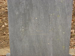
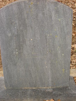
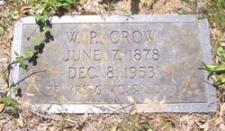
John Walter Crow
| Birth | : | 3 Feb 1891 Greenville County, South Carolina, USA |
| Death | : | 10 Nov 1923 Cherokee County, South Carolina, USA |
| Burial | : | Bellview Cemetery, Springfield, Greene County, USA |
| Coordinate | : | 37.2880287, -93.2539215 |
| Description | : | Info provided by Dwight Crowe: Death certificate, number 17256 on Ancestry.com for Walter Crow. Full name as John Walter Crow. Parents listed as James A. Crow and Mattie Manley, informant, Wilton P. Crow. Burial Mt. Zion Church [SIC; Zion Hill Baptist Church] on 12 Nov 1923. Died of a fractured skull in automobile accident. Single when he died in 1923. 1900 Census shows James A Mattie Crow in Dunklin Township (near Hickory Tavern, Greenville County, SC. Four sons and one daughter living at home: Arthur (19), Lucia (17), Ella (14), Jesse (11), Walter (9). James b.Nov 1859; Mattie b.Jun 1858. 1930 Census... Read More |
frequently asked questions (FAQ):
-
Where is John Walter Crow's memorial?
John Walter Crow's memorial is located at: Bellview Cemetery, Springfield, Greene County, USA.
-
When did John Walter Crow death?
John Walter Crow death on 10 Nov 1923 in Cherokee County, South Carolina, USA
-
Where are the coordinates of the John Walter Crow's memorial?
Latitude: 37.2880287
Longitude: -93.2539215
Family Members:
Parent
Siblings
Flowers:
Nearby Cemetories:
1. Bellview Cemetery
Springfield, Greene County, USA
Coordinate: 37.2880287, -93.2539215
2. Greenlawn Memorial Gardens
Springfield, Greene County, USA
Coordinate: 37.2611008, -93.2750015
3. Union Campground Cemetery
Springfield, Greene County, USA
Coordinate: 37.2609400, -93.2234000
4. Mount Comfort Cemetery
Springfield, Greene County, USA
Coordinate: 37.3250010, -93.2475450
5. Banfield Cemetery
Greene County, USA
Coordinate: 37.2779400, -93.3071900
6. Dysart Cemetery
Springfield, Greene County, USA
Coordinate: 37.2516020, -93.2913170
7. Hancock-Morton-Westmoreland Cemetery
Greene County, USA
Coordinate: 37.2489014, -93.2133026
8. Doling Park
Springfield, Greene County, USA
Coordinate: 37.2461815, -93.2902374
9. Liberty Cemetery
Springfield, Greene County, USA
Coordinate: 37.3192000, -93.1993900
10. Mullings Family Cemetery
Greene County, USA
Coordinate: 37.3111110, -93.3197520
11. Wilson Cemetery
Robberson Number 2 Township, Greene County, USA
Coordinate: 37.2894530, -93.3388070
12. Sac River Cemetery AKA Slave Cemetery
Robberson Number 2 Township, Greene County, USA
Coordinate: 37.2898990, -93.3398060
13. Old Salem Cemetery
Springfield, Greene County, USA
Coordinate: 37.3558006, -93.2380981
14. Eastlawn Cemetery
Springfield, Greene County, USA
Coordinate: 37.2155991, -93.2514038
15. Lincoln Memorial Park Cemetery
Springfield, Greene County, USA
Coordinate: 37.2108002, -93.2518997
16. Elm Springs Cemetery
Greene County, USA
Coordinate: 37.3426674, -93.1851045
17. Elm Spring Cemetery
Greene County, USA
Coordinate: 37.3427600, -93.1849600
18. Christ Episcopal Church Columbarium
Springfield, Greene County, USA
Coordinate: 37.2071800, -93.2862800
19. Keet Burial
Springfield, Greene County, USA
Coordinate: 37.2069190, -93.2883940
20. Antioch Cemetery
Springfield, Greene County, USA
Coordinate: 37.2505989, -93.3538971
21. Bodenhamer Cemetery
Greene County, USA
Coordinate: 37.2153015, -93.1841965
22. Robberson Prairie Cemetery
Ebenezer, Greene County, USA
Coordinate: 37.3522600, -93.3366900
23. Danforth Cemetery
Strafford, Greene County, USA
Coordinate: 37.2368850, -93.1554670
24. Potter Family Cemetery
Strafford, Greene County, USA
Coordinate: 37.2656517, -93.1362610


