
| Birth | : | 24 Mar 1844 |
| Death | : | 17 Sep 1903 Van Buren, Crawford County, Arkansas, USA |
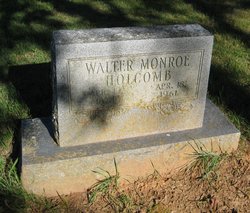
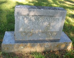
| Burial | : | Holcomb Cemetery, West Fork, Washington County, USA |
| Coordinate | : | 35.8954065, -94.2519087 |
| Description | : | Husband of Martha Marzee Curtis. John was a Farmer and Minister and donated some land for the Holcomb School. John Wesley Holcomb is a Confederate Veteran and served in Arkansas Cavalry, Company F, Washington Regiment. Wife applied for pension record in 1905 and the pension states that John died 17 Sep 1903. HOLCOMB, John W. – (from West Fork) John Holcomb of Valley View died at his daughter’s in Van Buren Thursday. The remains were brought home for interment Friday. Mr. Holcomb leaves a large circle of relatives and friends to mourn his departure. [The... Read More |
frequently asked questions (FAQ):
-
Where is John Wesley Holcomb's memorial?
John Wesley Holcomb's memorial is located at: Holcomb Cemetery, West Fork, Washington County, USA.
-
When did John Wesley Holcomb death?
John Wesley Holcomb death on 17 Sep 1903 in Van Buren, Crawford County, Arkansas, USA
-
Where are the coordinates of the John Wesley Holcomb's memorial?
Latitude: 35.8954065
Longitude: -94.2519087
Family Members:
Spouse

Children
Flowers:


Nearby Cemetories:
1. Holcomb Cemetery
West Fork, Washington County, USA
Coordinate: 35.8954065, -94.2519087
2. Burris Cemetery
Washington County, USA
Coordinate: 35.8935000, -94.2482650
3. Phillips Cemetery
Hogeye, Washington County, USA
Coordinate: 35.9119760, -94.2556360
4. Choate Cemetery
Onda, Washington County, USA
Coordinate: 35.8938200, -94.2732500
5. Billingsley Cemetery
West Fork, Washington County, USA
Coordinate: 35.9132996, -94.2716980
6. Friendship Cemetery
West Fork, Washington County, USA
Coordinate: 35.9043740, -94.2217230
7. McDonald Cemetery
Onda, Washington County, USA
Coordinate: 35.8806000, -94.2799988
8. Howell Cemetery
Prairie Grove, Washington County, USA
Coordinate: 35.9056015, -94.2835999
9. Carney Cemetery
Washington County, USA
Coordinate: 35.9242710, -94.2484530
10. Parks Cemetery
Hogeye, Washington County, USA
Coordinate: 35.8988991, -94.2906036
11. McClelland Cemetery
Washington County, USA
Coordinate: 35.8635950, -94.2410980
12. Union Star Cemetery
West Fork, Washington County, USA
Coordinate: 35.8922005, -94.2031021
13. Baker Cemetery
Onda, Washington County, USA
Coordinate: 35.8680992, -94.2910995
14. Rutherford Cemetery
Prairie Grove, Washington County, USA
Coordinate: 35.9305992, -94.2825012
15. Low Gap Cemetery
West Fork, Washington County, USA
Coordinate: 35.8658218, -94.2063904
16. Dripping Springs Cemetery
Onda, Washington County, USA
Coordinate: 35.8584310, -94.2932080
17. Sharp Cemetery
Prairie Grove, Washington County, USA
Coordinate: 35.9393997, -94.2827988
18. Old Bethlehem Baptist Church Cemetery
Washington County, USA
Coordinate: 35.8481865, -94.2252731
19. Karnes Cemetery
West Fork, Washington County, USA
Coordinate: 35.9084930, -94.1865082
20. West Fork Cemetery
West Fork, Washington County, USA
Coordinate: 35.9324989, -94.1932983
21. Stevenson Leach Cemetery
Prairie Grove, Washington County, USA
Coordinate: 35.9586000, -94.2524000
22. Serenity Place Cemetery
Washington County, USA
Coordinate: 35.8312100, -94.2665000
23. Barron Cemetery
Greenland, Washington County, USA
Coordinate: 35.9599440, -94.2355570
24. John A Rutherford - Martin Cemetery
Washington County, USA
Coordinate: 35.9513950, -94.2011490