
| Birth | : | 12 Oct 1836 Kaltenholzhausen, Rhein-Lahn-Kreis, Rheinland-Pfalz, Germany |
| Death | : | 28 Nov 1912 California, USA |
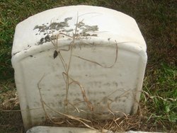
| Burial | : | Gavilan Hills Memorial Park, Gilroy, Santa Clara County, USA |
| Coordinate | : | 37.0124000, -121.5909200 |
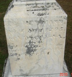
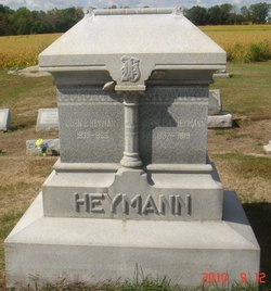
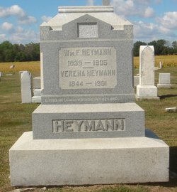
| Description | : | Note: The name appears as both Mohr and Moore. Katherine attended the village school in Kaltenholzhausen until age 12 when she immigrated with her parents and four brothers to the United States. They settled in Lyme Township, Huron County, Ohio, and Katherine stayed living with her family until her marriage to Charles Mohr/Moore on October 25, 1853. She and Charles moved to a farm in Sherman Township, Huron County. This would be their home for the next 19 years and where 11 of their fifteen children would be born. In the spring of 1873, the family moved to a farm with more... Read More |
frequently asked questions (FAQ):
-
Where is Katherine Heymann Moore's memorial?
Katherine Heymann Moore's memorial is located at: Gavilan Hills Memorial Park, Gilroy, Santa Clara County, USA.
-
When did Katherine Heymann Moore death?
Katherine Heymann Moore death on 28 Nov 1912 in California, USA
-
Where are the coordinates of the Katherine Heymann Moore's memorial?
Latitude: 37.0124000
Longitude: -121.5909200
Family Members:
Parent
Spouse

Siblings
Children
Flowers:


Nearby Cemetories:
1. Gavilan Hills Memorial Park
Gilroy, Santa Clara County, USA
Coordinate: 37.0124000, -121.5909200
2. Saint Mary Cemetery
Gilroy, Santa Clara County, USA
Coordinate: 37.0134300, -121.5882000
3. Saint Mary Church Cemetery
Gilroy, Santa Clara County, USA
Coordinate: 37.0155970, -121.5765950
4. Pajaro Valley Memorial Park
Watsonville, Santa Cruz County, USA
Coordinate: 36.9629669, -121.7219391
5. Mount Hope Cemetery
Morgan Hill, Santa Clara County, USA
Coordinate: 37.1195900, -121.6530000
6. Valley Public Cemetery
Watsonville, Santa Cruz County, USA
Coordinate: 36.9418983, -121.7400513
7. Valley Catholic Cemetery
Watsonville, Santa Cruz County, USA
Coordinate: 36.9415932, -121.7405777
8. Pioneer Cemetery
Watsonville, Santa Cruz County, USA
Coordinate: 36.9258560, -121.7642790
9. Watsonville Catholic Cemetery
Watsonville, Santa Cruz County, USA
Coordinate: 36.9278564, -121.7658463
10. All Saints Episcopal Church Memorial Garden
Watsonville, Santa Cruz County, USA
Coordinate: 36.9102310, -121.7568950
11. San Juan Bautista Cemetery
San Juan Bautista, San Benito County, USA
Coordinate: 36.8457985, -121.5438995
12. Mission San Juan Bautista Cemetery
San Juan Bautista, San Benito County, USA
Coordinate: 36.8460007, -121.5339966
13. Hambey Cemetery
Monterey County, USA
Coordinate: 36.8372002, -121.6793976
14. Monterey Bay Loved Pet Cemetery
Monterey County, USA
Coordinate: 36.8326160, -121.6812820
15. Saint Josephs Monastery Cemetery
Aptos, Santa Cruz County, USA
Coordinate: 36.9947200, -121.8361700
16. Day Valley Cemetery
Aptos, Santa Cruz County, USA
Coordinate: 36.9974050, -121.8503360
17. Odd Fellows Cemetery
Hollister, San Benito County, USA
Coordinate: 36.8571210, -121.4104100
18. Christ Lutheran Church Columbarium
Aptos, Santa Cruz County, USA
Coordinate: 36.9700550, -121.8704370
19. Stephen Norriss Gravesite
Monterey County, USA
Coordinate: 36.8214110, -121.7601080
20. Calvary-Sacred Heart Cemetery
Hollister, San Benito County, USA
Coordinate: 36.8483009, -121.3767014
21. Hacienda Cemetery and Memorial Park
New Almaden, Santa Clara County, USA
Coordinate: 37.1741940, -121.8230920
22. Hidalgo Cemetery
San Jose, Santa Clara County, USA
Coordinate: 37.1707800, -121.8358700
23. Saint Benedicts Columbarium
Hollister, San Benito County, USA
Coordinate: 36.8337440, -121.3667120
24. Guadalupe Cemetery
New Almaden, Santa Clara County, USA
Coordinate: 37.1734690, -121.8402820