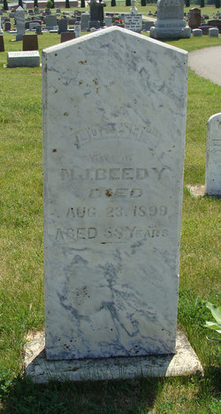
| Birth | : | 1848 New York, USA |
| Death | : | 30 Dec 1928 Newton, Jasper County, Iowa, USA |
| Burial | : | St. Agatha and St. Oswin Churchyard, Gilling West, Richmondshire District, England |
| Coordinate | : | 54.4414840, -1.7209980 |
| Plot | : | Sec 7 Lot 77 Block 1 |
| Description | : | Age 80, son of Elias & Hannah (Dodge) Hall |
frequently asked questions (FAQ):
-
Where is Lambert E Hall's memorial?
Lambert E Hall's memorial is located at: St. Agatha and St. Oswin Churchyard, Gilling West, Richmondshire District, England.
-
When did Lambert E Hall death?
Lambert E Hall death on 30 Dec 1928 in Newton, Jasper County, Iowa, USA
-
Where are the coordinates of the Lambert E Hall's memorial?
Latitude: 54.4414840
Longitude: -1.7209980
Family Members:
Parent
Spouse
Siblings
Flowers:
Nearby Cemetories:
1. St. Agatha and St. Oswin Churchyard
Gilling West, Richmondshire District, England
Coordinate: 54.4414840, -1.7209980
2. St James the Great Churchyard
Melsonby, Richmondshire District, England
Coordinate: 54.4711100, -1.6916100
3. St Mary the Virgin Churchyard
Richmond, Richmondshire District, England
Coordinate: 54.4046600, -1.7333700
4. St. Peter and St. Felix Churchyard
Kirby Hill, Richmondshire District, England
Coordinate: 54.4546050, -1.7851500
5. Middleton Lodge Chapel
Middleton Tyas, Richmondshire District, England
Coordinate: 54.4562000, -1.6567000
6. Richmond Cemetery
Richmond, Richmondshire District, England
Coordinate: 54.4053750, -1.7572010
7. St Agatha Churchyard
Easby, Richmondshire District, England
Coordinate: 54.3976010, -1.7158320
8. St Michael and All Angels Churchyard
Middleton Tyas, Richmondshire District, England
Coordinate: 54.4451400, -1.6390500
9. St Cuthbert and St Mary Churchyard
Barton, Richmondshire District, England
Coordinate: 54.4754490, -1.6458250
10. St Michael and All Angels Churchyard
Hudswell, Richmondshire District, England
Coordinate: 54.3990300, -1.7846500
11. Brompton-On-Swale Cemetery
Brompton on Swale, Richmondshire District, England
Coordinate: 54.3917400, -1.6608900
12. Catterick Garrison Military Cemetery
Hipswell, Richmondshire District, England
Coordinate: 54.3803100, -1.7138300
13. St John the Baptist Churchyard
Stanwick St John, Richmondshire District, England
Coordinate: 54.5028550, -1.7155730
14. St John The Evangelist Churchyard
Hipswell, Richmondshire District, England
Coordinate: 54.3798700, -1.7130100
15. St Cuthbert Churchyard
Forcett, Richmondshire District, England
Coordinate: 54.5051660, -1.7304510
16. St Paulinus Roman Catholic Churchyard
Brough with St Giles, Richmondshire District, England
Coordinate: 54.3779100, -1.6698900
17. St. Hilda's Churchyard
Caldwell, Richmondshire District, England
Coordinate: 54.5156390, -1.7508220
18. Scorton & District Joint Cemetery
Scorton, Richmondshire District, England
Coordinate: 54.3914400, -1.6156200
19. St Edmund the Martyr Churchyard
Marske, Richmondshire District, England
Coordinate: 54.3997500, -1.8403700
20. Catterick Cemetery
Catterick, Richmondshire District, England
Coordinate: 54.3774700, -1.6349100
21. Saint Mary’s Churchyard
Hutton Magna, Durham Unitary Authority, England
Coordinate: 54.5074500, -1.8060900
22. All Saints Churchyard
Manfield, Richmondshire District, England
Coordinate: 54.5154080, -1.6573120
23. St Anne Churchyard
Catterick, Richmondshire District, England
Coordinate: 54.3768500, -1.6319800
24. St Mary Churchyard
Bolton-on-Swale, Richmondshire District, England
Coordinate: 54.3875300, -1.6127600


