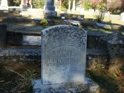
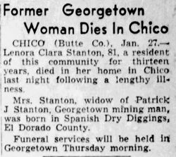
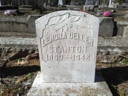
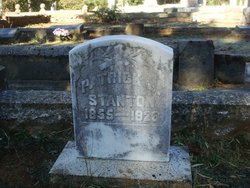
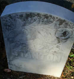
Lenora Clara Deller Stanton
| Birth | : | 5 Apr 1860 Greenwood, El Dorado County, California, USA |
| Death | : | 26 Jan 1942 Chico, Butte County, California, USA |
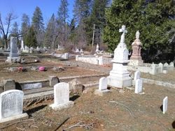
| Burial | : | Georgetown Pioneer Cemetery, Georgetown, El Dorado County, USA |
| Coordinate | : | 38.9068108, -120.8430862 |
| Plot | : | sec 1 row 4 plot 01-4 |
| Description | : | Chico Record Wednesday 28 January 1942 Page 3 Lenora Stanton Requiem mass will be held tomorrow at 10:30 a.m. at the Georgetown Catholic Church for Mrs. Lenora Clara Stanton, Chico resident for 13 years, who died Monday. Burial will follow in Georgetown Cemetery. Friends may call at the Black and Johnson Funeral Home until tonight. Transcribed by Timothy Cahalan Beilby September 5, 2017 from the original obit. |
frequently asked questions (FAQ):
-
Where is Lenora Clara Deller Stanton's memorial?
Lenora Clara Deller Stanton's memorial is located at: Georgetown Pioneer Cemetery, Georgetown, El Dorado County, USA.
-
When did Lenora Clara Deller Stanton death?
Lenora Clara Deller Stanton death on 26 Jan 1942 in Chico, Butte County, California, USA
-
Where are the coordinates of the Lenora Clara Deller Stanton's memorial?
Latitude: 38.9068108
Longitude: -120.8430862
Family Members:
Parent
Spouse
Siblings
Children
Flowers:
Nearby Cemetories:
1. Georgetown Pioneer Cemetery
Georgetown, El Dorado County, USA
Coordinate: 38.9068108, -120.8430862
2. Georgia Slide Cemetery
Georgetown, El Dorado County, USA
Coordinate: 38.9218063, -120.8377838
3. Carmelite Monastery Cemetery
Georgetown, El Dorado County, USA
Coordinate: 38.9273300, -120.8173840
4. Greenwood Pioneer Cemetery
Greenwood, El Dorado County, USA
Coordinate: 38.8985786, -120.9099274
5. Georgetown-Renke Cemetery Annex
Georgetown, El Dorado County, USA
Coordinate: 38.8964610, -120.9116240
6. Spanish Dry Diggings Cemetery
Greenwood, El Dorado County, USA
Coordinate: 38.9431600, -120.9158000
7. Alabama Flat Cemetery
Garden Valley, El Dorado County, USA
Coordinate: 38.8413660, -120.8770510
8. Josephine Mine Cemetery
Volcanoville, El Dorado County, USA
Coordinate: 38.9798000, -120.7892170
9. Todd Valley Cemetery
Placer County, USA
Coordinate: 38.9970900, -120.8541000
10. Spring Garden Indian Cemetery
Foresthill, Placer County, USA
Coordinate: 38.9998620, -120.9049310
11. Kelsey Cemetery
Kelsey, El Dorado County, USA
Coordinate: 38.7949791, -120.8200073
12. Foresthill Community Cemetery
Foresthill, Placer County, USA
Coordinate: 39.0184500, -120.8114700
13. Saint John's Catholic Churchyard
Coloma, El Dorado County, USA
Coordinate: 38.7975311, -120.8919678
14. James Marshall Monument and Gravesite
Coloma, El Dorado County, USA
Coordinate: 38.7963104, -120.8953781
15. Pioneer Cemetery
Coloma, El Dorado County, USA
Coordinate: 38.7943192, -120.8894577
16. Uniontown Cemetery
Lotus, El Dorado County, USA
Coordinate: 38.7994003, -120.9111023
17. Saint Joseph Catholic Cemetery
Foresthill, Placer County, USA
Coordinate: 39.0240200, -120.8068800
18. Indian Creek Cemetery
Coloma, El Dorado County, USA
Coordinate: 38.7974230, -120.9104530
19. Yankee Jims Cemetery
Foresthill, Placer County, USA
Coordinate: 39.0292511, -120.8614349
20. Esoteric Fraternity Cemetery
Applegate, Placer County, USA
Coordinate: 38.9946190, -120.9687490
21. Stoney Bar Cemetery
Foresthill, Placer County, USA
Coordinate: 39.0114980, -120.7408060
22. Chili Bar Toll House Cemetery
Placerville, El Dorado County, USA
Coordinate: 38.7700530, -120.8177660
23. Dickinson Family Cemetery
Placerville, El Dorado County, USA
Coordinate: 38.7970450, -120.7269010
24. Nelsonville Cemetery
Placerville, El Dorado County, USA
Coordinate: 38.7894490, -120.7380720

