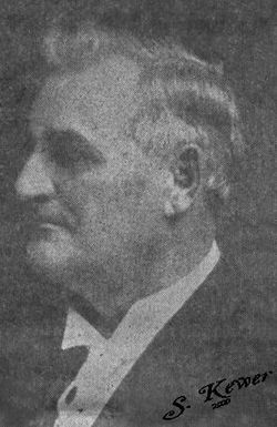
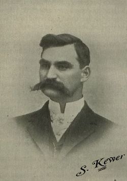
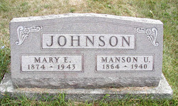
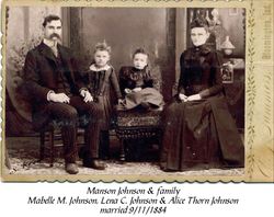
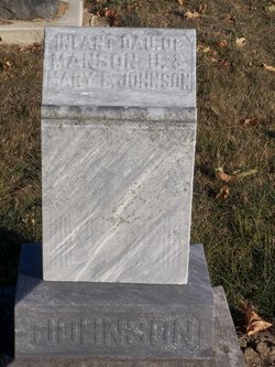
Manson Ulvain Johnson
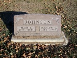
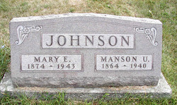
| Birth | : | 20 Oct 1864 Randolph County, Indiana, USA |
| Death | : | 4 Mar 1940 Washington County, Indiana, USA |
| Burial | : | St Agatha Churchyard, Easby, Richmondshire District, England |
| Coordinate | : | 54.3976010, -1.7158320 |
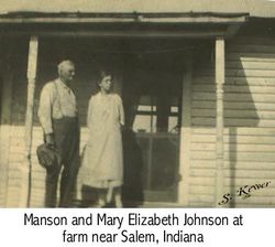
| Description | : | Manson was the oldest of 14 children born to Joseph A. and Elizabeth (Allen) Johnson. Manson graduated from Indiana University in 1890. In 1891 he wrote and published a book, "The Tariff". In 1893 he was elected as Representative to the Indiana General Assembly, 58th Session. In 1894, he began serving as Superintendent of Madison County Schools. In 1895 he became part owner of "The Democrat" newspaper of Madison County and served as publisher for both the Daily and Weekly Democrat. In 1918 he purchased a farm in Salem, Indiana, where he raised O.I.C.... Read More |
frequently asked questions (FAQ):
-
Where is Manson Ulvain Johnson's memorial?
Manson Ulvain Johnson's memorial is located at: St Agatha Churchyard, Easby, Richmondshire District, England.
-
When did Manson Ulvain Johnson death?
Manson Ulvain Johnson death on 4 Mar 1940 in Washington County, Indiana, USA
-
Where are the coordinates of the Manson Ulvain Johnson's memorial?
Latitude: 54.3976010
Longitude: -1.7158320
Family Members:
Parent
Spouse
Siblings
Children
Flowers:
Nearby Cemetories:
1. St Agatha Churchyard
Easby, Richmondshire District, England
Coordinate: 54.3976010, -1.7158320
2. St Mary the Virgin Churchyard
Richmond, Richmondshire District, England
Coordinate: 54.4046600, -1.7333700
3. Catterick Garrison Military Cemetery
Hipswell, Richmondshire District, England
Coordinate: 54.3803100, -1.7138300
4. St John The Evangelist Churchyard
Hipswell, Richmondshire District, England
Coordinate: 54.3798700, -1.7130100
5. Richmond Cemetery
Richmond, Richmondshire District, England
Coordinate: 54.4053750, -1.7572010
6. Brompton-On-Swale Cemetery
Brompton on Swale, Richmondshire District, England
Coordinate: 54.3917400, -1.6608900
7. St Paulinus Roman Catholic Churchyard
Brough with St Giles, Richmondshire District, England
Coordinate: 54.3779100, -1.6698900
8. St Michael and All Angels Churchyard
Hudswell, Richmondshire District, England
Coordinate: 54.3990300, -1.7846500
9. St. Agatha and St. Oswin Churchyard
Gilling West, Richmondshire District, England
Coordinate: 54.4414840, -1.7209980
10. Holy Trinity Churchyard
Tunstall, Richmondshire District, England
Coordinate: 54.3572840, -1.6683920
11. Catterick Cemetery
Catterick, Richmondshire District, England
Coordinate: 54.3774700, -1.6349100
12. St Anne Churchyard
Catterick, Richmondshire District, England
Coordinate: 54.3768500, -1.6319800
13. Scorton & District Joint Cemetery
Scorton, Richmondshire District, England
Coordinate: 54.3914400, -1.6156200
14. St Mary Churchyard
Bolton-on-Swale, Richmondshire District, England
Coordinate: 54.3875300, -1.6127600
15. St Oswald Churchyard
Hauxwell, Richmondshire District, England
Coordinate: 54.3333300, -1.7333300
16. St Michael and All Angels Churchyard
Middleton Tyas, Richmondshire District, England
Coordinate: 54.4451400, -1.6390500
17. St Mary Churchyard
Hornby, Richmondshire District, England
Coordinate: 54.3388470, -1.6594880
18. Middleton Lodge Chapel
Middleton Tyas, Richmondshire District, England
Coordinate: 54.4562000, -1.6567000
19. St Michael and All Angels Churchyard
Downholme, Richmondshire District, England
Coordinate: 54.3799700, -1.8313400
20. St. Peter and St. Felix Churchyard
Kirby Hill, Richmondshire District, England
Coordinate: 54.4546050, -1.7851500
21. St Edmund the Martyr Churchyard
Marske, Richmondshire District, England
Coordinate: 54.3997500, -1.8403700
22. St James the Great Churchyard
Melsonby, Richmondshire District, England
Coordinate: 54.4711100, -1.6916100
23. St Cuthbert and St Mary Churchyard
Barton, Richmondshire District, England
Coordinate: 54.4754490, -1.6458250
24. St. Andrew's Churchyard
Finghall, Richmondshire District, England
Coordinate: 54.3068300, -1.7085500

