

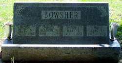
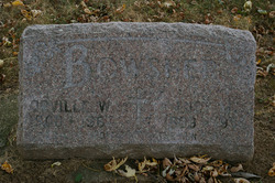
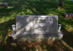
Minnie Blanche “Blanche” Bickel Bowsher
| Birth | : | 24 Jul 1881 Allen County, Ohio, USA |
| Death | : | 10 Jun 1975 Allen County, Ohio, USA |
| Burial | : | St. Andrews Churchyard, Witham on the Hill, South Kesteven District, England |
| Coordinate | : | 52.7364500, -0.4420300 |
| Plot | : | Section C, Row 16 |
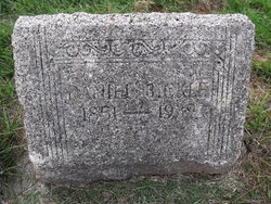
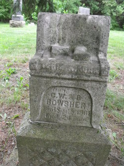
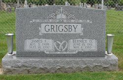
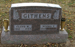
| Description | : | Blanche was born in Monroe Twp., Allen Co., OH, the daughter of Daniel Bickel and "Libbie" Mary Elizabeth Harruff. She married Cloyd William Bowsher on September 25, 1899 in Allen Co., OH. Cloyd and Blanche were the parents of eight children: 1. Orville William Bowsher 2. Verie Wikona Bowsher 3. "Vaundail" Etta Vaundail (Bowsher) Steele 4. Farold Leo Bowsher 5. "Bernice" Ora Bernice (Bowsher) Grigsby 6. Norma E. (Bowsher) Githens 7. Carl Edgar Bowsher 8. Mary Elizabeth Bowsher |
frequently asked questions (FAQ):
-
Where is Minnie Blanche “Blanche” Bickel Bowsher's memorial?
Minnie Blanche “Blanche” Bickel Bowsher's memorial is located at: St. Andrews Churchyard, Witham on the Hill, South Kesteven District, England.
-
When did Minnie Blanche “Blanche” Bickel Bowsher death?
Minnie Blanche “Blanche” Bickel Bowsher death on 10 Jun 1975 in Allen County, Ohio, USA
-
Where are the coordinates of the Minnie Blanche “Blanche” Bickel Bowsher's memorial?
Latitude: 52.7364500
Longitude: -0.4420300
Family Members:
Parent
Spouse
Siblings
Children

Flowers:


Nearby Cemetories:
1. St. Andrews Churchyard
Witham on the Hill, South Kesteven District, England
Coordinate: 52.7364500, -0.4420300
2. Saint Stephen
Carlby, South Kesteven District, England
Coordinate: 52.7125650, -0.4475800
3. St Stephen Churchyard
Careby, South Kesteven District, England
Coordinate: 52.7363500, -0.4823700
4. St Mary Magdalene Churchyard
Essendine, Rutland Unitary Authority, England
Coordinate: 52.7026000, -0.4489000
5. St Faith Churchyard
Wilsthorpe, South Kesteven District, England
Coordinate: 52.7095208, -0.3848166
6. St Wilfrid
Holywell, South Kesteven District, England
Coordinate: 52.7329915, -0.5149881
7. St Peter Churchyard
Creeton, South Kesteven District, England
Coordinate: 52.7669500, -0.4977300
8. St Firmin Churchyard
Thurlby, South Kesteven District, England
Coordinate: 52.7375960, -0.3646650
9. St Michael Churchyard
Edenham, South Kesteven District, England
Coordinate: 52.7836110, -0.4266560
10. Bourne Cemetery
Bourne, South Kesteven District, England
Coordinate: 52.7607264, -0.3714663
11. Bourne Abbey
Bourne, South Kesteven District, England
Coordinate: 52.7661320, -0.3758389
12. St John the Evangelist Churchyard
Ryhall, Rutland Unitary Authority, England
Coordinate: 52.6852000, -0.4685000
13. Ryhall Churchyard Extension
Ryhall, Rutland Unitary Authority, England
Coordinate: 52.6849000, -0.4678700
14. Baston Cemetery
Baston, South Kesteven District, England
Coordinate: 52.7149917, -0.3531338
15. St John the Baptist Churchyard
Baston, South Kesteven District, England
Coordinate: 52.7149530, -0.3530650
16. St James Churchyard
Castle Bytham, South Kesteven District, England
Coordinate: 52.7537140, -0.5367360
17. St Martin Churchyard
Barholm, South Kesteven District, England
Coordinate: 52.6855000, -0.3887600
18. St Mary Churchyard
Swinstead, South Kesteven District, England
Coordinate: 52.7900380, -0.4909380
19. All Saints Churchyard
Little Casterton, Rutland Unitary Authority, England
Coordinate: 52.6775807, -0.4965072
20. St Michael and All Angels Churchyard
Langtoft, South Kesteven District, England
Coordinate: 52.6990300, -0.3389800
21. St Nicholas Churchyard
Swayfield, South Kesteven District, England
Coordinate: 52.7922400, -0.5284400
22. St John the Baptist Churchyard
Morton, South Kesteven District, England
Coordinate: 52.8025100, -0.3724200
23. Newstead Priory
Stamford, South Kesteven District, England
Coordinate: 52.6582800, -0.4542480
24. St Michael & All Angels Churchyard
Uffington, South Kesteven District, England
Coordinate: 52.6570400, -0.4321700