
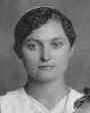
| Birth | : | 30 Mar 1915 |
| Death | : | 11 Feb 2007 |
| Burial | : | Sylvan Cemetery, Citrus Heights, Sacramento County, USA |
| Coordinate | : | 38.7001534, -121.2904587 |
frequently asked questions (FAQ):
-
Where is Tillie A. Policky Karst's memorial?
Tillie A. Policky Karst's memorial is located at: Sylvan Cemetery, Citrus Heights, Sacramento County, USA.
-
When did Tillie A. Policky Karst death?
Tillie A. Policky Karst death on 11 Feb 2007 in
-
Where are the coordinates of the Tillie A. Policky Karst's memorial?
Latitude: 38.7001534
Longitude: -121.2904587
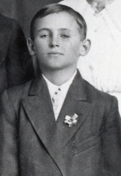
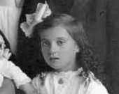
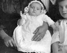
Family Members:
Parent
Spouse
Siblings

Flowers:


Nearby Cemetories:
1. Sylvan Cemetery
Citrus Heights, Sacramento County, USA
Coordinate: 38.7001534, -121.2904587
2. Calvary Catholic Cemetery and Mausoleum
Sacramento, Sacramento County, USA
Coordinate: 38.6937180, -121.3233109
3. Mount Vernon Memorial Park
Fair Oaks, Sacramento County, USA
Coordinate: 38.6800003, -121.2566986
4. Sierra Hills Memorial Park
Sacramento, Sacramento County, USA
Coordinate: 38.6843987, -121.3281021
5. Sierra Hills Pet Cemetery
Sacramento, Sacramento County, USA
Coordinate: 38.6863500, -121.3305300
6. Fair Oaks Cemetery
Fair Oaks, Sacramento County, USA
Coordinate: 38.6501167, -121.2792000
7. Boothill Cemetery
Roseville, Placer County, USA
Coordinate: 38.7598730, -121.2712130
8. Fair Oaks United Methodist Church Memorial Garden
Fair Oaks, Sacramento County, USA
Coordinate: 38.6396300, -121.2744600
9. Roseville Public Cemetery District
Roseville, Placer County, USA
Coordinate: 38.7606010, -121.2707977
10. Union Cemetery
Roseville, Placer County, USA
Coordinate: 38.7302600, -121.3924200
11. China Mission-Chung Wah Chinese Cemetery
Folsom, Sacramento County, USA
Coordinate: 38.6698410, -121.1851790
12. Young Wo Cemetery
Folsom, Sacramento County, USA
Coordinate: 38.6733400, -121.1835000
13. Lakeside Memorial Lawn Cemetery
Folsom, Sacramento County, USA
Coordinate: 38.6715300, -121.1841000
14. Carmichael Presbyterian Church Columbarium
Carmichael, Sacramento County, USA
Coordinate: 38.6179500, -121.3324500
15. Saint John the Baptist Catholic Church Cemetery
Folsom, Sacramento County, USA
Coordinate: 38.6721900, -121.1803000
16. F.O.E. 929 Cemetery
Folsom, Sacramento County, USA
Coordinate: 38.6717010, -121.1801010
17. Rocklin Cemetery
Rocklin, Placer County, USA
Coordinate: 38.7827670, -121.2337980
18. Folsom Prison Cemetery
Folsom, Sacramento County, USA
Coordinate: 38.6952860, -121.1636690
19. School House Park Cemetery
Roseville, Placer County, USA
Coordinate: 38.7893180, -121.3578670
20. Kilgore Cemetery
Rancho Cordova, Sacramento County, USA
Coordinate: 38.5978012, -121.2683029
21. Saint Michaels Episcopal Church Columbarium
Carmichael, Sacramento County, USA
Coordinate: 38.6042800, -121.3547200
22. Saint Marks Methodist Church Memorial Tree
Sacramento, Sacramento County, USA
Coordinate: 38.6076500, -121.3750680
23. Shepherd of the Sierra Memorial Garden
Loomis, Placer County, USA
Coordinate: 38.7890800, -121.1944200
24. Sunset Lawn Chapel of the Chimes Memorial Park
Sacramento, Sacramento County, USA
Coordinate: 38.6514816, -121.4384842