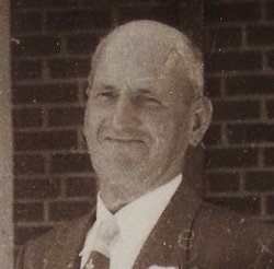
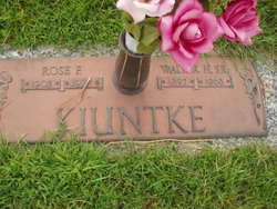
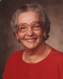
Walter Henry Kiuntke Sr.
| Birth | : | 23 Sep 1892 Germany |
| Death | : | 31 Jul 1968 Columbus, Platte County, Nebraska, USA |
| Burial | : | St. Nicholas Churchyard, Guisborough, Redcar and Cleveland Unitary Authority, England |
| Coordinate | : | 54.5366500, -1.0482800 |
| Description | : | Thanks to Find A Grave contributor #47552612 Walter Henry Kiuntke Sr., 75, of 1619 9th Street, died Wednesday night at St. Mary Hospital. Funeral services will be conducted at 2:30 p.m. Saturday at St. Luke United Church of Christ, with the Rev. Russell F. Mertz officiating, and burial will be in Roselawn Memorial cemetery. The body will lie in state from 1 p.m. Friday until noon Saturday at Gass-Haney Funeral Home, then at the church from 1:30 p.m. to the time of service. There will be a family prayer service at 11 a.m. Saturday at the funeral... Read More |
frequently asked questions (FAQ):
-
Where is Walter Henry Kiuntke Sr.'s memorial?
Walter Henry Kiuntke Sr.'s memorial is located at: St. Nicholas Churchyard, Guisborough, Redcar and Cleveland Unitary Authority, England.
-
When did Walter Henry Kiuntke Sr. death?
Walter Henry Kiuntke Sr. death on 31 Jul 1968 in Columbus, Platte County, Nebraska, USA
-
Where are the coordinates of the Walter Henry Kiuntke Sr.'s memorial?
Latitude: 54.5366500
Longitude: -1.0482800
Family Members:
Parent
Spouse
Siblings
Children
Flowers:
Nearby Cemetories:
1. St. Nicholas Churchyard
Guisborough, Redcar and Cleveland Unitary Authority, England
Coordinate: 54.5366500, -1.0482800
2. Guisborough Priory
Guisborough, Redcar and Cleveland Unitary Authority, England
Coordinate: 54.5361700, -1.0489500
3. Quakers Burial Ground
Guisborough, Redcar and Cleveland Unitary Authority, England
Coordinate: 54.5355100, -1.0569760
4. Guisborough Cemetery
Guisborough, Redcar and Cleveland Unitary Authority, England
Coordinate: 54.5448330, -1.0430940
5. St. Andrew's Old Churchyard
Upleatham, Redcar and Cleveland Unitary Authority, England
Coordinate: 54.5656900, -1.0164700
6. St Aidan Churchyard
Boosbeck, Redcar and Cleveland Unitary Authority, England
Coordinate: 54.5428560, -0.9786800
7. All Saints Old Churchyard
Skelton, Redcar and Cleveland Unitary Authority, England
Coordinate: 54.5623500, -0.9927600
8. Boosbeck Cemetery
Boosbeck, Redcar and Cleveland Unitary Authority, England
Coordinate: 54.5434900, -0.9779200
9. St Cuthbert Churchyard
Wilton, Redcar and Cleveland Unitary Authority, England
Coordinate: 54.5694200, -1.0992400
10. Skelton Cemetery
Skelton, Redcar and Cleveland Unitary Authority, England
Coordinate: 54.5604320, -0.9736353
11. St. Oswald's Churchyard
Newton under Roseberry, Redcar and Cleveland Unitary Authority, England
Coordinate: 54.5115243, -1.1223073
12. Kirkleatham Memorial Park and Crematorium
Yearby, Redcar and Cleveland Unitary Authority, England
Coordinate: 54.5866300, -1.0753800
13. St Cuthbert Churchyard
Kirkleatham, Redcar and Cleveland Unitary Authority, England
Coordinate: 54.5881700, -1.0825600
14. Saltburn by the Sea Cemetery
Saltburn-by-the-Sea, Redcar and Cleveland Unitary Authority, England
Coordinate: 54.5808780, -0.9880640
15. St Cuthbert Churchyard
Kildale, Hambleton District, England
Coordinate: 54.4779100, -1.0689200
16. St. Germain Churchyard
Marske-by-the-Sea, Redcar and Cleveland Unitary Authority, England
Coordinate: 54.5946000, -1.0115200
17. St Peter Churchyard
Commondale, Scarborough Borough, England
Coordinate: 54.4863700, -0.9766200
18. St Mary Churchyard
Moorsholm, Redcar and Cleveland Unitary Authority, England
Coordinate: 54.5207800, -0.9375800
19. Eston Cemetery
Eston, Redcar and Cleveland Unitary Authority, England
Coordinate: 54.5620460, -1.1552320
20. Great Ayton Cemetery
Great Ayton, Hambleton District, England
Coordinate: 54.4931360, -1.1390010
21. Friends Burial Ground
Great Ayton, Hambleton District, England
Coordinate: 54.4880800, -1.1315580
22. St Mary Churchyard
Nunthorpe, Middlesbrough Unitary Authority, England
Coordinate: 54.5187530, -1.1670180
23. All Saints Churchyard
Great Ayton, Hambleton District, England
Coordinate: 54.4897000, -1.1429000
24. St Margaret of Antioch Churchyard
Brotton, Redcar and Cleveland Unitary Authority, England
Coordinate: 54.5691380, -0.9358330

