| Memorials | : | 1 |
| Location | : | Gamlingay, South Cambridgeshire District, England |
| Coordinate | : | 52.1549840, -0.1872690 |
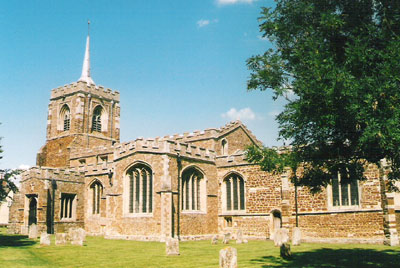
| Description | : | Gamlingay is an ancient village on the Cambridgeshire/Bedfordshire border, on the B1040 road from Biggleswade to Saint Ives. Saint Mary the Virgin church and churchyard date from the 13th Century, and are situated on the corner of Church Lane, Gamlingay |
frequently asked questions (FAQ):
-
Where is St Mary the Virgin Churchyard?
St Mary the Virgin Churchyard is located at Gamlingay, South Cambridgeshire District ,Cambridgeshire ,England.
-
St Mary the Virgin Churchyard cemetery's updated grave count on graveviews.com?
1 memorials
-
Where are the coordinates of the St Mary the Virgin Churchyard?
Latitude: 52.1549840
Longitude: -0.1872690
Nearby Cemetories:
1. St. James the Great New Churchyard
Waresley, Huntingdonshire District, England
Coordinate: 52.1747700, -0.1740900
2. St James the Great Old Churchyard
Waresley, Huntingdonshire District, England
Coordinate: 52.1740400, -0.1710700
3. St John the Baptist Churchyard
Cockayne Hatley, Central Bedfordshire Unitary Authority, England
Coordinate: 52.1308660, -0.1663740
4. St Mary the Virgin Churchyard
Potton, Central Bedfordshire Unitary Authority, England
Coordinate: 52.1295800, -0.2066700
5. Potton Baptist Church (Defunct)
Potton, Central Bedfordshire Unitary Authority, England
Coordinate: 52.1242617, -0.2096524
6. St George Church
Hatley St George, South Cambridgeshire District, England
Coordinate: 52.1437000, -0.1348000
7. St Peter & St Paul Churchyard
Little Gransden, South Cambridgeshire District, England
Coordinate: 52.1801800, -0.1427200
8. St Bartholomew Churchyard
Great Gransden, Huntingdonshire District, England
Coordinate: 52.1841660, -0.1425220
9. St. Denis Churchyard
East Hatley, South Cambridgeshire District, England
Coordinate: 52.1379956, -0.1233863
10. All Saints Churchyard
Sutton, Central Bedfordshire Unitary Authority, England
Coordinate: 52.1126500, -0.2212200
11. All Saints Churchyard
Eyeworth, Central Bedfordshire Unitary Authority, England
Coordinate: 52.0945940, -0.1770800
12. St. James Churchyard
Croxton, South Cambridgeshire District, England
Coordinate: 52.2174280, -0.1688510
13. Sandy Cemetery
Sandy, Central Bedfordshire Unitary Authority, England
Coordinate: 52.1245500, -0.2783300
14. St Swithun Churchyard
Sandy, Central Bedfordshire Unitary Authority, England
Coordinate: 52.1273583, -0.2862773
15. Old Baptist Burial Ground
Sandy, Central Bedfordshire Unitary Authority, England
Coordinate: 52.1299590, -0.2884590
16. St Mary The Virgin
Longstowe, South Cambridgeshire District, England
Coordinate: 52.1815300, -0.0845300
17. St Pandionia and St John the Baptist Churchyard
Eltisley, South Cambridgeshire District, England
Coordinate: 52.2205960, -0.1445670
18. St Deny's Churchyard
Little Barford, Bedford Borough, England
Coordinate: 52.1982210, -0.2785350
19. All Saints Churchyard
Croydon, South Cambridgeshire District, England
Coordinate: 52.1290100, -0.0796720
20. Tempsford Village Cemetery
Tempsford, Central Bedfordshire Unitary Authority, England
Coordinate: 52.1639000, -0.3024500
21. St Mary Magdalene Churchyard
Dunton, Central Bedfordshire Unitary Authority, England
Coordinate: 52.0825200, -0.1955600
22. Church of St Andrew
Caxton, South Cambridgeshire District, England
Coordinate: 52.2031956, -0.0986441
23. Stratton Way Cemetery
Biggleswade, Central Bedfordshire Unitary Authority, England
Coordinate: 52.0919432, -0.2474864
24. Dunton Cemetery
Dunton, Central Bedfordshire Unitary Authority, England
Coordinate: 52.0820490, -0.1982770

