
| Memorials | : | 21 |
| Location | : | Eaton, Carroll County, USA |
| Coordinate | : | 43.8708500, -71.0433400 |
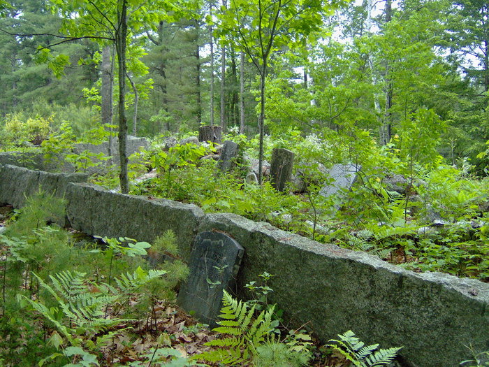
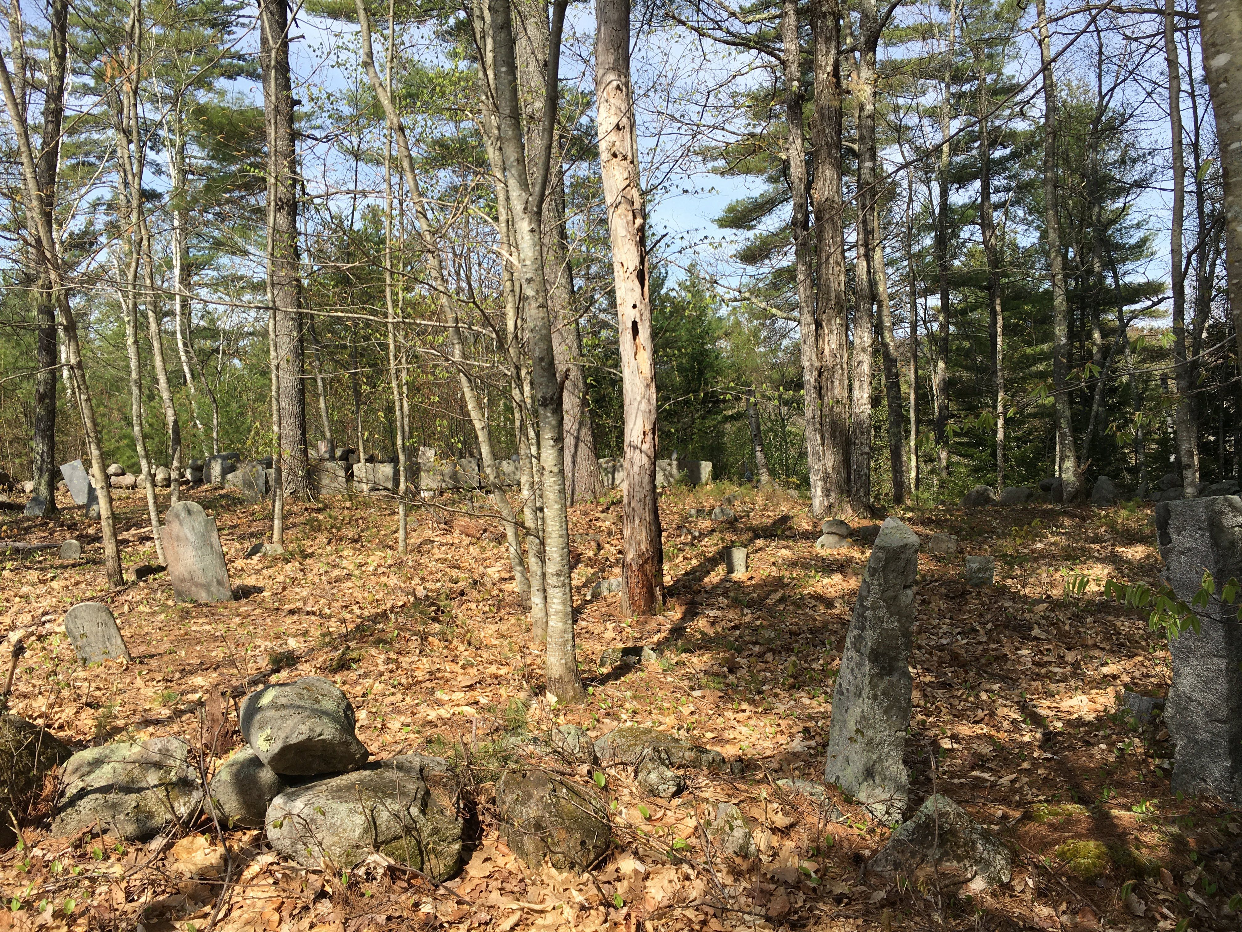
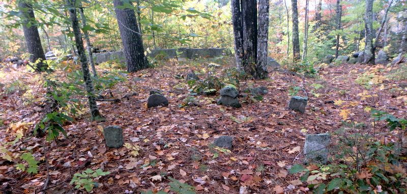
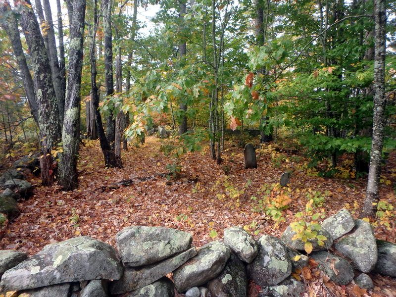
| Description | : | From its intersection with Towle Hill Road, drive north and west on Currier Road/Paul Hill Road for close to 0.7 miles. On the left (west) side is a cellar in a pasture. The cemetery is 200 feet west along the north edge of the pasture. This larger multi-family cemetery is surrounded by a stone wall. The back (west) section is surrounded by split granite slabs. Note: The northern part of Paul Hill Road is not maintained for winter travel. |
frequently asked questions (FAQ):
-
Where is Currier-Wilkinson Cemetery?
Currier-Wilkinson Cemetery is located at Paul Hill Road, South Eaton Eaton, Carroll County ,New Hampshire ,USA.
-
Currier-Wilkinson Cemetery cemetery's updated grave count on graveviews.com?
21 memorials
-
Where are the coordinates of the Currier-Wilkinson Cemetery?
Latitude: 43.8708500
Longitude: -71.0433400
Nearby Cemetories:
1. Wilkinson Cemetery
Eaton, Carroll County, USA
Coordinate: 43.8663900, -71.0331800
2. Allen Cemetery
Eaton, Carroll County, USA
Coordinate: 43.8698200, -71.0591800
3. Allard Cemetery
Freedom, Carroll County, USA
Coordinate: 43.8599600, -71.0485000
4. Smart Cemetery
Freedom, Carroll County, USA
Coordinate: 43.8598700, -71.0483200
5. Drew Cemetery
Freedom, Carroll County, USA
Coordinate: 43.8607000, -71.0327000
6. Jenness-Leavitt Cemetery
Eaton, Carroll County, USA
Coordinate: 43.8804900, -71.0565000
7. Brooks Cemetery
Eaton, Carroll County, USA
Coordinate: 43.8860600, -71.0409300
8. Thurston Cemetery
Eaton Center, Carroll County, USA
Coordinate: 43.8690000, -71.0658000
9. Merrow-Gannett Cemetery
Eaton Center, Carroll County, USA
Coordinate: 43.8745200, -71.0153300
10. Moses-Young Cemetery
Freedom, Carroll County, USA
Coordinate: 43.8504800, -71.0317500
11. Fernald Cemetery
Eaton, Carroll County, USA
Coordinate: 43.8825600, -71.0159200
12. Swett Hill Cemetery
Freedom, Carroll County, USA
Coordinate: 43.8547000, -71.0183000
13. Eaton Old White Meeting House Cemetery
Eaton Center, Carroll County, USA
Coordinate: 43.8582000, -71.0760000
14. Durgin Cemetery
Eaton Center, Carroll County, USA
Coordinate: 43.8700000, -71.0816670
15. Ward-Stuart Cemetery
Eaton, Carroll County, USA
Coordinate: 43.8995300, -71.0391100
16. Flood Cemetery
Eaton Center, Carroll County, USA
Coordinate: 43.8988890, -71.0333330
17. Sawyer-Drew Cemetery
Eaton Center, Carroll County, USA
Coordinate: 43.9022200, -71.0453300
18. Brooks Cemetery
Freedom, Carroll County, USA
Coordinate: 43.8505900, -71.0066900
19. Elwell Cemetery
Eaton, Carroll County, USA
Coordinate: 43.8905200, -71.0819300
20. Drew-Kenneson Cemetery
Eaton Center, Carroll County, USA
Coordinate: 43.9038890, -71.0572220
21. Thurston and Burnham Cemetery
Freedom, Carroll County, USA
Coordinate: 43.8394000, -71.0636000
22. Watson Hill Cemetery
Freedom, Carroll County, USA
Coordinate: 43.8361000, -71.0486000
23. Thurston Cemetery
Freedom, Carroll County, USA
Coordinate: 43.8423200, -71.0753800
24. Palmer Cemetery
Eaton, Carroll County, USA
Coordinate: 43.8973200, -71.0803000