
| Memorials | : | 3 |
| Location | : | Adderley, Shropshire Unitary Authority, England |
| Coordinate | : | 52.9517090, -2.5061580 |
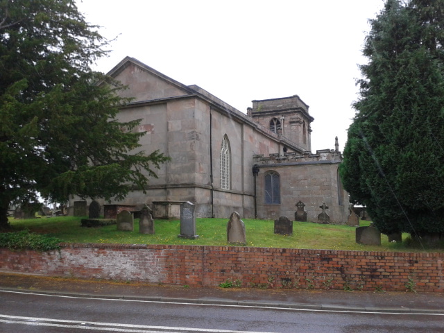
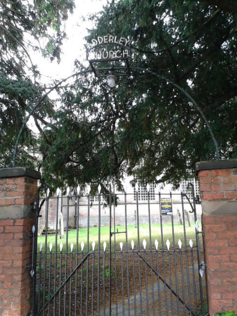
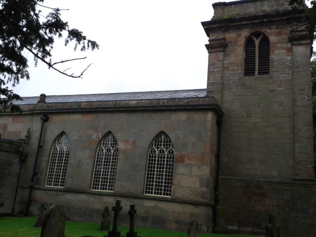
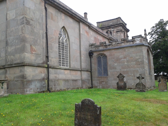
| Description | : | Anglican parish church dating from the early 1600's, built as a burial chapel for the Needham family, the Viscounts of Kilmorey, |
frequently asked questions (FAQ):
-
Where is St Peter Churchyard?
St Peter Churchyard is located at Adderley Road, Market Drayton Adderley, Shropshire Unitary Authority ,Shropshire ,England.
-
St Peter Churchyard cemetery's updated grave count on graveviews.com?
3 memorials
-
Where are the coordinates of the St Peter Churchyard?
Latitude: 52.9517090
Longitude: -2.5061580
Nearby Cemetories:
1. Calverhall Holy Trinity
Calverhall, Shropshire Unitary Authority, England
Coordinate: 52.9311270, -2.5917490
2. Saint Mary Church
Mucklestone, Newcastle-Under-Lyme Borough, England
Coordinate: 52.9328620, -2.4098060
3. St John The Baptist Churchyard
Ightfield, Shropshire Unitary Authority, England
Coordinate: 52.9438900, -2.6081000
4. St. Mary's Churchyard
Hales, Shropshire Unitary Authority, England
Coordinate: 52.9024580, -2.4274470
5. Christ Church
Ash Magna, Shropshire Unitary Authority, England
Coordinate: 52.9575430, -2.6287860
6. St John the Baptist Churchyard
Ashley, Newcastle-Under-Lyme Borough, England
Coordinate: 52.9247740, -2.3541570
7. St Margaret Churchyard
Wrenbury-cum-Frith, Cheshire East Unitary Authority, England
Coordinate: 53.0256700, -2.6073340
8. St. Chad Churchyard
Wybunbury, Cheshire East Unitary Authority, England
Coordinate: 53.0452760, -2.4488530
9. St. Swithun's Churchyard
Cheswardine, Shropshire Unitary Authority, England
Coordinate: 52.8660400, -2.4187700
10. St Michael Churchyard
Marbury-cum-Quoisley, Cheshire East Unitary Authority, England
Coordinate: 53.0062980, -2.6564160
11. Madeley Cemetery
Madeley, Newcastle-Under-Lyme Borough, England
Coordinate: 52.9878150, -2.3395660
12. St Luke's Churchyard
Hodnet, Shropshire Unitary Authority, England
Coordinate: 52.8536780, -2.5772160
13. St Peter Churchyard
Broughton, Stafford Borough, England
Coordinate: 52.9003430, -2.3491340
14. All Saints Churchyard
Madeley, Newcastle-Under-Lyme Borough, England
Coordinate: 52.9962463, -2.3400240
15. St Michael Churchyard
Baddiley, Cheshire East Unitary Authority, England
Coordinate: 53.0488780, -2.5905830
16. Nantwich Quaker Burial Ground (Defunct)
Nantwich, Cheshire East Unitary Authority, England
Coordinate: 53.0645719, -2.5214206
17. Barker Street Chapel Chapelyard
Nantwich, Cheshire East Unitary Authority, England
Coordinate: 53.0658770, -2.5222890
18. St Mary's Church
Nantwich, Cheshire East Unitary Authority, England
Coordinate: 53.0671000, -2.5206000
19. Coton Primitive Methodist Chapel
Cotonwood, Shropshire Unitary Authority, England
Coordinate: 52.9191890, -2.6926830
20. St Margaret Churchyard
Betley, Newcastle-Under-Lyme Borough, England
Coordinate: 53.0328100, -2.3658530
21. St Peter Churchyard
Maer, Newcastle-Under-Lyme Borough, England
Coordinate: 52.9419660, -2.3099140
22. St Oswald's Church Burial Ground
Hinstock, Shropshire Unitary Authority, England
Coordinate: 52.8346100, -2.4577700
23. Nantwich Cemetery
Nantwich, Cheshire East Unitary Authority, England
Coordinate: 53.0765120, -2.5108130
24. St Mary Churchyard
Acton, Cheshire East Unitary Authority, England
Coordinate: 53.0737140, -2.5511740