
| Memorials | : | 0 |
| Location | : | Kendal, South Lakeland District, England |
| Coordinate | : | 54.3301600, -2.7365160 |
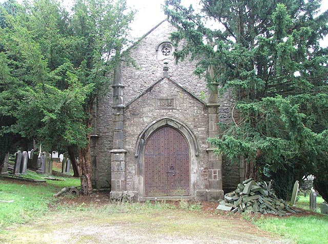
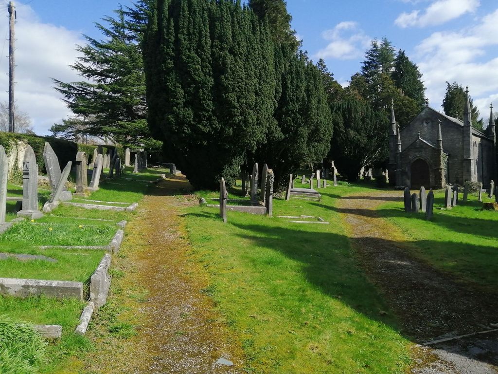
| Description | : | The Castle Street Cemetery is situated on the A684 Kendal Sedbergh Road between St. George's Church and the Kendal-Windermere railway overbridge. It opened on 17 May 1843. The disused chapel, which is thought to have been designed by Kendal Architect, George Webster, opened on 12 July 1845. The cemetery is now full for new burials, although occasional interments still take place in existing graves. There is no parking at this cemetery, and the cottage is a private residence. The cemetery is administered from the Cemeteries Office at South Lakeland House, Kendal, where all the cemetery records are kept. According to an 1855 letter... Read More |
frequently asked questions (FAQ):
-
Where is Castle Street Cemetery?
Castle Street Cemetery is located at On A684 Kendal Sedbergh Road between St. George Kendal, South Lakeland District ,Cumbria ,England.
-
Castle Street Cemetery cemetery's updated grave count on graveviews.com?
0 memorials
-
Where are the coordinates of the Castle Street Cemetery?
Latitude: 54.3301600
Longitude: -2.7365160
Nearby Cemetories:
1. Kendal Quaker Meeting House
Kendal, South Lakeland District, England
Coordinate: 54.3287200, -2.7431900
2. Quaker Burial Ground
Kendal, South Lakeland District, England
Coordinate: 54.3278200, -2.7285500
3. Kendal Unitarian Chapel Burial Ground
Kendal, South Lakeland District, England
Coordinate: 54.3287120, -2.7450940
4. St. Thomas Churchyard
Kendal, South Lakeland District, England
Coordinate: 54.3316130, -2.7489140
5. Stricklandgate Methodist
Kendal, South Lakeland District, England
Coordinate: 54.3321160, -2.7493720
6. The Sepulchre Quaker Burial Ground
Kendal, South Lakeland District, England
Coordinate: 54.3270022, -2.7502978
7. Parkside Cemetery
Kendal, South Lakeland District, England
Coordinate: 54.3210870, -2.7362680
8. Holy Trinity Church
Kendal, South Lakeland District, England
Coordinate: 54.3223970, -2.7448770
9. St. John The Baptist Cemetery Extension
Skelsmergh, South Lakeland District, England
Coordinate: 54.3519250, -2.7249650
10. St. John the Baptist Cemetery
Skelsmergh, South Lakeland District, England
Coordinate: 54.3521700, -2.7253800
11. St Oswald Churchyard
Burneside, South Lakeland District, England
Coordinate: 54.3546500, -2.7634950
12. St Mark's Churchyard
Natland, South Lakeland District, England
Coordinate: 54.2961380, -2.7374200
13. St. Stephen's Churchyard
New Hutton, South Lakeland District, England
Coordinate: 54.3156560, -2.6747130
14. Helsington Churchyard
Helsington, South Lakeland District, England
Coordinate: 54.2934390, -2.7871630
15. All Saints Churchyard
Underbarrow, South Lakeland District, England
Coordinate: 54.3262900, -2.8268240
16. St. Thomas' Churchyard
Crosscrake, South Lakeland District, England
Coordinate: 54.2763700, -2.7335300
17. St. Thomas' Churchyard
Selside, South Lakeland District, England
Coordinate: 54.3861600, -2.7169400
18. Quaker Burial Ground - Grayrigg
Grayrigg, South Lakeland District, England
Coordinate: 54.3664563, -2.6483654
19. St John the Evangelist Churchyard
Grayrigg, South Lakeland District, England
Coordinate: 54.3681500, -2.6501200
20. St. Catherine's Churchyard
Crook, South Lakeland District, England
Coordinate: 54.3480260, -2.8462220
21. Crook Chapel of Saint Catherine
Crook, South Lakeland District, England
Coordinate: 54.3445250, -2.8477290
22. St James Churchyard
Staveley, South Lakeland District, England
Coordinate: 54.3801350, -2.8183670
23. St. Mary's Churchyard
Crosthwaite, South Lakeland District, England
Coordinate: 54.3129300, -2.8526100
24. Crosthwaite Cemetery
Crosthwaite, South Lakeland District, England
Coordinate: 54.3126000, -2.8546900