
| Memorials | : | 0 |
| Location | : | Grayrigg, South Lakeland District, England |
| Website | : | www.lancaster.ac.uk/quakers/links/index_howgill.html |
| Coordinate | : | 54.3664563, -2.6483654 |
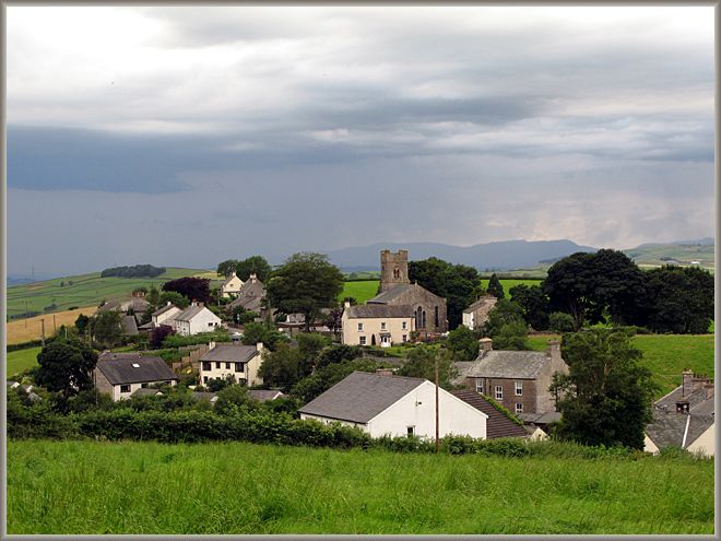
| Description | : | Location is approximate as no visible traces of the burial ground remain. Captain Ward gave a field below the house as a burial ground, but the exact site is now unknown. Francis Howgill was buried there after his death in prison in Appleby. Source(s): - Quaker Meeting Houses of the Lake Counties by David M Butler, published by the Friends Historical Society, 1978; ISBN 0 85245 128 8. - Guide book, LMS Route Book no.3, The Track of the Royal Scot, part 1 London Euston to Carlisle, by Edmund Vale, published by the London Midland and Scottish Railway, LMS, 1920s. - William C.... Read More |
frequently asked questions (FAQ):
-
Where is Quaker Burial Ground - Grayrigg?
Quaker Burial Ground - Grayrigg is located at Grayrigg, South Lakeland District ,Cumbria ,England.
-
Quaker Burial Ground - Grayrigg cemetery's updated grave count on graveviews.com?
0 memorials
-
Where are the coordinates of the Quaker Burial Ground - Grayrigg?
Latitude: 54.3664563
Longitude: -2.6483654
Nearby Cemetories:
1. St John the Evangelist Churchyard
Grayrigg, South Lakeland District, England
Coordinate: 54.3681500, -2.6501200
2. St. Thomas' Churchyard
Selside, South Lakeland District, England
Coordinate: 54.3861600, -2.7169400
3. St. John The Baptist Cemetery Extension
Skelsmergh, South Lakeland District, England
Coordinate: 54.3519250, -2.7249650
4. St. John the Baptist Cemetery
Skelsmergh, South Lakeland District, England
Coordinate: 54.3521700, -2.7253800
5. Holy Trinity Churchyard
Sedbergh, South Lakeland District, England
Coordinate: 54.3494590, -2.5651420
6. St John the Evangelist Churchyard
Firbank, South Lakeland District, England
Coordinate: 54.3365050, -2.5737670
7. St. Stephen's Churchyard
New Hutton, South Lakeland District, England
Coordinate: 54.3156560, -2.6747130
8. Quaker Burial Ground
Kendal, South Lakeland District, England
Coordinate: 54.3278200, -2.7285500
9. Castle Street Cemetery
Kendal, South Lakeland District, England
Coordinate: 54.3301600, -2.7365160
10. St Gregory Churchyard
Sedbergh, South Lakeland District, England
Coordinate: 54.3240650, -2.5637360
11. Kendal Quaker Meeting House
Kendal, South Lakeland District, England
Coordinate: 54.3287200, -2.7431900
12. Kendal Unitarian Chapel Burial Ground
Kendal, South Lakeland District, England
Coordinate: 54.3287120, -2.7450940
13. St Oswald Churchyard
Burneside, South Lakeland District, England
Coordinate: 54.3546500, -2.7634950
14. Stricklandgate Methodist
Kendal, South Lakeland District, England
Coordinate: 54.3321160, -2.7493720
15. St. Thomas Churchyard
Kendal, South Lakeland District, England
Coordinate: 54.3316130, -2.7489140
16. Parkside Cemetery
Kendal, South Lakeland District, England
Coordinate: 54.3210870, -2.7362680
17. The Sepulchre Quaker Burial Ground
Kendal, South Lakeland District, England
Coordinate: 54.3270022, -2.7502978
18. Holy Trinity Church
Kendal, South Lakeland District, England
Coordinate: 54.3223970, -2.7448770
19. St. James Churchyard
Tebay, Eden District, England
Coordinate: 54.4338540, -2.5931330
20. Quaker Graveyard
Brigflatts, South Lakeland District, England
Coordinate: 54.3146190, -2.5533360
21. Sedbergh Cemetery
Sedbergh, South Lakeland District, England
Coordinate: 54.3206230, -2.5361770
22. Saint Andrews Churchyard
Sedbergh, South Lakeland District, England
Coordinate: 54.3230690, -2.5285180
23. St Mark's Churchyard
Natland, South Lakeland District, England
Coordinate: 54.2961380, -2.7374200
24. St Mary Churchyard
Longsleddale, South Lakeland District, England
Coordinate: 54.4189730, -2.7706810