
| Memorials | : | 0 |
| Location | : | Grayrigg, South Lakeland District, England |
| Coordinate | : | 54.3681500, -2.6501200 |
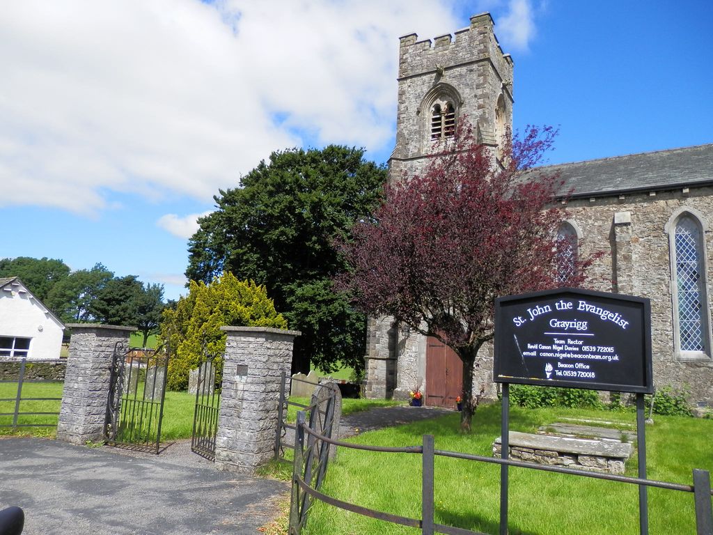
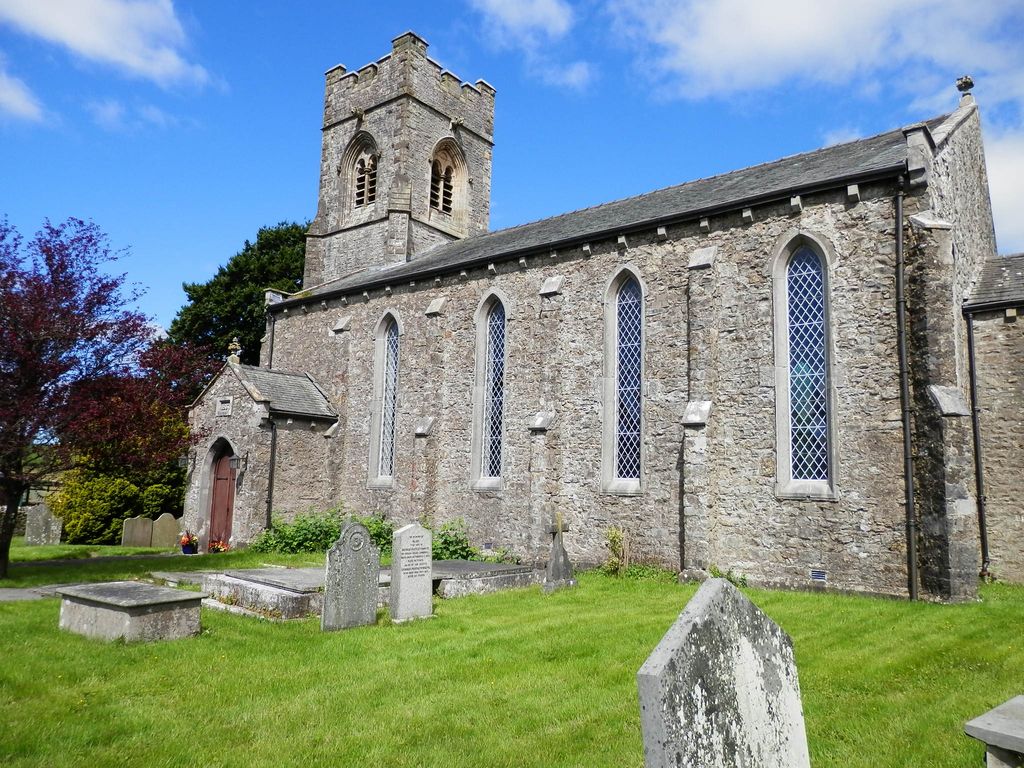
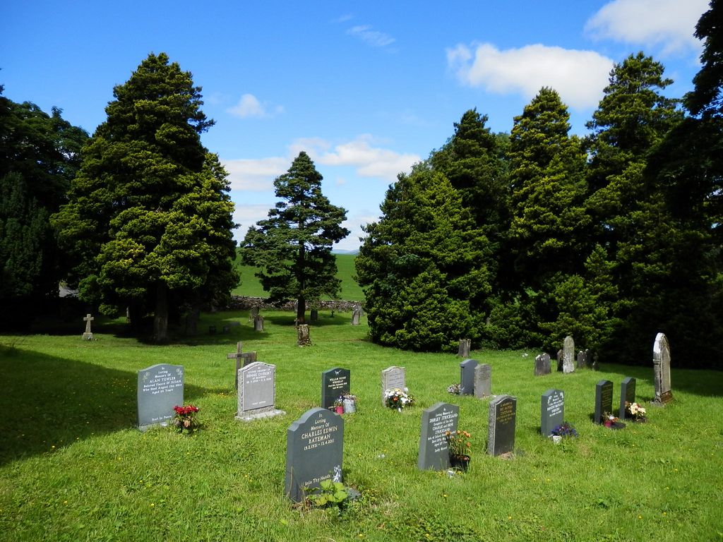
| Description | : | Grayrigg is a small village about 7 miles North East of Kendal, on the A685. Probably the most impressive building in the village is the church of St John the Evangelist, just set back off the road. The church was built in 1837, with a tower dated 1869, and is attributed to George Webster of Kendal. This church was preceded by another built in 1708 (which in turn replaced an earlier chapel) so the 1837 George Webster building may be the third church on or near this site. The churchyard is well-maintained ans still in use. |
frequently asked questions (FAQ):
-
Where is St John the Evangelist Churchyard?
St John the Evangelist Churchyard is located at Grayrigg, South Lakeland District ,Cumbria ,England.
-
St John the Evangelist Churchyard cemetery's updated grave count on graveviews.com?
0 memorials
-
Where are the coordinates of the St John the Evangelist Churchyard?
Latitude: 54.3681500
Longitude: -2.6501200
Nearby Cemetories:
1. Quaker Burial Ground - Grayrigg
Grayrigg, South Lakeland District, England
Coordinate: 54.3664563, -2.6483654
2. St. Thomas' Churchyard
Selside, South Lakeland District, England
Coordinate: 54.3861600, -2.7169400
3. St. John The Baptist Cemetery Extension
Skelsmergh, South Lakeland District, England
Coordinate: 54.3519250, -2.7249650
4. St. John the Baptist Cemetery
Skelsmergh, South Lakeland District, England
Coordinate: 54.3521700, -2.7253800
5. Holy Trinity Churchyard
Sedbergh, South Lakeland District, England
Coordinate: 54.3494590, -2.5651420
6. St. Stephen's Churchyard
New Hutton, South Lakeland District, England
Coordinate: 54.3156560, -2.6747130
7. St John the Evangelist Churchyard
Firbank, South Lakeland District, England
Coordinate: 54.3365050, -2.5737670
8. Quaker Burial Ground
Kendal, South Lakeland District, England
Coordinate: 54.3278200, -2.7285500
9. Castle Street Cemetery
Kendal, South Lakeland District, England
Coordinate: 54.3301600, -2.7365160
10. St Gregory Churchyard
Sedbergh, South Lakeland District, England
Coordinate: 54.3240650, -2.5637360
11. Kendal Quaker Meeting House
Kendal, South Lakeland District, England
Coordinate: 54.3287200, -2.7431900
12. St Oswald Churchyard
Burneside, South Lakeland District, England
Coordinate: 54.3546500, -2.7634950
13. Kendal Unitarian Chapel Burial Ground
Kendal, South Lakeland District, England
Coordinate: 54.3287120, -2.7450940
14. Stricklandgate Methodist
Kendal, South Lakeland District, England
Coordinate: 54.3321160, -2.7493720
15. St. Thomas Churchyard
Kendal, South Lakeland District, England
Coordinate: 54.3316130, -2.7489140
16. Parkside Cemetery
Kendal, South Lakeland District, England
Coordinate: 54.3210870, -2.7362680
17. The Sepulchre Quaker Burial Ground
Kendal, South Lakeland District, England
Coordinate: 54.3270022, -2.7502978
18. Holy Trinity Church
Kendal, South Lakeland District, England
Coordinate: 54.3223970, -2.7448770
19. St. James Churchyard
Tebay, Eden District, England
Coordinate: 54.4338540, -2.5931330
20. Quaker Graveyard
Brigflatts, South Lakeland District, England
Coordinate: 54.3146190, -2.5533360
21. Sedbergh Cemetery
Sedbergh, South Lakeland District, England
Coordinate: 54.3206230, -2.5361770
22. Saint Andrews Churchyard
Sedbergh, South Lakeland District, England
Coordinate: 54.3230690, -2.5285180
23. St Mary Churchyard
Longsleddale, South Lakeland District, England
Coordinate: 54.4189730, -2.7706810
24. St Mark's Churchyard
Natland, South Lakeland District, England
Coordinate: 54.2961380, -2.7374200