
| Memorials | : | 0 |
| Location | : | Terlingua Abaja, Brewster County, USA |
| Coordinate | : | 29.1878450, -103.6107320 |
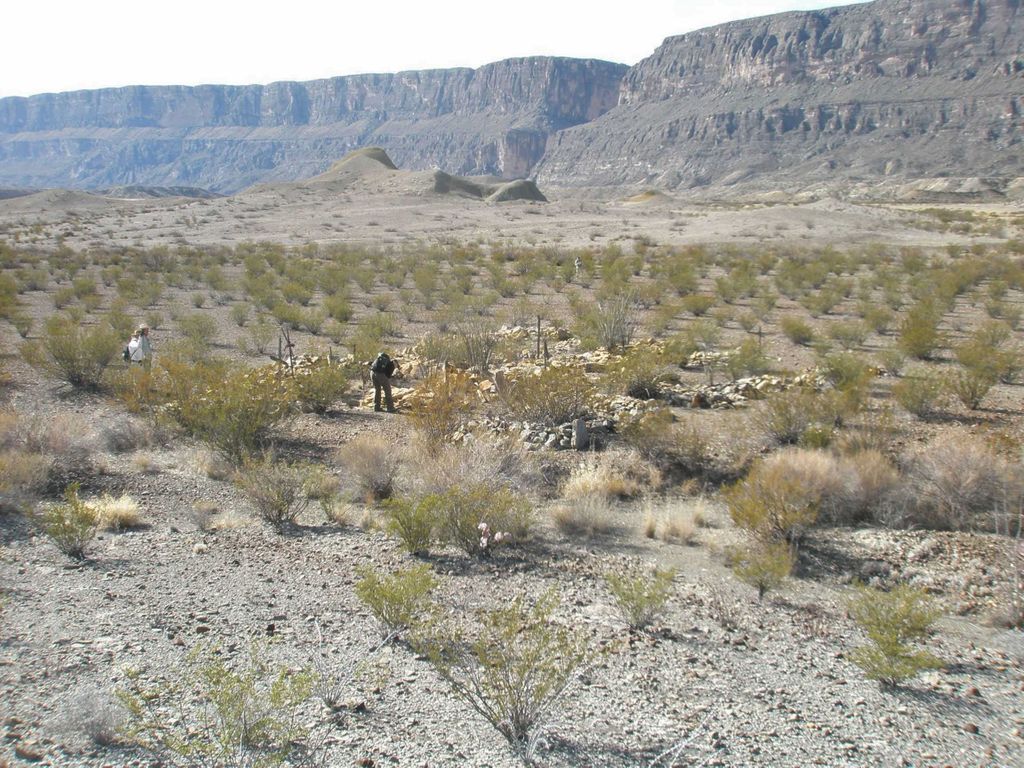
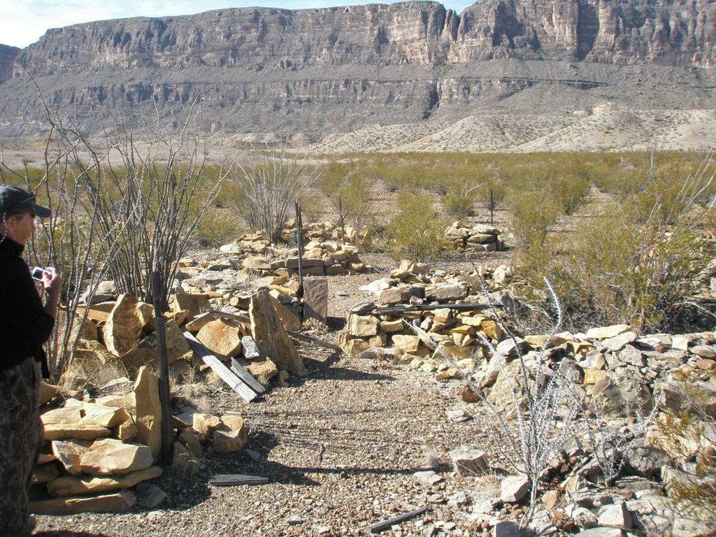
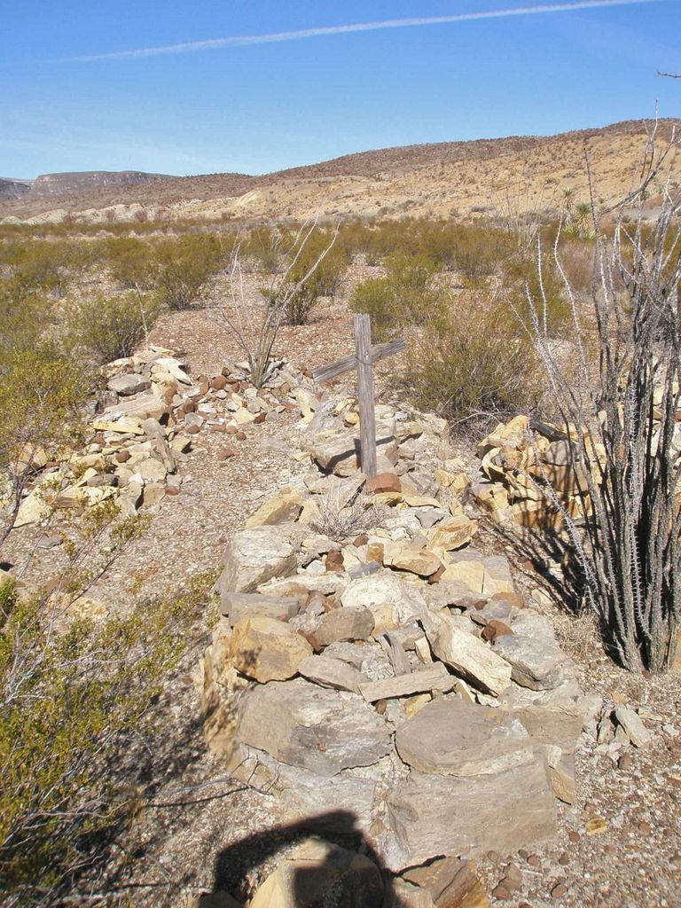
| Description | : | This cemetery is located in Big Bend National Park along Terlingua Creek, north of the mouth of Santa Elena Canyon, in the Terlingua Abaja area. This was the site of a former farming and ranching village, which supplied food to the miners in the area. There are 36 graves, all are unmarked. The burials consist of piles of stones, many with weathered wooden crosses. This is an adjunct cemetery to the other Terlingua Abaja cemetery which lies 500 feet away to the north-east. Directions: Start at the Terlingua Abaja campground, and hike nine-tenths of a mile to the south-southwest, towards the... Read More |
frequently asked questions (FAQ):
-
Where is Terlingua Abaja II Cemetery?
Terlingua Abaja II Cemetery is located at Terlingua Abaja, Brewster County ,Texas ,USA.
-
Terlingua Abaja II Cemetery cemetery's updated grave count on graveviews.com?
0 memorials
-
Where are the coordinates of the Terlingua Abaja II Cemetery?
Latitude: 29.1878450
Longitude: -103.6107320
Nearby Cemetories:
1. Terlingua Abajo Campground
Terlingua, Brewster County, USA
Coordinate: 29.1981970, -103.6034530
2. Dryden Ranch Cemetery
Brewster County, USA
Coordinate: 29.2169360, -103.5991290
3. Terlingua de Abajo Cemetery
Terlingua Abaja, Brewster County, USA
Coordinate: 29.2170550, -103.5989530
4. Valenzuela Ranch Cemetery
Terlingua, Brewster County, USA
Coordinate: 29.2236800, -103.5816010
5. Coyote Cemetery
Brewster County, USA
Coordinate: 29.1495750, -103.5430960
6. La Coyota Burial Site
Castolon, Brewster County, USA
Coordinate: 29.1459250, -103.5370170
7. Castolon Cemetery
Castolon, Brewster County, USA
Coordinate: 29.1339870, -103.5108100
8. El Ojito Cemetery
Castolon, Brewster County, USA
Coordinate: 29.1244320, -103.5036250
9. Terlingua Cemetery
Terlingua, Brewster County, USA
Coordinate: 29.3197994, -103.6123962
10. Study Butte Cemetery
Terlingua, Brewster County, USA
Coordinate: 29.3132880, -103.5249610
11. Lajitas Cemetery
Brewster County, USA
Coordinate: 29.2623005, -103.7745972
12. Sierra Chino Burial Site
Sierra Chino, Brewster County, USA
Coordinate: 29.0415820, -103.4155680
13. Panteón Municipal de Manuel Benavides
Manuel Benavides, Manuel Benavides Municipality, Mexico
Coordinate: 29.1040780, -103.9081030
14. Woodson's Cemetery
Brewster County, USA
Coordinate: 29.0076110, -103.2934410
15. Terlingua Ranch Cemetery
Terlingua, Brewster County, USA
Coordinate: 29.4616000, -103.3826000
16. Glenn Springs Cemetery
Brewster County, USA
Coordinate: 29.1741910, -103.1581210
17. Rice Cemetery
Brewster County, USA
Coordinate: 29.2455997, -103.1318970
18. Nina Marie Seawell Hannold Gravesite
Brewster County, USA
Coordinate: 29.3694020, -103.1674940
19. Solis Burial Site
Solis Landing, Brewster County, USA
Coordinate: 29.0593720, -103.1107950
20. Green Wax Camp Cemetery
Brewster County, USA
Coordinate: 29.4057800, -103.1052950
21. La Noria Cemetery
Brewster County, USA
Coordinate: 29.2484050, -103.0263025
22. San Vicente Crossing Cemetery
San Vicente Crossing, Brewster County, USA
Coordinate: 29.1326220, -103.0225550
23. San Vicente Cemetery
Brewster County, USA
Coordinate: 29.1557100, -103.0189420
24. Juan De Leon Gravesite
Brewster County, USA
Coordinate: 29.2465610, -103.0191900