
| Memorials | : | 0 |
| Location | : | Worthing, Worthing Borough, England |
| Coordinate | : | 50.8131570, -0.3739420 |
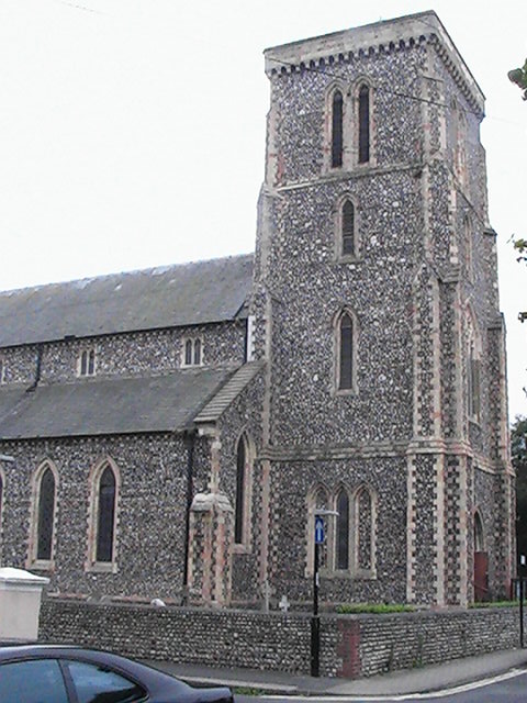
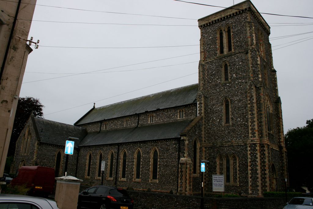
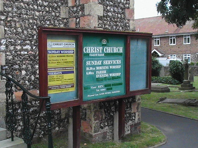
| Description | : | Christ Church and its burial grounds in Worthing, England, were consecrated in 1843 by the Bishop of Chichester, Ashurst Turner Gilbert, to meet the need for church accommodation for the poor. Built by subscription between 1840 and 1843, the Church was initially regarded as a chapel of ease to St Mary's Church in Broadwater. The chapel of ease was upgraded to the status of church with its own parish in 1855. Christ Church is the second oldest Church of England church still standing in Worthing town centre, after St Paul's Church which stands 100 metres to the east at the opposite... Read More |
frequently asked questions (FAQ):
-
Where is Christ Church Churchyard?
Christ Church Churchyard is located at Grafton Rd Worthing, Worthing Borough ,West Sussex , BN11 1QTEngland.
-
Christ Church Churchyard cemetery's updated grave count on graveviews.com?
0 memorials
-
Where are the coordinates of the Christ Church Churchyard?
Latitude: 50.8131570
Longitude: -0.3739420
Nearby Cemetories:
1. St Mary of the Angels RC Church
Worthing, Worthing Borough, England
Coordinate: 50.8133800, -0.3774000
2. St Andrew the Apostle Churchyard
Worthing, Worthing Borough, England
Coordinate: 50.8153000, -0.3774100
3. Holy Trinity Churchyard
Worthing, Worthing Borough, England
Coordinate: 50.8112700, -0.3785000
4. St Matthew Churchyard
Worthing, Worthing Borough, England
Coordinate: 50.8178900, -0.3830100
5. Heene Cemetery
Worthing, Worthing Borough, England
Coordinate: 50.8121180, -0.3881260
6. The Catholic Church of Saint Charles Borromeo
Worthing Borough, England
Coordinate: 50.8206203, -0.3544798
7. St Marys Churchyard
Broadwater, Worthing Borough, England
Coordinate: 50.8277750, -0.3734920
8. Broadwater Cemetery
Worthing, Worthing Borough, England
Coordinate: 50.8277650, -0.3799460
9. St Andrew Churchyard
Tarring, Worthing Borough, England
Coordinate: 50.8247000, -0.3956000
10. Durrington Cemetery
Durrington, Worthing Borough, England
Coordinate: 50.8390820, -0.3934460
11. St. Mary's Churchyard
Sompting, Adur District, England
Coordinate: 50.8386030, -0.3518740
12. St Mary Churchyard
Goring-by-Sea, Worthing Borough, England
Coordinate: 50.8129310, -0.4245400
13. St James the Less Churchyard Extension
Lancing, Adur District, England
Coordinate: 50.8367330, -0.3239250
14. Lancing and Sompting Cemetery
Lancing, Adur District, England
Coordinate: 50.8405270, -0.3280020
15. St. James the Less Churchyard
Lancing, Adur District, England
Coordinate: 50.8378170, -0.3226110
16. St Andrew's Churchyard
Ferring, Arun District, England
Coordinate: 50.8125800, -0.4482200
17. Landing College Chapel
Lancing, Adur District, England
Coordinate: 50.8459798, -0.3042240
18. Church of Saint Mary the Virgin
Clapham, Arun District, England
Coordinate: 50.8487294, -0.4446710
19. St John the Baptist Churchyard
Findon, Arun District, England
Coordinate: 50.8650400, -0.4148790
20. Findon Cemetery
Findon, Arun District, England
Coordinate: 50.8678500, -0.4100500
21. St. Nicolas' Churchyard
Old Shoreham, Adur District, England
Coordinate: 50.8407940, -0.2856690
22. St John the Divine Churchyard
Patching, Arun District, England
Coordinate: 50.8485920, -0.4570270
23. Coombes Churchyard
Coombes, Adur District, England
Coordinate: 50.8611730, -0.3082180
24. Worthing Crematorium
Findon, Arun District, England
Coordinate: 50.8728370, -0.4085170