
| Memorials | : | 0 |
| Location | : | Findon, Arun District, England |
| Coordinate | : | 50.8678500, -0.4100500 |
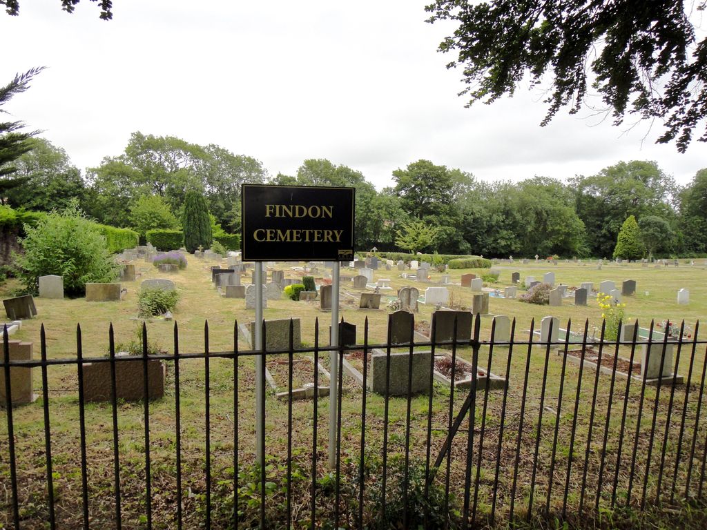
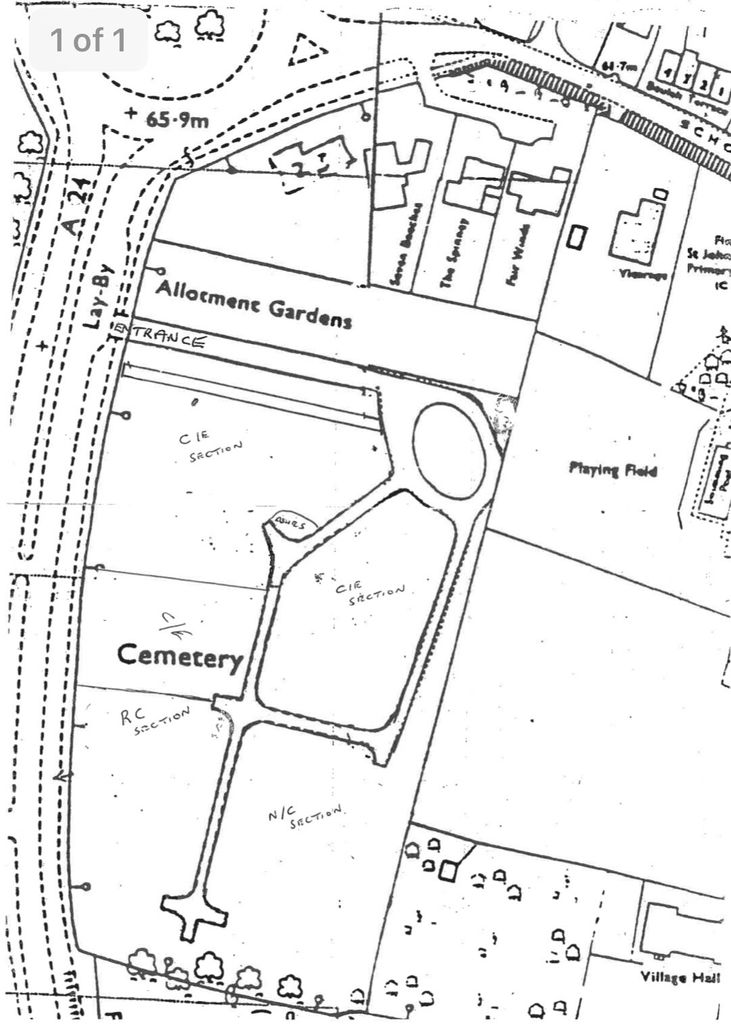
| Description | : | Findon Cemetery is located alongside the A24 Findon By-Pass (vehicle access is from the Southbound carriageway - A24). It lies to the western side of Findon village. The cemetery was consecrated in the early 1930s and the first burial took place on 28 November 1938. It is the burial place of many patients and nuns who were resident at the Convent Of The Holy Rood (built in 1930 and closed in 1967). The cemetery is still in use. Note this cemetery is not be confused with St John the Baptist Church, Findon cemetery. |
frequently asked questions (FAQ):
-
Where is Findon Cemetery?
Findon Cemetery is located at A24 Findon By-Pass, Findon, West Sussex Findon, Arun District ,West Sussex , BN14 0AAEngland.
-
Findon Cemetery cemetery's updated grave count on graveviews.com?
0 memorials
-
Where are the coordinates of the Findon Cemetery?
Latitude: 50.8678500
Longitude: -0.4100500
Nearby Cemetories:
1. St John the Baptist Churchyard
Findon, Arun District, England
Coordinate: 50.8650400, -0.4148790
2. Worthing Crematorium
Findon, Arun District, England
Coordinate: 50.8728370, -0.4085170
3. Church of Saint Mary the Virgin
Clapham, Arun District, England
Coordinate: 50.8487294, -0.4446710
4. Durrington Cemetery
Durrington, Worthing Borough, England
Coordinate: 50.8390820, -0.3934460
5. St John the Divine Churchyard
Patching, Arun District, England
Coordinate: 50.8485920, -0.4570270
6. St Mary's Churchyard Extension
Washington, Horsham District, England
Coordinate: 50.9036269, -0.4089782
7. St. Mary's Parish Churchyard
Washington, Horsham District, England
Coordinate: 50.9043450, -0.4103140
8. Saint Marys Churchyard
Sullington, Horsham District, England
Coordinate: 50.9070090, -0.4391640
9. St Andrew Churchyard
Tarring, Worthing Borough, England
Coordinate: 50.8247000, -0.3956000
10. Broadwater Cemetery
Worthing, Worthing Borough, England
Coordinate: 50.8277650, -0.3799460
11. St Mary Churchyard
Wiston, Horsham District, England
Coordinate: 50.8995280, -0.3582890
12. St Marys Churchyard
Broadwater, Worthing Borough, England
Coordinate: 50.8277750, -0.3734920
13. St. Mary's Churchyard
Sompting, Adur District, England
Coordinate: 50.8386030, -0.3518740
14. All Saints Churchyard
Wiston, Horsham District, England
Coordinate: 50.9132350, -0.3725910
15. St Matthew Churchyard
Worthing, Worthing Borough, England
Coordinate: 50.8178900, -0.3830100
16. St Mary Churchyard
Goring-by-Sea, Worthing Borough, England
Coordinate: 50.8129310, -0.4245400
17. St. Mary's Churchyard
Storrington, Horsham District, England
Coordinate: 50.9160360, -0.4566160
18. St Andrew the Apostle Churchyard
Worthing, Worthing Borough, England
Coordinate: 50.8153000, -0.3774100
19. Heene Cemetery
Worthing, Worthing Borough, England
Coordinate: 50.8121180, -0.3881260
20. Our Lady of England Churchyard
Storrington, Horsham District, England
Coordinate: 50.9164980, -0.4599130
21. St Andrew and St Cuthman Churchyard
Steyning, Horsham District, England
Coordinate: 50.8900700, -0.3250280
22. St Mary of the Angels RC Church
Worthing, Worthing Borough, England
Coordinate: 50.8133800, -0.3774000
23. Lancing and Sompting Cemetery
Lancing, Adur District, England
Coordinate: 50.8405270, -0.3280020
24. The Catholic Church of Saint Charles Borromeo
Worthing Borough, England
Coordinate: 50.8206203, -0.3544798