
| Memorials | : | 0 |
| Location | : | Sompting, Adur District, England |
| Coordinate | : | 50.8386030, -0.3518740 |
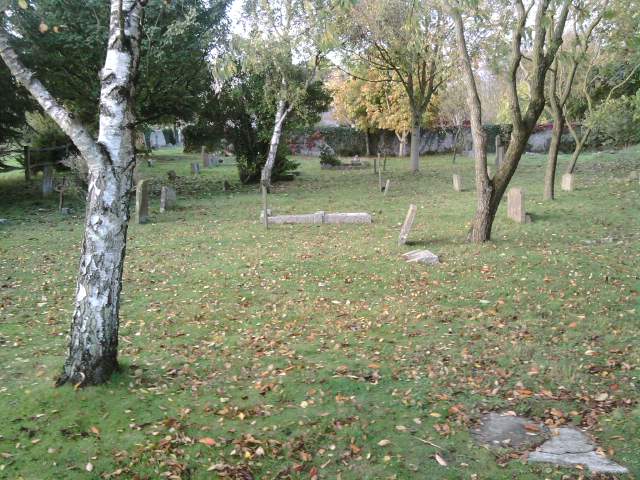
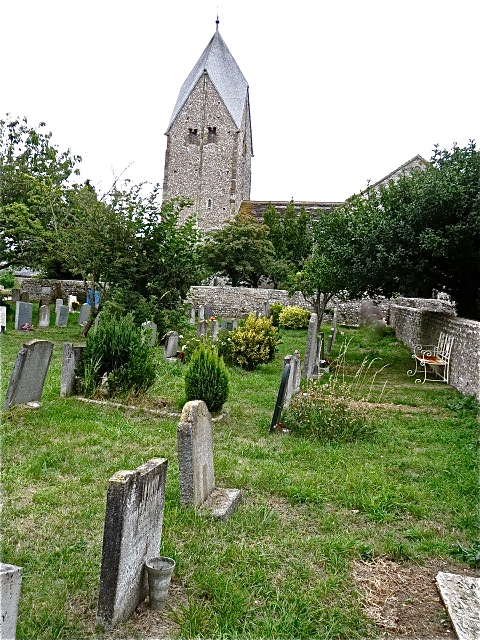
| Description | : | Sompting is a village and civil parish in the Adur District of West Sussex, England, located between Lancing and Worthing, at the foot of the southern slope of the South Downs. Twentieth century development has linked it to Lancing. The civil parish covers an area of 10.35 square kilometres and has a population of 8,514 persons (2001 census). The name Sompting (known as Sultinges in the Domesday Book) is said to come from the Old English for dwellers by the marsh The Church of St Mary the Blessed Virgin is a Grade I-listed Anglo-Saxon and Norman church, separated from the centre... Read More |
frequently asked questions (FAQ):
-
Where is St. Mary's Churchyard?
St. Mary's Churchyard is located at Church Lane Sompting, Adur District ,West Sussex ,England.
-
St. Mary's Churchyard cemetery's updated grave count on graveviews.com?
0 memorials
-
Where are the coordinates of the St. Mary's Churchyard?
Latitude: 50.8386030
Longitude: -0.3518740


Nearby Cemetories:
1. Lancing and Sompting Cemetery
Lancing, Adur District, England
Coordinate: 50.8405270, -0.3280020
2. St Marys Churchyard
Broadwater, Worthing Borough, England
Coordinate: 50.8277750, -0.3734920
3. St James the Less Churchyard Extension
Lancing, Adur District, England
Coordinate: 50.8367330, -0.3239250
4. The Catholic Church of Saint Charles Borromeo
Worthing Borough, England
Coordinate: 50.8206203, -0.3544798
5. St. James the Less Churchyard
Lancing, Adur District, England
Coordinate: 50.8378170, -0.3226110
6. Broadwater Cemetery
Worthing, Worthing Borough, England
Coordinate: 50.8277650, -0.3799460
7. Durrington Cemetery
Durrington, Worthing Borough, England
Coordinate: 50.8390820, -0.3934460
8. St Andrew the Apostle Churchyard
Worthing, Worthing Borough, England
Coordinate: 50.8153000, -0.3774100
9. St Matthew Churchyard
Worthing, Worthing Borough, England
Coordinate: 50.8178900, -0.3830100
10. Christ Church Churchyard
Worthing, Worthing Borough, England
Coordinate: 50.8131570, -0.3739420
11. St Mary of the Angels RC Church
Worthing, Worthing Borough, England
Coordinate: 50.8133800, -0.3774000
12. St Andrew Churchyard
Tarring, Worthing Borough, England
Coordinate: 50.8247000, -0.3956000
13. Landing College Chapel
Lancing, Adur District, England
Coordinate: 50.8459798, -0.3042240
14. Holy Trinity Churchyard
Worthing, Worthing Borough, England
Coordinate: 50.8112700, -0.3785000
15. Heene Cemetery
Worthing, Worthing Borough, England
Coordinate: 50.8121180, -0.3881260
16. Coombes Churchyard
Coombes, Adur District, England
Coordinate: 50.8611730, -0.3082180
17. St. Nicolas' Churchyard
Old Shoreham, Adur District, England
Coordinate: 50.8407940, -0.2856690
18. Botolph Cemetery
Steyning, Horsham District, England
Coordinate: 50.8698470, -0.3051070
19. St Botolph's
Boto By, Guldborgsund Kommune, Denmark
Coordinate: 50.8704488, -0.3049848
20. Mill Lane Cemetery
Shoreham-by-Sea, Adur District, England
Coordinate: 50.8378990, -0.2783270
21. Findon Cemetery
Findon, Arun District, England
Coordinate: 50.8678500, -0.4100500
22. St John the Baptist Churchyard
Findon, Arun District, England
Coordinate: 50.8650400, -0.4148790
23. Worthing Crematorium
Findon, Arun District, England
Coordinate: 50.8728370, -0.4085170
24. St Nicholas Churchyard
Bramber, Horsham District, England
Coordinate: 50.8828660, -0.3153580