
| Memorials | : | 0 |
| Location | : | Coombes, Adur District, England |
| Coordinate | : | 50.8611730, -0.3082180 |
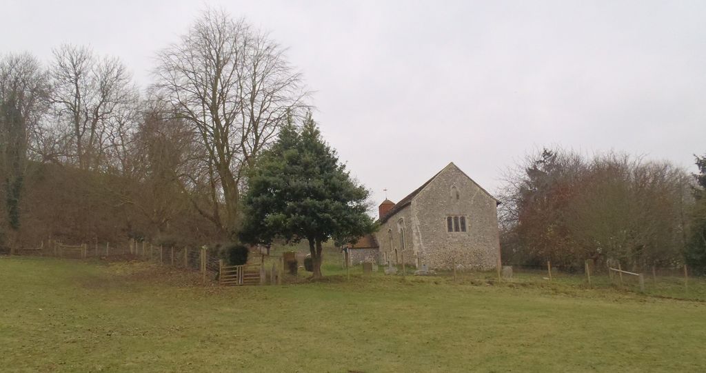
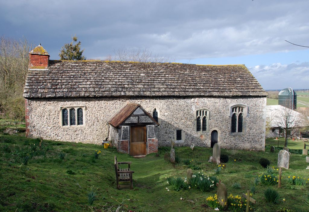
| Description | : | .Coombes Church, whose original dedication has now been lost[(although it has been attributed to John the Baptist), existed at the time of the Domesday survey. At that time it was a simple flint structure in three parts: chancel, nave and a tower at the west end. It was built so far into the rising land of the hillside that the base of the west window was just above the ground. The building was added to and altered several times over the next few centuries, such that Nikolaus Pevsner described it as a "century-by-century accretion of piety". Most of the nave,... Read More |
frequently asked questions (FAQ):
-
Where is Coombes Churchyard?
Coombes Churchyard is located at Coombes Road Coombes, Adur District ,West Sussex , BN15 0RSEngland.
-
Coombes Churchyard cemetery's updated grave count on graveviews.com?
0 memorials
-
Where are the coordinates of the Coombes Churchyard?
Latitude: 50.8611730
Longitude: -0.3082180


Nearby Cemetories:
1. Botolph Cemetery
Steyning, Horsham District, England
Coordinate: 50.8698470, -0.3051070
2. St Botolph's
Boto By, Guldborgsund Kommune, Denmark
Coordinate: 50.8704488, -0.3049848
3. Landing College Chapel
Lancing, Adur District, England
Coordinate: 50.8459798, -0.3042240
4. St Nicholas Churchyard
Bramber, Horsham District, England
Coordinate: 50.8828660, -0.3153580
5. Lancing and Sompting Cemetery
Lancing, Adur District, England
Coordinate: 50.8405270, -0.3280020
6. St. Nicolas' Churchyard
Old Shoreham, Adur District, England
Coordinate: 50.8407940, -0.2856690
7. St. James the Less Churchyard
Lancing, Adur District, England
Coordinate: 50.8378170, -0.3226110
8. St Peter Churchyard
Upper Beeding, Horsham District, England
Coordinate: 50.8873530, -0.3056540
9. St James the Less Churchyard Extension
Lancing, Adur District, England
Coordinate: 50.8367330, -0.3239250
10. Mill Lane Cemetery
Shoreham-by-Sea, Adur District, England
Coordinate: 50.8378990, -0.2783270
11. St Andrew and St Cuthman Churchyard
Steyning, Horsham District, England
Coordinate: 50.8900700, -0.3250280
12. St. Mary's Churchyard
Sompting, Adur District, England
Coordinate: 50.8386030, -0.3518740
13. St. Julian's Churchyard
Shoreham-by-Sea, Adur District, England
Coordinate: 50.8340600, -0.2465500
14. St Mary Churchyard
Wiston, Horsham District, England
Coordinate: 50.8995280, -0.3582890
15. St. Michael & All Angels Churchyard
Southwick, Adur District, England
Coordinate: 50.8348240, -0.2411970
16. The Catholic Church of Saint Charles Borromeo
Worthing Borough, England
Coordinate: 50.8206203, -0.3544798
17. Southwick Cemetery
Southwick, Adur District, England
Coordinate: 50.8429050, -0.2316730
18. St Marys Churchyard
Broadwater, Worthing Borough, England
Coordinate: 50.8277750, -0.3734920
19. Broadwater Cemetery
Worthing, Worthing Borough, England
Coordinate: 50.8277650, -0.3799460
20. Durrington Cemetery
Durrington, Worthing Borough, England
Coordinate: 50.8390820, -0.3934460
21. St. Nicolas Churchyard
Portslade, Brighton and Hove Unitary Authority, England
Coordinate: 50.8430280, -0.2181350
22. St Andrew the Apostle Churchyard
Worthing, Worthing Borough, England
Coordinate: 50.8153000, -0.3774100
23. Christ Church Churchyard
Worthing, Worthing Borough, England
Coordinate: 50.8131570, -0.3739420
24. St Matthew Churchyard
Worthing, Worthing Borough, England
Coordinate: 50.8178900, -0.3830100