
| Memorials | : | 0 |
| Location | : | Washington, Horsham District, England |
| Coordinate | : | 50.9043450, -0.4103140 |
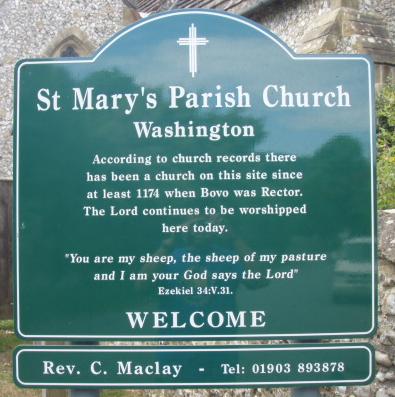
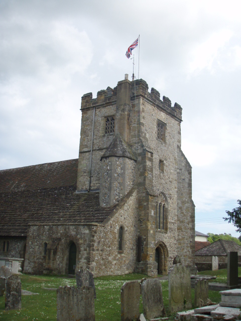
| Description | : | There has been a church on this site since around 1174. The present day Church was almost totally rebuilt in 1866, although the Tudor tower is still original. Added by Anthony Bysouth |
frequently asked questions (FAQ):
-
Where is St. Mary's Parish Churchyard?
St. Mary's Parish Churchyard is located at The Street Washington, Horsham District ,West Sussex , RH20 4ASEngland.
-
St. Mary's Parish Churchyard cemetery's updated grave count on graveviews.com?
0 memorials
-
Where are the coordinates of the St. Mary's Parish Churchyard?
Latitude: 50.9043450
Longitude: -0.4103140

Nearby Cemetories:
1. St Mary's Churchyard Extension
Washington, Horsham District, England
Coordinate: 50.9036269, -0.4089782
2. Saint Marys Churchyard
Sullington, Horsham District, England
Coordinate: 50.9070090, -0.4391640
3. All Saints Churchyard
Wiston, Horsham District, England
Coordinate: 50.9132350, -0.3725910
4. St. Mary's Churchyard
Storrington, Horsham District, England
Coordinate: 50.9160360, -0.4566160
5. Worthing Crematorium
Findon, Arun District, England
Coordinate: 50.8728370, -0.4085170
6. St Mary Churchyard
Wiston, Horsham District, England
Coordinate: 50.8995280, -0.3582890
7. Our Lady of England Churchyard
Storrington, Horsham District, England
Coordinate: 50.9164980, -0.4599130
8. Holy Sepulchre Churchyard
Warminghurst, Horsham District, England
Coordinate: 50.9402980, -0.4113760
9. Findon Cemetery
Findon, Arun District, England
Coordinate: 50.8678500, -0.4100500
10. St John the Baptist Churchyard
Findon, Arun District, England
Coordinate: 50.8650400, -0.4148790
11. St. Mary's Churchyard
Thakeham, Horsham District, England
Coordinate: 50.9446420, -0.4213350
12. St. Mary's Churchyard
West Chiltington, Horsham District, England
Coordinate: 50.9542360, -0.4492980
13. St Andrew and St Cuthman Churchyard
Steyning, Horsham District, England
Coordinate: 50.8900700, -0.3250280
14. Church of Saint Mary the Virgin
Clapham, Arun District, England
Coordinate: 50.8487294, -0.4446710
15. St James Churchyard
Ashurst, Horsham District, England
Coordinate: 50.9347992, -0.3273070
16. St John the Divine Churchyard
Patching, Arun District, England
Coordinate: 50.8485920, -0.4570270
17. Wiggonholt Churchyard
Parham, Horsham District, England
Coordinate: 50.9404490, -0.4924910
18. St Nicholas Churchyard
Bramber, Horsham District, England
Coordinate: 50.8828660, -0.3153580
19. Durrington Cemetery
Durrington, Worthing Borough, England
Coordinate: 50.8390820, -0.3934460
20. St Peter Churchyard
Upper Beeding, Horsham District, England
Coordinate: 50.8873530, -0.3056540
21. Greatham Parish Churchyard
Pulborough, Horsham District, England
Coordinate: 50.9339600, -0.5156300
22. St Botolph's
Boto By, Guldborgsund Kommune, Denmark
Coordinate: 50.8704488, -0.3049848
23. Botolph Cemetery
Steyning, Horsham District, England
Coordinate: 50.8698470, -0.3051070
24. St. Mary's Churchyard
Sompting, Adur District, England
Coordinate: 50.8386030, -0.3518740