
| Memorials | : | 0 |
| Location | : | Oslo kommune, Norway |
frequently asked questions (FAQ):
-
Where is Helsfyr Jewish Cemetery?
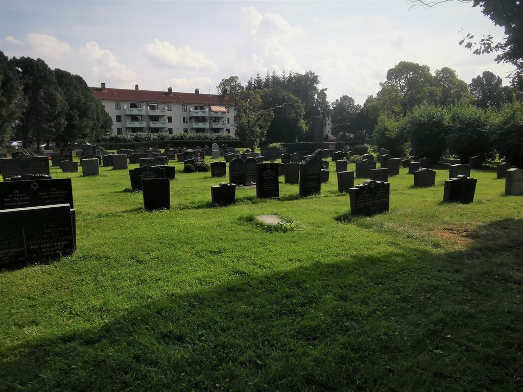
Helsfyr Jewish Cemetery is located at No GPS information available Add GPSTvetenveien 7 Oslo kommune ,Oslo fylke , 0661Norway.
-
Helsfyr Jewish Cemetery cemetery's updated grave count on graveviews.com?
0 memorials


Nearby Cemetories:
1. Østre Aker kirkegård
Okern, Oslo kommune, Norway
Coordinate: 59.9435670, 10.9113910
2. Alfaset gravlund
Oslo, Oslo kommune, Norway
Coordinate: 59.8319960, 10.8513850
3. Alfaset – tysk krigskirkegård
Oslo, Oslo kommune, Norway
Coordinate: 59.9172300, 10.7467380
4. Bekkelaget kirkegård
Oslo, Oslo kommune, Norway
Coordinate: 59.9034515, 10.7621204
5. Bekkelaget urnelund
Oslo, Oslo kommune, Norway
Coordinate: 59.9371400, 10.7483990
6. Det kongelige mausoleum i Akershus Slott
Oslo, Oslo kommune, Norway
Coordinate: 59.8591400, 10.8031780
7. Gamle Aker kirkegård
Oslo, Oslo kommune, Norway
Coordinate: 59.9478110, 10.7012330
8. Gamlebyen Gravlund
Oslo, Oslo kommune, Norway
Coordinate: 59.1135500, 11.4002833
9. Grefsen kirkegård
Oslo, Oslo kommune, Norway
Coordinate: 59.9229390, 10.7668660
10. Grorud kirkegård
Oslo, Oslo kommune, Norway
Coordinate: 60.0156200, 10.6165900
11. Hallvardskatedralens ruin
Oslo, Oslo kommune, Norway
Coordinate: 59.9252790, 10.6542960
12. Helsfyr gravlund
Oslo, Oslo kommune, Norway
Coordinate: 59.9369400, 10.7291200
13. Høybråten kirkegård
Oslo, Oslo kommune, Norway
Coordinate: 59.9435670, 10.9113910
14. Klemetsrud kirkegård
Oslo, Oslo kommune, Norway
Coordinate: 59.8319960, 10.8513850
15. Krist kirkegård
Oslo, Oslo kommune, Norway
Coordinate: 59.9172300, 10.7467380
16. Mariekirkens ruin
Oslo, Oslo kommune, Norway
Coordinate: 59.9034515, 10.7621204
17. Nordre gravlund
Oslo, Oslo kommune, Norway
Coordinate: 59.9371400, 10.7483990
18. Nordstrand kirkegård
Oslo, Oslo kommune, Norway
Coordinate: 59.8591400, 10.8031780
19. Ris urnelund
Oslo, Oslo kommune, Norway
Coordinate: 59.9478110, 10.7012330
20. Slavekirkegården
Oslo, Oslo kommune, Norway
Coordinate: 59.1135500, 11.4002833
21. Sofienberg jødiske gravlund
Oslo, Oslo kommune, Norway
Coordinate: 59.9229390, 10.7668660
22. Sørkedalen kirkegård
Oslo, Oslo kommune, Norway
Coordinate: 60.0156200, 10.6165900
23. Ullern kirkegård
Oslo, Oslo kommune, Norway
Coordinate: 59.9252790, 10.6542960
24. Vestre Aker kirkegård
Oslo, Oslo kommune, Norway
Coordinate: 59.9369400, 10.7291200