
| Memorials | : | 0 |
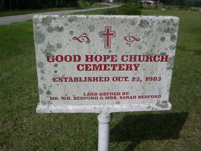
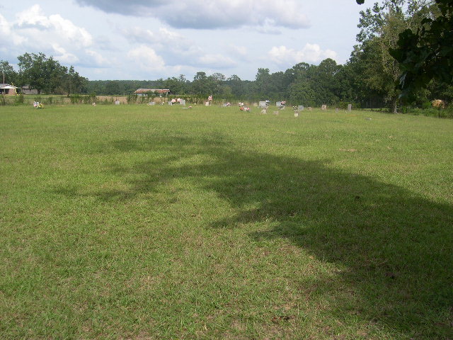
| Location | : | Smith County, USA |
| Coordinate | : | 32.1613100, -89.5345100 |
| Description | : | From Raleigh Mississippi proceed North on Highway 35 until reaching the intersection of Highway 481 (a distance of approximately 6.5 miles.) Turn left (West) on Highway 481 and proceed 2.1 miles to the intersection with Highway 902 (also Smith County Road 32.) Turn Right (North) and proceed 2 miles, cemetery will be on right (East) side of road, specifically: NE1/4 NW1/4, S25, T4N-R7E, Smith, Homewood Quadrangle map, USNG: 16S BA 60971 61140. |
frequently asked questions (FAQ):
-
Where is Good Hope Cemetery?
Good Hope Cemetery is located at Mississippi Highway 902 Smith County ,Mississippi , 39152USA.
-
Good Hope Cemetery cemetery's updated grave count on graveviews.com?
0 memorials
-
Where are the coordinates of the Good Hope Cemetery?
Latitude: 32.1613100
Longitude: -89.5345100

Nearby Cemetories:
1. Gasque Chapel Cemetery
Smith County, USA
Coordinate: 32.1793540, -89.5297340
2. Bethel Baptist Church Cemetery
Smith County, USA
Coordinate: 32.1830920, -89.5565660
3. Burns Baptist Church Cemetery
Raleigh, Smith County, USA
Coordinate: 32.1321880, -89.5384430
4. Barber Cemetery
Raleigh, Smith County, USA
Coordinate: 32.1321810, -89.5385960
5. Providence Cemetery
Burns, Smith County, USA
Coordinate: 32.1357400, -89.5528600
6. Burns United Methodist Church Cemetery
Burns, Smith County, USA
Coordinate: 32.1310501, -89.5399399
7. Goodwater Baptist Church Cemetery
Smith County, USA
Coordinate: 32.1415200, -89.5027900
8. Derrick Cemetery
Smith County, USA
Coordinate: 32.1484800, -89.5742400
9. Lorena Baptist Church Cemetery
Lorena, Smith County, USA
Coordinate: 32.1917890, -89.5061570
10. Henderson Family Cemetery
Smith County, USA
Coordinate: 32.1207008, -89.5181122
11. Lorena Baptist Church Extension Cemetery
Smith County, USA
Coordinate: 32.1976340, -89.5059530
12. Roberts Cemetery
Smith County, USA
Coordinate: 32.1968100, -89.5688000
13. Zion Cemetery
Smith County, USA
Coordinate: 32.1689700, -89.5918000
14. New Chapel Cemetery
Smith County, USA
Coordinate: 32.1710100, -89.5944800
15. Union Grove Cemetery
Smith County, USA
Coordinate: 32.1888520, -89.4801290
16. Old Henderson Cemetery
Smith County, USA
Coordinate: 32.1199100, -89.4919700
17. Luther Chapel Lutheran Church Cemetery
Lingle, Smith County, USA
Coordinate: 32.2183500, -89.5443800
18. Lingle Cemetery
Lingle, Smith County, USA
Coordinate: 32.2091200, -89.5731800
19. Black Cemetery
Smith County, USA
Coordinate: 32.2098070, -89.5739170
20. Lemon Christian Cemetery
Raleigh, Smith County, USA
Coordinate: 32.1225570, -89.4748020
21. Mount Carmel Cemetery
Smith County, USA
Coordinate: 32.1748200, -89.4593010
22. Moulder Cemetery
Smith County, USA
Coordinate: 32.1239014, -89.6007996
23. Barnes Cemetery
Raleigh, Smith County, USA
Coordinate: 32.0946999, -89.5068970
24. Page Cemetery
Raleigh, Smith County, USA
Coordinate: 32.0891991, -89.5432968