
| Memorials | : | 1 |
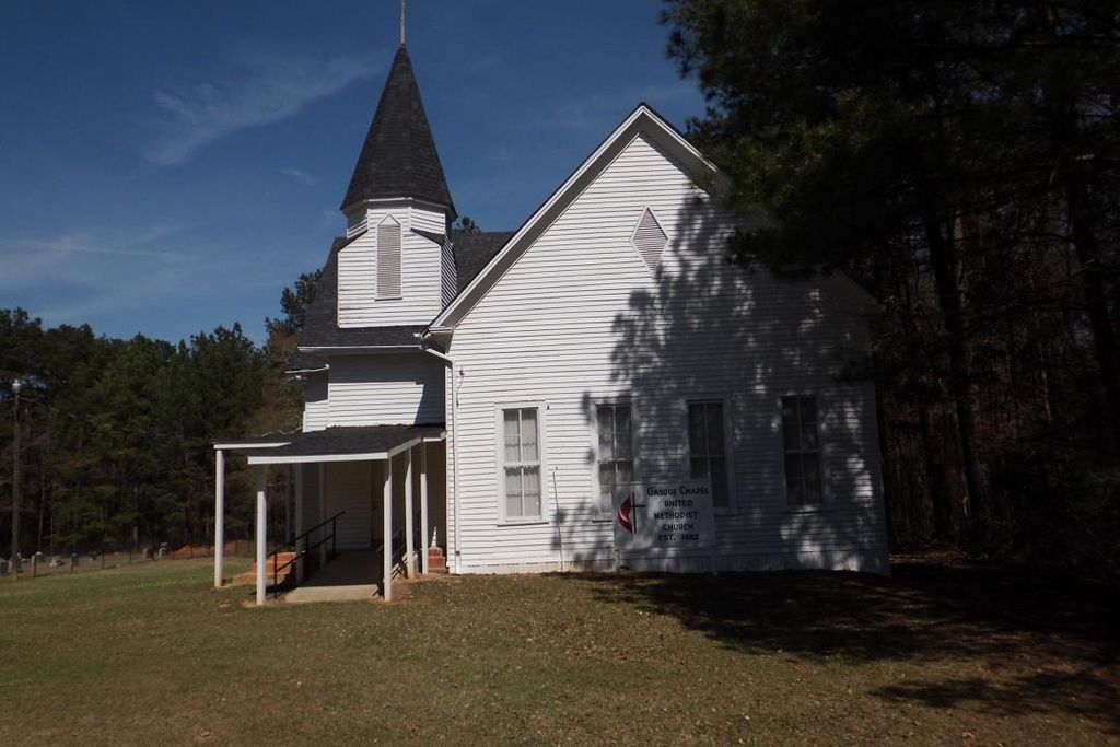
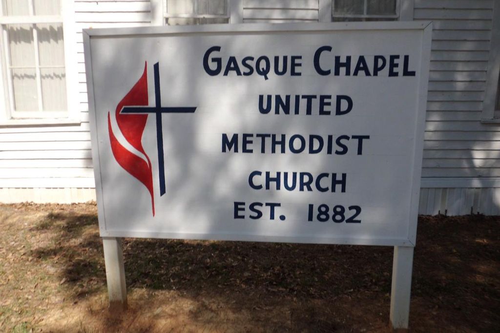
| Location | : | Smith County, USA |
| Coordinate | : | 32.1793540, -89.5297340 |
| Description | : | From Raleigh Mississippi proceed North on Highway 35 until reaching the intersection of Highway 481 (a distance of approximately 6.5 miles.) Turn left (West) on Highway 481 and proceed 2.1 miles to the intersection with Highway 902 (also Smith County Road 32.) Turn Right (North) and proceed 3.2 miles until the junction with Smith County Road 32-B (SCR 32-B) and turn left (North West.) Continue on SCR 32-B for approximately four tenths of a mile, the cemetery will be on the right (North) side of the road, specifically: SE1/4 SE1/4, S13 T4N-R7E, Smith, Homewood Quadrangle map, 16S BA 61485 63121. |
frequently asked questions (FAQ):
-
Where is Gasque Chapel Cemetery?
Gasque Chapel Cemetery is located at 574 Smith County Road 32B Smith County ,Mississippi , 39152USA.
-
Gasque Chapel Cemetery cemetery's updated grave count on graveviews.com?
1 memorials
-
Where are the coordinates of the Gasque Chapel Cemetery?
Latitude: 32.1793540
Longitude: -89.5297340
Nearby Cemetories:
1. Good Hope Cemetery
Smith County, USA
Coordinate: 32.1613100, -89.5345100
2. Bethel Baptist Church Cemetery
Smith County, USA
Coordinate: 32.1830920, -89.5565660
3. Lorena Baptist Church Cemetery
Lorena, Smith County, USA
Coordinate: 32.1917890, -89.5061570
4. Lorena Baptist Church Extension Cemetery
Smith County, USA
Coordinate: 32.1976340, -89.5059530
5. Roberts Cemetery
Smith County, USA
Coordinate: 32.1968100, -89.5688000
6. Luther Chapel Lutheran Church Cemetery
Lingle, Smith County, USA
Coordinate: 32.2183500, -89.5443800
7. Union Grove Cemetery
Smith County, USA
Coordinate: 32.1888520, -89.4801290
8. Goodwater Baptist Church Cemetery
Smith County, USA
Coordinate: 32.1415200, -89.5027900
9. Lingle Cemetery
Lingle, Smith County, USA
Coordinate: 32.2091200, -89.5731800
10. Burns Baptist Church Cemetery
Raleigh, Smith County, USA
Coordinate: 32.1321880, -89.5384430
11. Barber Cemetery
Raleigh, Smith County, USA
Coordinate: 32.1321810, -89.5385960
12. Providence Cemetery
Burns, Smith County, USA
Coordinate: 32.1357400, -89.5528600
13. Black Cemetery
Smith County, USA
Coordinate: 32.2098070, -89.5739170
14. Derrick Cemetery
Smith County, USA
Coordinate: 32.1484800, -89.5742400
15. Burns United Methodist Church Cemetery
Burns, Smith County, USA
Coordinate: 32.1310501, -89.5399399
16. Zion Cemetery
Smith County, USA
Coordinate: 32.1689700, -89.5918000
17. New Chapel Cemetery
Smith County, USA
Coordinate: 32.1710100, -89.5944800
18. Noblin Cemetery
Forest, Scott County, USA
Coordinate: 32.2310210, -89.4952380
19. Henderson Family Cemetery
Smith County, USA
Coordinate: 32.1207008, -89.5181122
20. Mount Carmel Cemetery
Smith County, USA
Coordinate: 32.1748200, -89.4593010
21. Luther Chapel Cemetery
Pulaski, Scott County, USA
Coordinate: 32.2405100, -89.5511900
22. Homewood Methodist Church Cemetery
Forest, Scott County, USA
Coordinate: 32.2410500, -89.5046000
23. Old Henderson Cemetery
Smith County, USA
Coordinate: 32.1199100, -89.4919700
24. Lemon Christian Cemetery
Raleigh, Smith County, USA
Coordinate: 32.1225570, -89.4748020