
| Memorials | : | 128 |
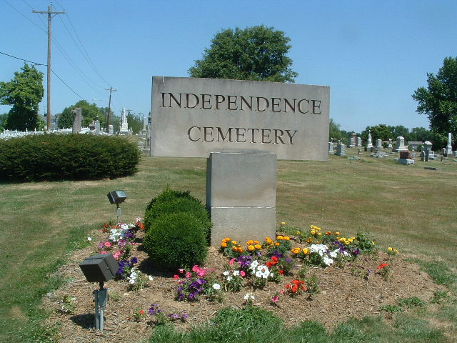
| Location | : | Independence, Kenton County, USA |
| Phone | : | (859) 331-3220 |
| Website | : | highlandcemeterysite.wordpress.com |
| Coordinate | : | 38.9364014, -84.5419006 |
| Description | : | The 65-acre cemetery was incorporated as a nonprofit organization in 1886. On January 1, 1988, the cemetery management and operation became a division of non-profit Highland Cemetery, Inc., in Fort Mitchell. In 1996, Independence Cemetery bought the adjacent 64-acre farmland, doubling the acreage owned by the cemetery. The U.S. Geological Survey (USGS) Geographic Names Information System (GNIS) feature ID for the cemetery is 494902 (Independence Cemetery). |
frequently asked questions (FAQ):
-
Where is Independence Cemetery?
Independence Cemetery is located at Madison Pike Independence, Kenton County ,Kentucky , 41051USA.
-
Independence Cemetery cemetery's updated grave count on graveviews.com?
117 memorials
-
Where are the coordinates of the Independence Cemetery?
Latitude: 38.9364014
Longitude: -84.5419006
Nearby Cemetories:
1. Saint Cecilias Cemetery
Independence, Kenton County, USA
Coordinate: 38.9397011, -84.5466995
2. McCollum Cemetery
Independence, Kenton County, USA
Coordinate: 38.9431490, -84.5350520
3. B'Hymer Cemetery
Independence, Kenton County, USA
Coordinate: 38.9525000, -84.5575000
4. Faulkner Cemetery
Independence, Kenton County, USA
Coordinate: 38.9166670, -84.5333330
5. Pelly Cemetery
Latonia Lakes, Kenton County, USA
Coordinate: 38.9611110, -84.5294440
6. Grizzell Family Cemetery
Independence, Kenton County, USA
Coordinate: 38.9260320, -84.5089030
7. Hoffman Cemetery
Independence, Kenton County, USA
Coordinate: 38.9616670, -84.5630560
8. Hoffman Cemetery
Independence, Kenton County, USA
Coordinate: 38.9102777, -84.5200000
9. Wilson-Williams Cemetery
Ricedale, Kenton County, USA
Coordinate: 38.9409840, -84.5832880
10. Stephens Cemetery
Ryland Heights, Kenton County, USA
Coordinate: 38.9374570, -84.4977570
11. Bird Cemetery
Independence, Kenton County, USA
Coordinate: 38.9027780, -84.5327780
12. Cox Cemetery
Covington, Kenton County, USA
Coordinate: 38.9716670, -84.5188890
13. Minter Cemetery
Covington, Kenton County, USA
Coordinate: 38.9642300, -84.5055100
14. Armstrong Cemetery #1
Nicholson, Kenton County, USA
Coordinate: 38.8961111, -84.5338889
15. Dewire Cemetery
Ricedale, Kenton County, USA
Coordinate: 38.9361110, -84.5963890
16. Osborn Cemetery
Latonia Lakes, Kenton County, USA
Coordinate: 38.9661110, -84.5016670
17. Ashford Road Cemetery
Independence, Kenton County, USA
Coordinate: 38.9528850, -84.4892100
18. Petty Cemetery
Ryland, Kenton County, USA
Coordinate: 38.9391000, -84.4847100
19. Lighthouse Memorial Gardens
Covington, Kenton County, USA
Coordinate: 38.9689350, -84.5025500
20. Klette Cemetery
Latonia Lakes, Kenton County, USA
Coordinate: 38.9616670, -84.4944400
21. Oak Ridge Church Cemetery
Latonia Lakes, Kenton County, USA
Coordinate: 38.9691460, -84.5024180
22. Aaron Wayman Cemetery
Independence, Kenton County, USA
Coordinate: 38.9819440, -84.5469440
23. Rector Cemetery
Independence, Kenton County, USA
Coordinate: 38.9433300, -84.6002800
24. Bannister Cemetery
Taylor Mill, Kenton County, USA
Coordinate: 38.9758333, -84.5111110