
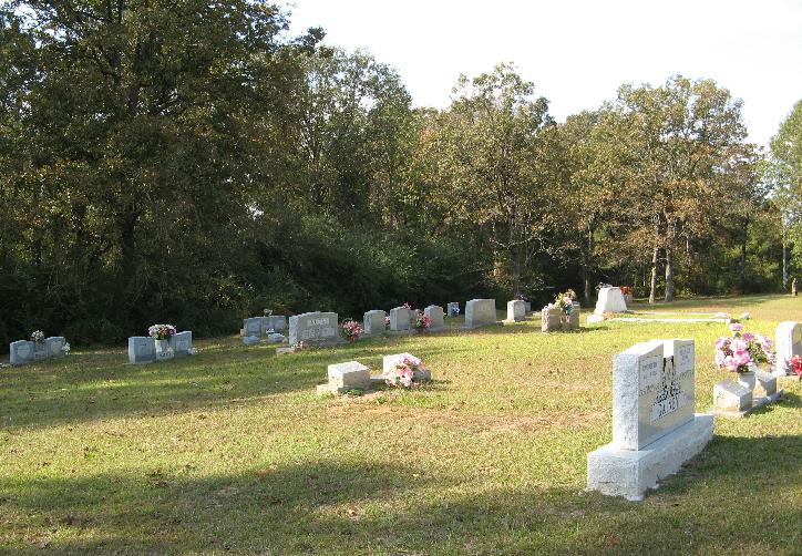
| Memorials | : | 0 |
| Location | : | Lingle, Smith County, USA |
| Coordinate | : | 32.2183500, -89.5443800 |
| Description | : | From Raleigh, MS proceed North on Mississippi Highway 35 (MS 35) to the intersection of Smith County Road 558 (SCR 558 aka Wicker Mill Road.) Turn Left (West) onto SCR 558 and continue 2.8 miles to the intersection of Smith County Road 32B (SCR 32B.) Turn Left (South) onto SCR 32B and continue 290 feet. Cemetery will be on the Right (West) side of road, specifically SE1/4 NE1/4, S2, T4N-R7E, Smith, Homewood Quadrangle map, USNG 16S BA 60211 67474. |
frequently asked questions (FAQ):
-
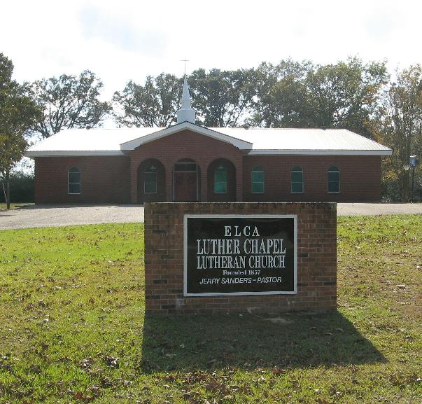
Where is Luther Chapel Lutheran Church Cemetery?
Luther Chapel Lutheran Church Cemetery is located at 3541 Smith County Road 32B Lingle, Smith County ,Mississippi , 39152USA.
-
Luther Chapel Lutheran Church Cemetery cemetery's updated grave count on graveviews.com?
0 memorials
-
Where are the coordinates of the Luther Chapel Lutheran Church Cemetery?
Latitude: 32.2183500
Longitude: -89.5443800
Nearby Cemetories:
1. Luther Chapel Cemetery
Pulaski, Scott County, USA
Coordinate: 32.2405100, -89.5511900
2. Lingle Cemetery
Lingle, Smith County, USA
Coordinate: 32.2091200, -89.5731800
3. Black Cemetery
Smith County, USA
Coordinate: 32.2098070, -89.5739170
4. Roberts Cemetery
Smith County, USA
Coordinate: 32.1968100, -89.5688000
5. Bethel Baptist Church Cemetery
Smith County, USA
Coordinate: 32.1830920, -89.5565660
6. Lorena Baptist Church Extension Cemetery
Smith County, USA
Coordinate: 32.1976340, -89.5059530
7. Homewood Methodist Church Cemetery
Forest, Scott County, USA
Coordinate: 32.2410500, -89.5046000
8. Gasque Chapel Cemetery
Smith County, USA
Coordinate: 32.1793540, -89.5297340
9. Lorena Baptist Church Cemetery
Lorena, Smith County, USA
Coordinate: 32.1917890, -89.5061570
10. New Goodhope Baptist Cemetery
Pulaski, Scott County, USA
Coordinate: 32.2314030, -89.5920360
11. Noblin Cemetery
Forest, Scott County, USA
Coordinate: 32.2310210, -89.4952380
12. Warrens Cemetery
Pulaski, Scott County, USA
Coordinate: 32.2570700, -89.5885500
13. Mount Mariah Missionary Baptist Church Cemetery
Pulaski, Scott County, USA
Coordinate: 32.2686700, -89.5760100
14. Good Hope Cemetery
Smith County, USA
Coordinate: 32.1613100, -89.5345100
15. Union Grove Cemetery
Smith County, USA
Coordinate: 32.1888520, -89.4801290
16. New Chapel Cemetery
Smith County, USA
Coordinate: 32.1710100, -89.5944800
17. Zion Cemetery
Smith County, USA
Coordinate: 32.1689700, -89.5918000
18. Searcy Cemetery
Pulaski, Scott County, USA
Coordinate: 32.2608200, -89.6004700
19. Brassell Cemetery
Pulaski, Scott County, USA
Coordinate: 32.2728004, -89.5849991
20. Derrick Cemetery
Smith County, USA
Coordinate: 32.1484800, -89.5742400
21. Pulaski Cemetery
Pulaski, Scott County, USA
Coordinate: 32.2744300, -89.6032100
22. Alice German Gravesite
Pulaski, Scott County, USA
Coordinate: 32.2915800, -89.5866800
23. Providence Cemetery
Burns, Smith County, USA
Coordinate: 32.1357400, -89.5528600
24. Mount Carmel Cemetery
Smith County, USA
Coordinate: 32.1748200, -89.4593010