
| Memorials | : | 0 |
| Location | : | Smith County, USA |
| Coordinate | : | 32.1830920, -89.5565660 |
| Description | : | From Raleigh, Mississippi proceed North on Highway 35 11 miles to the intersection of Highway 902 (also known as Smith County Road 32, SCR 32) and turn left (West.) Continue 9 tenths of a mile on Hwy 902 until reaching Smith County Road 32-B (SCR 32-B) and turn right (NorthWest.) Proceed on SCR 32-B for one-third mile to the intersection of Smith County Road 559 (SCR 559) and turn left (West.) Continue approximately 1.6 miles on SCR 559 to the intersection of Smith County Road 502 (SCR 502) turning right (North) onto SCR 502 and proceeding two tenths of a... Read More |
frequently asked questions (FAQ):
-
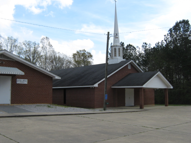
Where is Bethel Baptist Church Cemetery?
Bethel Baptist Church Cemetery is located at 3196 Smith County Road 502 Smith County ,Mississippi , 39152USA.
-
Bethel Baptist Church Cemetery cemetery's updated grave count on graveviews.com?
0 memorials
-
Where are the coordinates of the Bethel Baptist Church Cemetery?
Latitude: 32.1830920
Longitude: -89.5565660

Nearby Cemetories:
1. Roberts Cemetery
Smith County, USA
Coordinate: 32.1968100, -89.5688000
2. Gasque Chapel Cemetery
Smith County, USA
Coordinate: 32.1793540, -89.5297340
3. Good Hope Cemetery
Smith County, USA
Coordinate: 32.1613100, -89.5345100
4. Lingle Cemetery
Lingle, Smith County, USA
Coordinate: 32.2091200, -89.5731800
5. Black Cemetery
Smith County, USA
Coordinate: 32.2098070, -89.5739170
6. Zion Cemetery
Smith County, USA
Coordinate: 32.1689700, -89.5918000
7. New Chapel Cemetery
Smith County, USA
Coordinate: 32.1710100, -89.5944800
8. Luther Chapel Lutheran Church Cemetery
Lingle, Smith County, USA
Coordinate: 32.2183500, -89.5443800
9. Derrick Cemetery
Smith County, USA
Coordinate: 32.1484800, -89.5742400
10. Lorena Baptist Church Cemetery
Lorena, Smith County, USA
Coordinate: 32.1917890, -89.5061570
11. Lorena Baptist Church Extension Cemetery
Smith County, USA
Coordinate: 32.1976340, -89.5059530
12. Providence Cemetery
Burns, Smith County, USA
Coordinate: 32.1357400, -89.5528600
13. Barber Cemetery
Raleigh, Smith County, USA
Coordinate: 32.1321810, -89.5385960
14. Burns Baptist Church Cemetery
Raleigh, Smith County, USA
Coordinate: 32.1321880, -89.5384430
15. Burns United Methodist Church Cemetery
Burns, Smith County, USA
Coordinate: 32.1310501, -89.5399399
16. New Goodhope Baptist Cemetery
Pulaski, Scott County, USA
Coordinate: 32.2314030, -89.5920360
17. Luther Chapel Cemetery
Pulaski, Scott County, USA
Coordinate: 32.2405100, -89.5511900
18. Goodwater Baptist Church Cemetery
Smith County, USA
Coordinate: 32.1415200, -89.5027900
19. Union Grove Cemetery
Smith County, USA
Coordinate: 32.1888520, -89.4801290
20. Moulder Cemetery
Smith County, USA
Coordinate: 32.1239014, -89.6007996
21. Henderson Family Cemetery
Smith County, USA
Coordinate: 32.1207008, -89.5181122
22. Noblin Cemetery
Forest, Scott County, USA
Coordinate: 32.2310210, -89.4952380
23. Homewood Methodist Church Cemetery
Forest, Scott County, USA
Coordinate: 32.2410500, -89.5046000
24. Warrens Cemetery
Pulaski, Scott County, USA
Coordinate: 32.2570700, -89.5885500