
| Memorials | : | 0 |
| Location | : | Sandy, Central Bedfordshire Unitary Authority, England |
| Coordinate | : | 52.1273583, -0.2862773 |
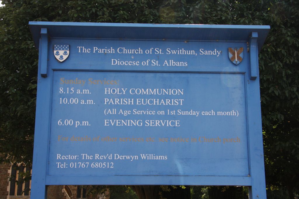
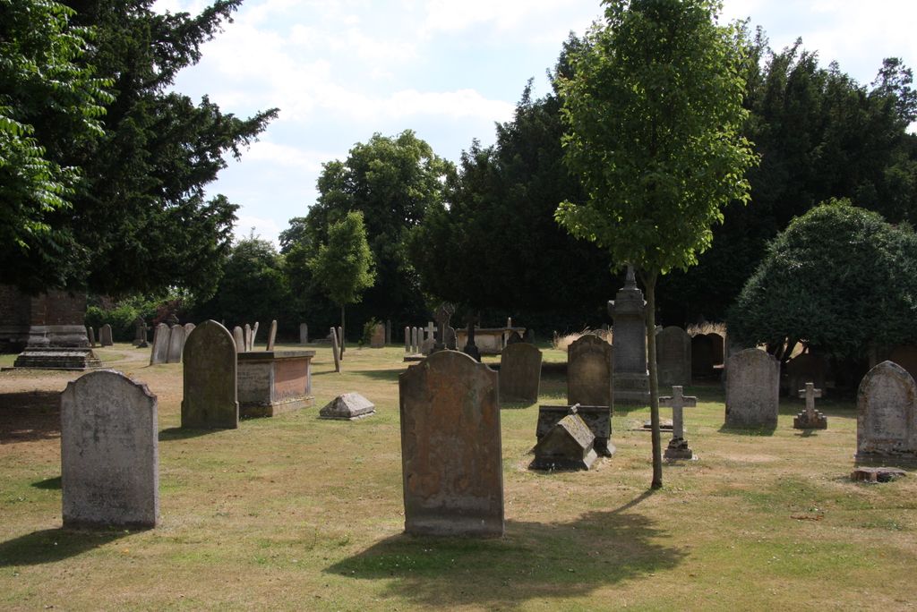
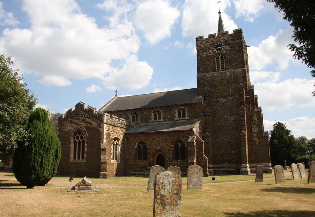
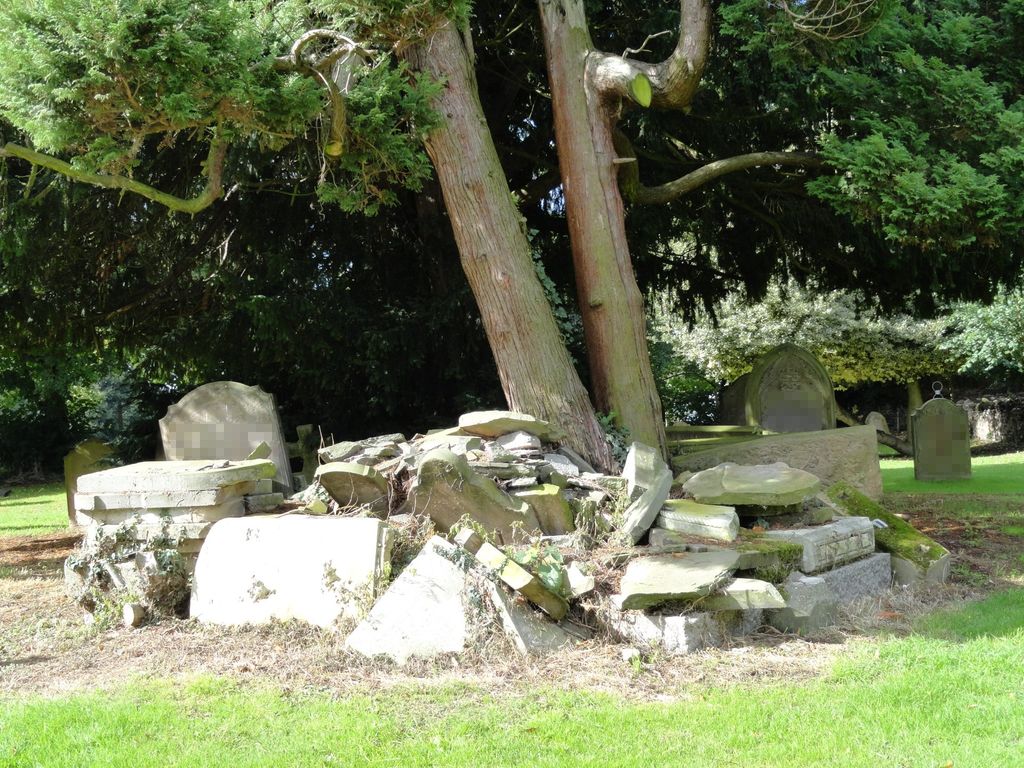
| Description | : | St Swithun's Church dates back to the mid 14th Century but very little of the original construction remains today. The churchyard is maintained by the local Town Council and is now closed for all burials. Present day interments take place at the Sandy Cemetery (Potton Road Cemetery). |
frequently asked questions (FAQ):
-
Where is St Swithun Churchyard?
St Swithun Churchyard is located at High Street Sandy, Central Bedfordshire Unitary Authority ,Bedfordshire , SG19 1AQEngland.
-
St Swithun Churchyard cemetery's updated grave count on graveviews.com?
0 memorials
-
Where are the coordinates of the St Swithun Churchyard?
Latitude: 52.1273583
Longitude: -0.2862773
Nearby Cemetories:
1. Old Baptist Burial Ground
Sandy, Central Bedfordshire Unitary Authority, England
Coordinate: 52.1299590, -0.2884590
2. Sandy Cemetery
Sandy, Central Bedfordshire Unitary Authority, England
Coordinate: 52.1245500, -0.2783300
3. St. John the Evangelist Churchyard
Mogerhanger, Central Bedfordshire Unitary Authority, England
Coordinate: 52.1305000, -0.3325000
4. St Mary the Virgin Churchyard
Northill, Central Bedfordshire Unitary Authority, England
Coordinate: 52.1053300, -0.3239650
5. Tempsford Village Cemetery
Tempsford, Central Bedfordshire Unitary Authority, England
Coordinate: 52.1639000, -0.3024500
6. St Andrew Churchyard
Biggleswade, Central Bedfordshire Unitary Authority, England
Coordinate: 52.0875360, -0.2666970
7. All Saints Churchyard
Sutton, Central Bedfordshire Unitary Authority, England
Coordinate: 52.1126500, -0.2212200
8. Stratton Way Cemetery
Biggleswade, Central Bedfordshire Unitary Authority, England
Coordinate: 52.0919432, -0.2474864
9. Drove Road Cemetery
Biggleswade, Central Bedfordshire Unitary Authority, England
Coordinate: 52.0895000, -0.2527300
10. All Saints Churchyard
Great Barford, Bedford Borough, England
Coordinate: 52.1520280, -0.3439850
11. Potton Baptist Church (Defunct)
Potton, Central Bedfordshire Unitary Authority, England
Coordinate: 52.1242617, -0.2096524
12. St Mary the Virgin Churchyard
Potton, Central Bedfordshire Unitary Authority, England
Coordinate: 52.1295800, -0.2066700
13. St. Mary Magdalene Churchyard
Roxton, Bedford Borough, England
Coordinate: 52.1769310, -0.3146280
14. St. Leonard's Churchyard
Old Warden, Central Bedfordshire Unitary Authority, England
Coordinate: 52.0855860, -0.3424550
15. St. Lawrence's Churchyard
Willington, Bedford Borough, England
Coordinate: 52.1362631, -0.3847213
16. All Saints Churchyard
Cople, Bedford Borough, England
Coordinate: 52.1235000, -0.3899000
17. Langford Cemetery
Langford, Central Bedfordshire Unitary Authority, England
Coordinate: 52.0640000, -0.2710830
18. Cople Cemetery
Cople, Bedford Borough, England
Coordinate: 52.1227395, -0.3910262
19. All Saints Churchyard
Southill, Central Bedfordshire Unitary Authority, England
Coordinate: 52.0666240, -0.3298690
20. St Mary the Virgin Churchyard
Gamlingay, South Cambridgeshire District, England
Coordinate: 52.1549840, -0.1872690
21. St Andrew Churchyard
Langford, Central Bedfordshire Unitary Authority, England
Coordinate: 52.0583270, -0.2721350
22. Dunton Cemetery
Dunton, Central Bedfordshire Unitary Authority, England
Coordinate: 52.0820490, -0.1982770
23. St Deny's Churchyard
Little Barford, Bedford Borough, England
Coordinate: 52.1982210, -0.2785350
24. St Mary Magdalene Churchyard
Dunton, Central Bedfordshire Unitary Authority, England
Coordinate: 52.0825200, -0.1955600