
| Memorials | : | 17 |
| Location | : | Croughton, South Northamptonshire Borough, England |
| Coordinate | : | 51.9977370, -1.2065760 |
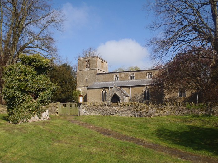
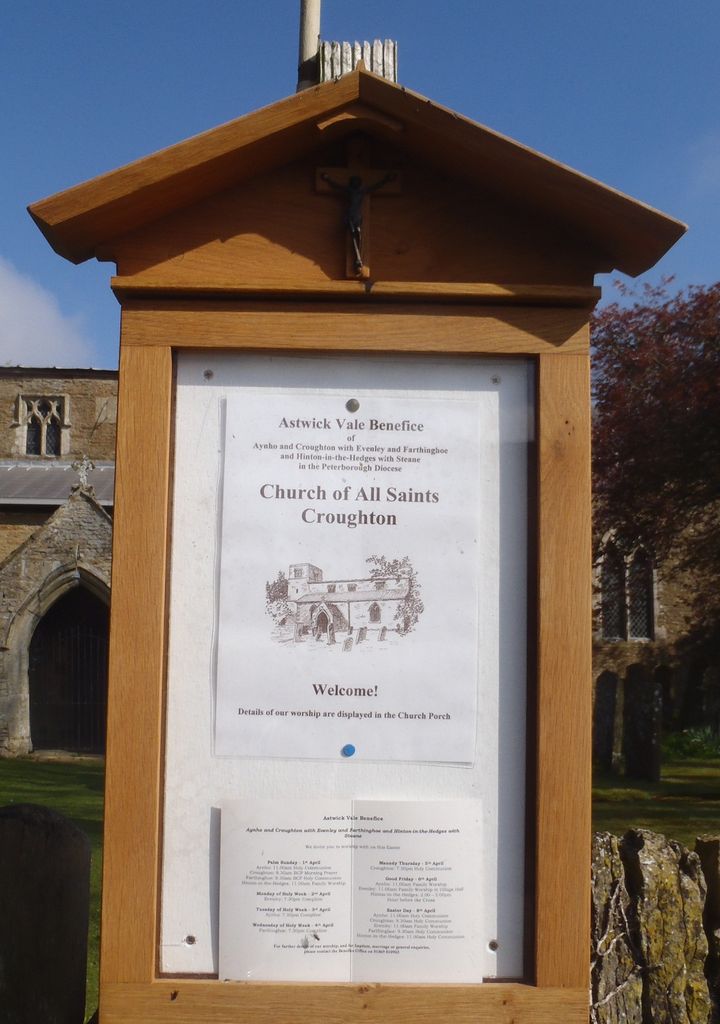
| Description | : | The village is best known for its Parish Church, which is of historical significance for its murals, now sadly damaged. An historic elm reputedly stood in the church grounds for 800 years, and although it is believed to have died of Dutch elm disease in the 1970s, its demise dates back to the early 1900s |
frequently asked questions (FAQ):
-
Where is All Saints Churchyard?
All Saints Churchyard is located at Church Lane Croughton, South Northamptonshire Borough ,Northamptonshire , NN13 5LSEngland.
-
All Saints Churchyard cemetery's updated grave count on graveviews.com?
17 memorials
-
Where are the coordinates of the All Saints Churchyard?
Latitude: 51.9977370
Longitude: -1.2065760
Nearby Cemetories:
1. Croughton Cemetery
Croughton, South Northamptonshire Borough, England
Coordinate: 52.0014880, -1.2031960
2. St Mary the Virgin Churchyard
Souldern, Cherwell District, England
Coordinate: 51.9808600, -1.2399900
3. St Michael Churchyard
Aynho, South Northamptonshire Borough, England
Coordinate: 51.9936080, -1.2522380
4. Newbottle and Charlton Cemetery
Newbottle, South Northamptonshire Borough, England
Coordinate: 52.0225300, -1.2351200
5. Holy Trinity Church
Hinton-in-the-Hedges, South Northamptonshire Borough, England
Coordinate: 52.0281190, -1.1881330
6. Saint James' Churchyard
Newbottle, South Northamptonshire Borough, England
Coordinate: 52.0280500, -1.2382170
7. Fritwell Parish Council Cemetery
Fritwell, Cherwell District, England
Coordinate: 51.9599490, -1.2380650
8. St Olave Churchyard
Fritwell, Cherwell District, England
Coordinate: 51.9596980, -1.2381180
9. Kings Sutton Cemetery
Kings Sutton, South Northamptonshire Borough, England
Coordinate: 52.0151400, -1.2711000
10. St. Mary's Churchyard
Cottisford, Cherwell District, England
Coordinate: 51.9749070, -1.1464410
11. St Mary the Virgin Churchyard
Hardwick, Cherwell District, England
Coordinate: 51.9616750, -1.1615570
12. Hospital of St James and St John
Brackley, South Northamptonshire Borough, England
Coordinate: 52.0284000, -1.1473000
13. Ss Peter and Paul Churchyard
Kings Sutton, South Northamptonshire Borough, England
Coordinate: 52.0212000, -1.2763560
14. Fewcott All Saints Churchyard
Albury, South Oxfordshire District, England
Coordinate: 51.9477100, -1.2170700
15. St Peters Churchyard
Stoke Lyne, Cherwell District, England
Coordinate: 51.9505340, -1.1771680
16. Holy Trinity Churchyard
Hethe, Cherwell District, England
Coordinate: 51.9615600, -1.1452100
17. St. Peter's Churchyard
Brackley, South Northamptonshire Borough, England
Coordinate: 52.0309710, -1.1390480
18. Halse Road Cemetery
Brackley, South Northamptonshire Borough, England
Coordinate: 52.0395310, -1.1494450
19. St. Mary's Churchyard
Ardley, Cherwell District, England
Coordinate: 51.9422140, -1.2122580
20. St. Edmund and St. George Churchyard
Hethe, Cherwell District, England
Coordinate: 51.9604830, -1.1384690
21. Mixbury All Saints Churchyard
Mixbury, Cherwell District, England
Coordinate: 52.0010100, -1.1131800
22. St. Mary's Churchyard
Turweston, Aylesbury Vale District, England
Coordinate: 52.0345400, -1.1257500
23. St James Churchyard
Somerton, Cherwell District, England
Coordinate: 51.9539990, -1.2786200
24. St Michaels and All Angels Churchyard
Fringford, Cherwell District, England
Coordinate: 51.9573680, -1.1189880