
| Memorials | : | 0 |
| Location | : | Gloucester, City of Gloucester, England |
| Coordinate | : | 51.8686720, -2.2321530 |
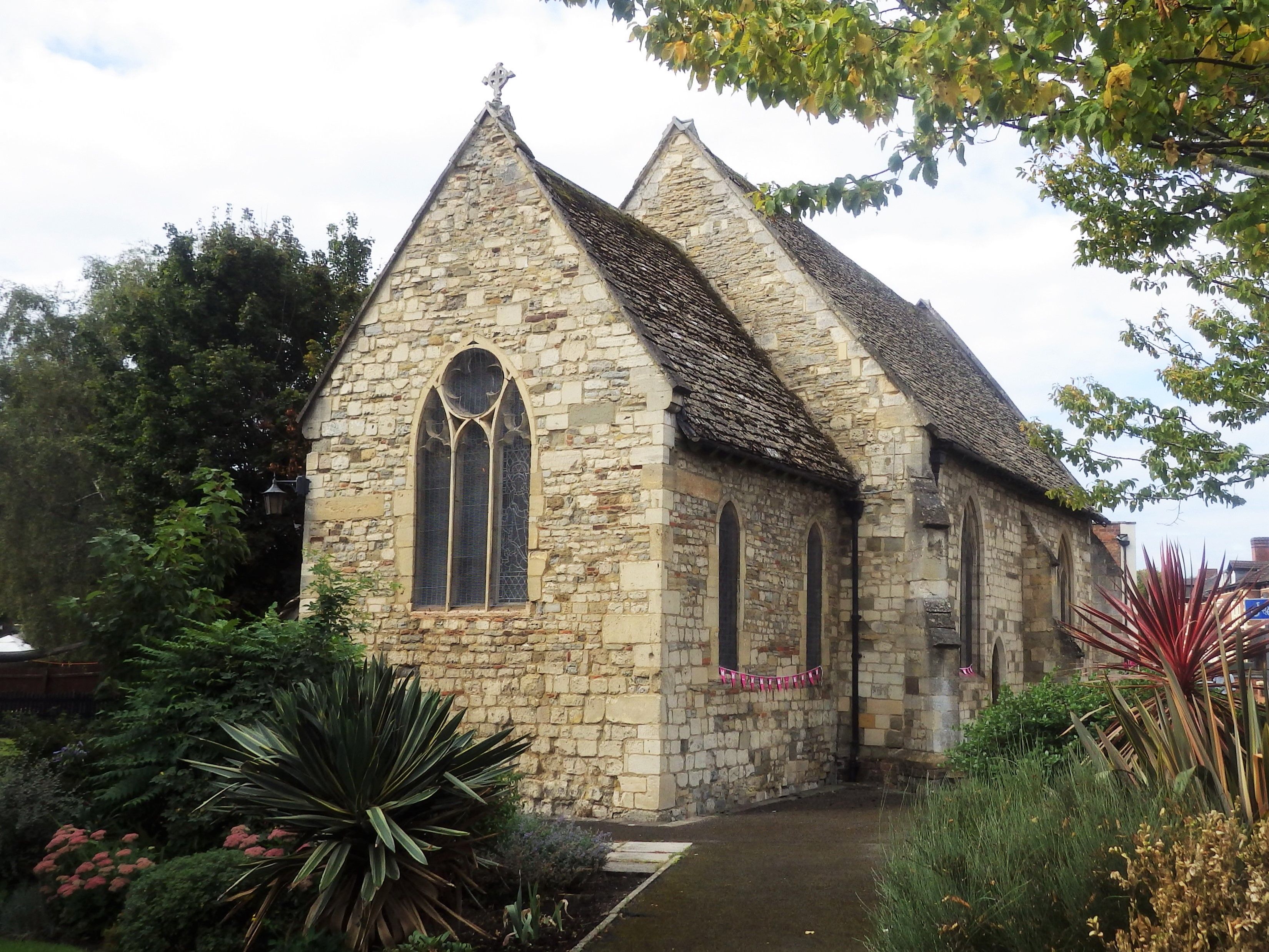
| Description | : | Situated outside the city boundary on the south-east side of London Road and in the grounds of Magdalen House Nursing Home. The Chapel was originally built for the benefit of those suffering from leprosy. St Margarets belonged to the Leper Hospital of St Margaret and St Sepulchre, which was founded prior to 1163. The present Chapel building is thought to date from the early 1400's and be on the site of an earlier building. It was restored in 1846 and again in 1875 when the south vestry was added. There is a bricked-up door on the exterior leading to the chapel... Read More |
frequently asked questions (FAQ):
-
Where is St Margaret's Chapel?
St Margaret's Chapel is located at 98A London Rd, Gloucester Gloucester, City of Gloucester ,Gloucestershire , GL1 3PHEngland.
-
St Margaret's Chapel cemetery's updated grave count on graveviews.com?
0 memorials
-
Where are the coordinates of the St Margaret's Chapel?
Latitude: 51.8686720
Longitude: -2.2321530
Nearby Cemetories:
1. Chapel of St Mary Magdalen
Gloucester, City of Gloucester, England
Coordinate: 51.8693000, -2.2291000
2. Saint Catharine's
Gloucester, City of Gloucester, England
Coordinate: 51.8691700, -2.2273500
3. Horton Road Cemetery
Gloucester, City of Gloucester, England
Coordinate: 51.8666900, -2.2268300
4. Gloucester Cathedral
Gloucester, City of Gloucester, England
Coordinate: 51.8675920, -2.2467670
5. Saint Oswald's Priory
Gloucester, City of Gloucester, England
Coordinate: 51.8694000, -2.2478000
6. St Nicholas' Church
Gloucester, City of Gloucester, England
Coordinate: 51.8672800, -2.2496760
7. Gloucester Crematorium
Gloucester, City of Gloucester, England
Coordinate: 51.8538180, -2.2219260
8. Llanthony Secunda Priory
Hempsted, City of Gloucester, England
Coordinate: 51.8602130, -2.2572640
9. St Lawrence Churchyard
Barnwood, City of Gloucester, England
Coordinate: 51.8580470, -2.2069750
10. Gloucester Old Cemetery
Gloucester, City of Gloucester, England
Coordinate: 51.8482100, -2.2276700
11. St. Matthew's Cemetery
Twigworth, Tewkesbury Borough, England
Coordinate: 51.8936090, -2.2307820
12. Ss Philip and James Churchyard
Hucclecote, Tewkesbury Borough, England
Coordinate: 51.8573040, -2.1876440
13. St. Swithun's Churchyard
Hempsted, City of Gloucester, England
Coordinate: 51.8515740, -2.2719420
14. St. Giles Churchyard
Maisemore, Tewkesbury Borough, England
Coordinate: 51.8931690, -2.2719540
15. Holy Innocents Churchyard
Highnam, Tewkesbury Borough, England
Coordinate: 51.8740890, -2.2970050
16. St Lawrence Churchyard
Sandhurst, Tewkesbury Borough, England
Coordinate: 51.9083260, -2.2489570
17. St. Oswald Churchyard
Lassington, Tewkesbury Borough, England
Coordinate: 51.8884700, -2.2978000
18. St Margaret Church
Whaddon, Stroud District, England
Coordinate: 51.8214600, -2.2433000
19. St George Churchyard
Brockworth, Tewkesbury Borough, England
Coordinate: 51.8517460, -2.1598180
20. St. James' Churchyard
Quedgeley, City of Gloucester, England
Coordinate: 51.8257770, -2.2811150
21. Holy Trinity Churchyard
Badgeworth, Tewkesbury Borough, England
Coordinate: 51.8715360, -2.1444640
22. Prinknash Abbey
Cranham, Stroud District, England
Coordinate: 51.8225000, -2.1761110
23. St. Swithun Churchyard
Brookthorpe, Stroud District, England
Coordinate: 51.8087500, -2.2402900
24. St. Mary the Virgin Cemetery
Rudford, Forest of Dean District, England
Coordinate: 51.8936272, -2.3213976