
| Memorials | : | 0 |
| Location | : | Steyning, Horsham District, England |
| Coordinate | : | 50.8698470, -0.3051070 |
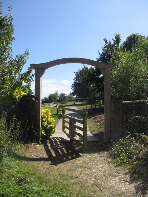
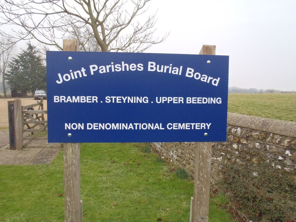
| Description | : | Botolphs, formerly called Annington, is a tiny village in the Horsham District of West Sussex, England. It is in the Adur Valley 1.5 miles (2.4 km) southeast of Steyning on the road between Steyning and Coombes. The Cemetery is near St Botolphs Churchyard but is not a classed as a extension as it in non-conformist. |
frequently asked questions (FAQ):
-
Where is Botolph Cemetery?
Botolph Cemetery is located at Annington Road Steyning, Horsham District ,West Sussex ,England.
-
Botolph Cemetery cemetery's updated grave count on graveviews.com?
0 memorials
-
Where are the coordinates of the Botolph Cemetery?
Latitude: 50.8698470
Longitude: -0.3051070

Nearby Cemetories:
1. St Botolph's
Boto By, Guldborgsund Kommune, Denmark
Coordinate: 50.8704488, -0.3049848
2. Coombes Churchyard
Coombes, Adur District, England
Coordinate: 50.8611730, -0.3082180
3. St Nicholas Churchyard
Bramber, Horsham District, England
Coordinate: 50.8828660, -0.3153580
4. St Peter Churchyard
Upper Beeding, Horsham District, England
Coordinate: 50.8873530, -0.3056540
5. St Andrew and St Cuthman Churchyard
Steyning, Horsham District, England
Coordinate: 50.8900700, -0.3250280
6. Landing College Chapel
Lancing, Adur District, England
Coordinate: 50.8459798, -0.3042240
7. St. Nicolas' Churchyard
Old Shoreham, Adur District, England
Coordinate: 50.8407940, -0.2856690
8. Lancing and Sompting Cemetery
Lancing, Adur District, England
Coordinate: 50.8405270, -0.3280020
9. St. James the Less Churchyard
Lancing, Adur District, England
Coordinate: 50.8378170, -0.3226110
10. St James the Less Churchyard Extension
Lancing, Adur District, England
Coordinate: 50.8367330, -0.3239250
11. Mill Lane Cemetery
Shoreham-by-Sea, Adur District, England
Coordinate: 50.8378990, -0.2783270
12. St. Mary's Churchyard
Sompting, Adur District, England
Coordinate: 50.8386030, -0.3518740
13. St Mary Churchyard
Wiston, Horsham District, England
Coordinate: 50.8995280, -0.3582890
14. St. Julian's Churchyard
Shoreham-by-Sea, Adur District, England
Coordinate: 50.8340600, -0.2465500
15. St. Michael & All Angels Churchyard
Southwick, Adur District, England
Coordinate: 50.8348240, -0.2411970
16. Southwick Cemetery
Southwick, Adur District, England
Coordinate: 50.8429050, -0.2316730
17. The Catholic Church of Saint Charles Borromeo
Worthing Borough, England
Coordinate: 50.8206203, -0.3544798
18. St Marys Churchyard
Broadwater, Worthing Borough, England
Coordinate: 50.8277750, -0.3734920
19. All Saints Churchyard
Wiston, Horsham District, England
Coordinate: 50.9132350, -0.3725910
20. St. Nicolas Churchyard
Portslade, Brighton and Hove Unitary Authority, England
Coordinate: 50.8430280, -0.2181350
21. St Peter's Churchyard
Woodmancote, Horsham District, England
Coordinate: 50.9213180, -0.2497350
22. Broadwater Cemetery
Worthing, Worthing Borough, England
Coordinate: 50.8277650, -0.3799460
23. Durrington Cemetery
Durrington, Worthing Borough, England
Coordinate: 50.8390820, -0.3934460
24. St Peter's Churchyard
Henfield, Horsham District, England
Coordinate: 50.9323340, -0.2762030