
| Memorials | : | 0 |
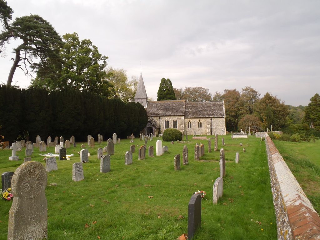
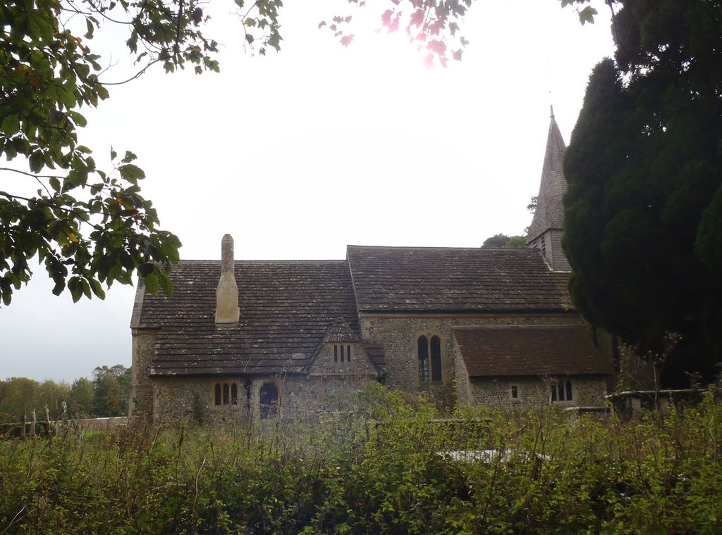
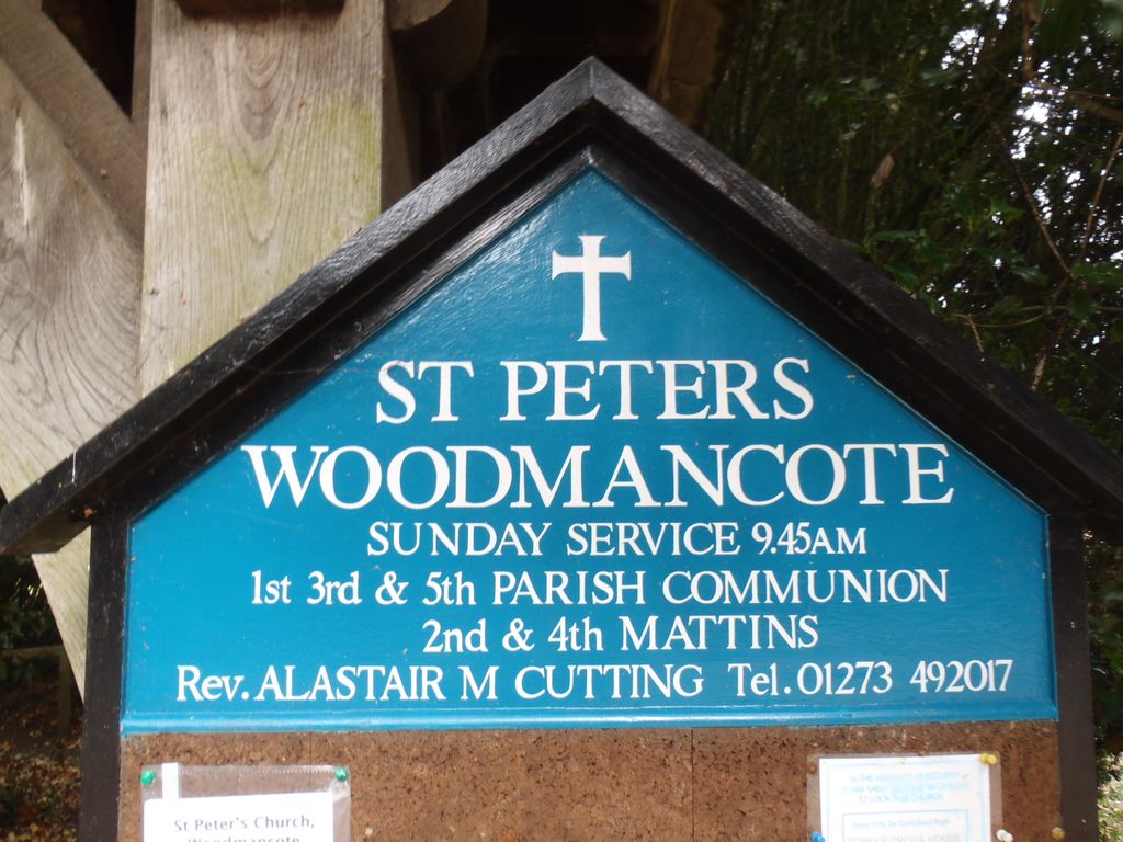
| Location | : | Woodmancote, Horsham District, England |
| Coordinate | : | 50.9213180, -0.2497350 |
frequently asked questions (FAQ):
-
Where is St Peter's Churchyard?
St Peter's Churchyard is located at Off A281 Woodmancote, Horsham District ,West Sussex , BN5 9SUEngland.
-
St Peter's Churchyard cemetery's updated grave count on graveviews.com?
0 memorials
-
Where are the coordinates of the St Peter's Churchyard?
Latitude: 50.9213180
Longitude: -0.2497350


Nearby Cemetories:
1. St Peter's Churchyard
Henfield, Horsham District, England
Coordinate: 50.9323340, -0.2762030
2. Henfield Cemetery
Henfield, Horsham District, England
Coordinate: 50.9342000, -0.2764400
3. St Giles Churchyard
Shermanbury, Horsham District, England
Coordinate: 50.9561320, -0.2726010
4. Poynings Cemetery
Poynings, Mid Sussex District, England
Coordinate: 50.8931150, -0.2024450
5. Holy Trinity Churchyard
Hurstpierpoint, Mid Sussex District, England
Coordinate: 50.9337020, -0.1804460
6. Hurstpierpoint South Avenue Cemetery
Hurstpierpoint, Mid Sussex District, England
Coordinate: 50.9300110, -0.1753150
7. St Peters Churchyard
Twineham, Mid Sussex District, England
Coordinate: 50.9657310, -0.2174410
8. St Peter Churchyard
Upper Beeding, Horsham District, England
Coordinate: 50.8873530, -0.3056540
9. St James Churchyard
Ashurst, Horsham District, England
Coordinate: 50.9347992, -0.3273070
10. St Michael & All Angels Churchyard
Partridge Green, Horsham District, England
Coordinate: 50.9618600, -0.3081540
11. St Michael and All Angels Churchyard
West Grinstead, Horsham District, England
Coordinate: 50.9619680, -0.3081750
12. St Hugh's Charterhouse
Horsham, Horsham District, England
Coordinate: 50.9730110, -0.2827360
13. St Nicholas Churchyard
Bramber, Horsham District, England
Coordinate: 50.8828660, -0.3153580
14. St Andrew and St Cuthman Churchyard
Steyning, Horsham District, England
Coordinate: 50.8900700, -0.3250280
15. Church of the Transfiguration Churchyard
Pyecombe, Mid Sussex District, England
Coordinate: 50.8984590, -0.1642370
16. Clayton Wood Natural Burial Ground
Clayton, Mid Sussex District, England
Coordinate: 50.9160900, -0.1547600
17. St Botolph's
Boto By, Guldborgsund Kommune, Denmark
Coordinate: 50.8704488, -0.3049848
18. St John the Baptist Churchyard
Clayton, Mid Sussex District, England
Coordinate: 50.9105170, -0.1534370
19. Botolph Cemetery
Steyning, Horsham District, England
Coordinate: 50.8698470, -0.3051070
20. Burgess Hill Burial Ground
Burgess Hill, Mid Sussex District, England
Coordinate: 50.9542794, -0.1583567
21. St Peter Churchyard
Cowfold, Horsham District, England
Coordinate: 50.9898500, -0.2740200
22. Coombes Churchyard
Coombes, Adur District, England
Coordinate: 50.8611730, -0.3082180
23. St Mary Churchyard
Wiston, Horsham District, England
Coordinate: 50.8995280, -0.3582890
24. Our Lady Of Consolation and St Francis Churchyard
West Grinstead, Horsham District, England
Coordinate: 50.9779220, -0.3245590