

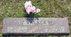
Christopher Joseph Walker
| Birth | : | 25 Feb 1915 Mayetta, Jackson County, Kansas, USA |
| Death | : | 21 Sep 2002 Topeka, Shawnee County, Kansas, USA |
| Burial | : | Saint John's Catholic Cemetery, Delphos, Allen County, USA |
| Coordinate | : | 40.8423620, -84.3319580 |
| Description | : | Christopher Joseph Walker, 87, Holton, formerly of Mayetta, died Saturday, Sept. 21, 2002, at a Topeka hospice house. He was born Feb. 25, 1915, near Mayetta, to Christopher B. and Mary Gooderl Walker, and graduated from Mayetta Rural High School in 1931. He was a teacher in rural schools on the Potawatomie Indian Reservation for 12 years. He was a farmer near Mayetta for 68 years. He was a member of St. Dominic's Catholic Church in Holton and had been a member of St. Francis Xavier Catholic Church in Mayetta... Read More |
frequently asked questions (FAQ):
-
Where is Christopher Joseph Walker's memorial?
Christopher Joseph Walker's memorial is located at: Saint John's Catholic Cemetery, Delphos, Allen County, USA.
-
When did Christopher Joseph Walker death?
Christopher Joseph Walker death on 21 Sep 2002 in Topeka, Shawnee County, Kansas, USA
-
Where are the coordinates of the Christopher Joseph Walker's memorial?
Latitude: 40.8423620
Longitude: -84.3319580
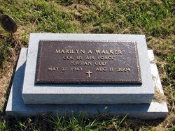
Family Members:
Parent

Spouse
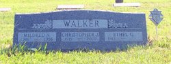
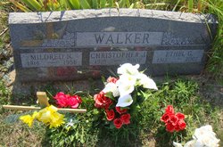
Siblings
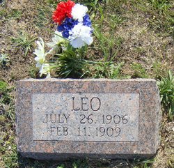
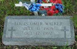

Children
Flowers:


Nearby Cemetories:
1. Westside Cemetery
Delphos, Van Wert County, USA
Coordinate: 40.8452988, -84.3507996
2. Hartshorn Cemetery
Allen County, USA
Coordinate: 40.8424988, -84.2908020
3. New Saint John's Catholic Cemetery
Delphos, Allen County, USA
Coordinate: 40.8451390, -84.2889380
4. Walnut Grove Cemetery
Delphos, Allen County, USA
Coordinate: 40.8300018, -84.2906036
5. King Cemetery
Marion Township, Allen County, USA
Coordinate: 40.8060989, -84.2869034
6. Saint John the Baptist Catholic Cemetery
Landeck, Allen County, USA
Coordinate: 40.7999992, -84.3874969
7. Mount Calvary Cemetery
Fort Jennings, Putnam County, USA
Coordinate: 40.8986015, -84.3035965
8. Raabe Cemetery
Fort Jennings, Putnam County, USA
Coordinate: 40.8993988, -84.2789001
9. Saint Joseph Cemetery
Fort Jennings, Putnam County, USA
Coordinate: 40.9056015, -84.2928009
10. Pike Cemetery
Elida, Allen County, USA
Coordinate: 40.7947006, -84.2585983
11. King Cemetery
Middle Point, Van Wert County, USA
Coordinate: 40.8664017, -84.4377975
12. Saint Marys Cemetery
Ottoville, Putnam County, USA
Coordinate: 40.9261017, -84.3399963
13. Hammons Cemetery
Ottoville, Putnam County, USA
Coordinate: 40.9223370, -84.3701410
14. Horeb Cemetery
Venedocia, Van Wert County, USA
Coordinate: 40.8005981, -84.4341965
15. West Union Cemetery
Spencerville, Allen County, USA
Coordinate: 40.7574997, -84.3641968
16. Carmen Cemetery
Gomer, Allen County, USA
Coordinate: 40.8531380, -84.2118660
17. Doner Cemetery
Elida, Allen County, USA
Coordinate: 40.7951330, -84.2277470
18. Sharon Mennonite Cemetery
Elida, Allen County, USA
Coordinate: 40.7828080, -84.2332721
19. Keirns Cemetery
Sugar Creek Township, Putnam County, USA
Coordinate: 40.8875008, -84.2181015
20. Hadding Cemetery
Gomer, Allen County, USA
Coordinate: 40.8319016, -84.2035980
21. Hartford Cemetery
Spencerville, Allen County, USA
Coordinate: 40.7386017, -84.3158035
22. Old Hartford Cemetery
Allen County, USA
Coordinate: 40.7371788, -84.3140564
23. Ridge Cemetery
Middle Point, Van Wert County, USA
Coordinate: 40.8781013, -84.4692001
24. Lutheran Cemetery
Elida, Allen County, USA
Coordinate: 40.7877998, -84.2050018