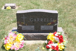
| Birth | : | 6 Apr 1920 Sac County, Iowa, USA |
| Death | : | 16 Mar 2005 Milford, Dickinson County, Iowa, USA |
| Burial | : | Saint Michael's Churchyard, Haselbech, Daventry District, England |
| Coordinate | : | 52.3891890, -0.9556720 |
| Description | : | Eleanor Smidt, age 84, formerly of Auburn, Iowa passed away on Wednesday, March 16, 2005, at the Milford Care Center in Milford, Iowa. Eleanor Dorothy Anna Buse was born on April 6, 1921 (sic), in Sac County, Iowa, the daughter of Tony and Alvena (Peters) Buse. Eleanor was baptized in the Lutheran faith and confirmed on March 16, 1941, at the Peace Lutheran Church in Ulmer, Iowa. She attended rural school in Coon Valley Township and graduated from the Auburn High School in 1938. On April 20, 1939, Eleanor was united in marriage to Harold Phillip Smidt. The couple lived on a... Read More |
frequently asked questions (FAQ):
-
Where is Eleanor Dorothy Anna Buse Smidt's memorial?
Eleanor Dorothy Anna Buse Smidt's memorial is located at: Saint Michael's Churchyard, Haselbech, Daventry District, England.
-
When did Eleanor Dorothy Anna Buse Smidt death?
Eleanor Dorothy Anna Buse Smidt death on 16 Mar 2005 in Milford, Dickinson County, Iowa, USA
-
Where are the coordinates of the Eleanor Dorothy Anna Buse Smidt's memorial?
Latitude: 52.3891890
Longitude: -0.9556720
Family Members:
Parent
Spouse
Siblings
Children
Flowers:
Nearby Cemetories:
1. Saint Michael's Churchyard
Haselbech, Daventry District, England
Coordinate: 52.3891890, -0.9556720
2. All Saints Churchyard
Naseby, Daventry District, England
Coordinate: 52.3968790, -0.9889740
3. St. Deny's Churchyard
Kelmarsh, Daventry District, England
Coordinate: 52.4060590, -0.9207120
4. Saint Mary the Virgin
Maidwell, Daventry District, England
Coordinate: 52.3854950, -0.9007770
5. All Saints Churchyard
Cottesbrooke, Daventry District, England
Coordinate: 52.3552260, -0.9588300
6. All Saints Churchyard
Clipston, Daventry District, England
Coordinate: 52.4273400, -0.9517300
7. Baptist Graveyard
Clipston, Daventry District, England
Coordinate: 52.4296989, -0.9582000
8. Saint Catherine
Draughton, Daventry District, England
Coordinate: 52.3840770, -0.8821840
9. All Saints Churchyard
Lamport, Daventry District, England
Coordinate: 52.3637900, -0.8883600
10. St. Denys' Churchyard
Cold Ashby, Daventry District, England
Coordinate: 52.3806000, -1.0372700
11. St Etheldreda Churchyard
Guilsborough, Daventry District, England
Coordinate: 52.3480310, -1.0089780
12. St James Churchyard
Hollowell, Daventry District, England
Coordinate: 52.3404638, -0.9912752
13. St Andrew Churchyard
Arthingworth, Daventry District, England
Coordinate: 52.4255400, -0.8914700
14. St. Helen's Churchyard
Sibbertoft, Daventry District, England
Coordinate: 52.4386400, -0.9989200
15. Saint Helen's Churchyard
Great Oxendon, Daventry District, England
Coordinate: 52.4484500, -0.9191000
16. St Andrew Churchyard
Spratton, Daventry District, England
Coordinate: 52.3243520, -0.9483460
17. St Peter and St Paul Churchyard
Scaldwell, Daventry District, England
Coordinate: 52.3459100, -0.8732100
18. Saint John the Baptist Churchyard
East Farndon, Daventry District, England
Coordinate: 52.4562100, -0.9472400
19. St Mary the Virgin Churchyard
Welford, Daventry District, England
Coordinate: 52.4172618, -1.0587465
20. St. Mary's Churchyard Extension
Welford, Daventry District, England
Coordinate: 52.4173836, -1.0595687
21. St Denys' Church
Northampton Borough, England
Coordinate: 52.3271318, -1.0182438
22. Independent Chapel Burial Yard
Old, Daventry District, England
Coordinate: 52.3514947, -0.8506201
23. Saint Andrew Churchyard
Old, Daventry District, England
Coordinate: 52.3503600, -0.8484200
24. St. Nicholas' Churchyard
Marston Trussell, Daventry District, England
Coordinate: 52.4669200, -0.9804650


