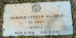
Harold Ledden Waldrip
| Birth | : | 11 Nov 1931 Havre, Hill County, Montana, USA |
| Death | : | 11 Jan 1987 Portland, Multnomah County, Oregon, USA |
| Burial | : | Plain Cemetery, Ashfield, Franklin County, USA |
| Coordinate | : | 42.5292015, -72.7889023 |
| Plot | : | Space D Lot 11 Block 19 |
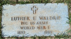
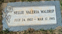
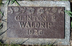
| Description | : | Son of Luther Elwood Waldrip & Nellie Valeria Casady. Husband of Maxine Biggs & Betty Alysworth. |
frequently asked questions (FAQ):
-
Where is Harold Ledden Waldrip's memorial?
Harold Ledden Waldrip's memorial is located at: Plain Cemetery, Ashfield, Franklin County, USA.
-
When did Harold Ledden Waldrip death?
Harold Ledden Waldrip death on 11 Jan 1987 in Portland, Multnomah County, Oregon, USA
-
Where are the coordinates of the Harold Ledden Waldrip's memorial?
Latitude: 42.5292015
Longitude: -72.7889023
Family Members:
Parent
Siblings
Flowers:
Nearby Cemetories:
1. Plain Cemetery
Ashfield, Franklin County, USA
Coordinate: 42.5292015, -72.7889023
2. Saint John's Church
Ashfield, Franklin County, USA
Coordinate: 42.5258600, -72.7894260
3. Hill Cemetery
Ashfield, Franklin County, USA
Coordinate: 42.5208015, -72.7992020
4. Beldingville Cemetery
Ashfield, Franklin County, USA
Coordinate: 42.5365562, -72.7638016
5. South Ashfield Cemetery
Ashfield, Franklin County, USA
Coordinate: 42.5077209, -72.7730026
6. Baptist Corner Cemetery
Ashfield, Franklin County, USA
Coordinate: 42.5540771, -72.7639313
7. Northwest Cemetery
Ashfield, Franklin County, USA
Coordinate: 42.5587500, -72.8250500
8. Spruce Corner Cemetery
Ashfield, Franklin County, USA
Coordinate: 42.5026817, -72.8481293
9. Briar Hill Cemetery
Ashfield, Franklin County, USA
Coordinate: 42.4742600, -72.7798300
10. Old Cemetery #01
Buckland, Franklin County, USA
Coordinate: 42.5918580, -72.7906890
11. Center Cemetery #03
Buckland, Franklin County, USA
Coordinate: 42.5926950, -72.7898960
12. North Shirkshire Cemetery
Conway, Franklin County, USA
Coordinate: 42.5689011, -72.7210999
13. Upper City Cemetery
Buckland, Franklin County, USA
Coordinate: 42.5832640, -72.8355360
14. Trow Cemetery #04
Buckland, Franklin County, USA
Coordinate: 42.5932800, -72.7915000
15. Taylor Cemetery #02
Buckland, Franklin County, USA
Coordinate: 42.5932808, -72.7915039
16. East Street Cemetery
Plainfield, Hampshire County, USA
Coordinate: 42.5136600, -72.8780700
17. Maynard Cemetery
Conway, Franklin County, USA
Coordinate: 42.4836630, -72.7195800
18. Old East Buckland Cemetery
Buckland, Franklin County, USA
Coordinate: 42.5969400, -72.7677900
19. Howland Cemetery
Conway, Franklin County, USA
Coordinate: 42.5127983, -72.6967010
20. East Buckland Cemetery
Buckland, Franklin County, USA
Coordinate: 42.5962500, -72.7610600
21. Southwest Cemetery
Conway, Franklin County, USA
Coordinate: 42.4660280, -72.7458610
22. Pine Grove Cemetery
Conway, Franklin County, USA
Coordinate: 42.5222015, -72.6908035
23. East Hawley Cemetery
Hawley, Franklin County, USA
Coordinate: 42.5621071, -72.8768005
24. South Centre Cemetery
Conway, Franklin County, USA
Coordinate: 42.5015940, -72.6973490

