
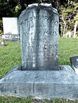
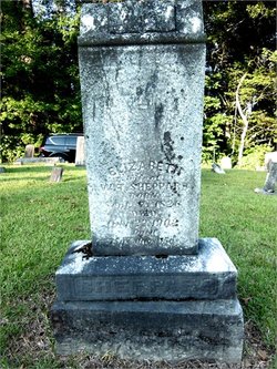
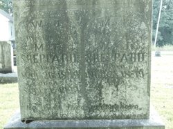
| Birth | : | 5 Jan 1854 Henderson County, Tennessee, USA |
| Death | : | 17 May 1919 |
| Burial | : | Prospect Church Cemetery, Sardis, Henderson County, USA |
| Coordinate | : | 35.4584950, -88.2683120 |
| Description | : | Henderson County, Tennessee Cemetery Inscriptions (Memphis, R. H. Harris,1976), Vol. III, pp. 606-613 by Anita Webb, Betty Patterson, and Blanch Buck. David Donahue recorded and updated this cemetery 1995 & 2001. Sheppard, Annie, n.d. Sheppard, J. F., Jan. 5, 1854-May 17, 1919 Sheppard, R. E., Jan. 21, 1849 first name, middle name, death place, parent links & spouse marriage year updated by 50438088 After researching, the nick name of "Jack" has been removed as it was taken from the 1900 census, which is a transcription error. |
frequently asked questions (FAQ):
-
Where is Joel Frank Sheppard's memorial?
Joel Frank Sheppard's memorial is located at: Prospect Church Cemetery, Sardis, Henderson County, USA.
-
When did Joel Frank Sheppard death?
Joel Frank Sheppard death on 17 May 1919 in
-
Where are the coordinates of the Joel Frank Sheppard's memorial?
Latitude: 35.4584950
Longitude: -88.2683120
Family Members:
Parent
Spouse
Siblings

Flowers:


Nearby Cemetories:
1. Prospect Church Cemetery
Sardis, Henderson County, USA
Coordinate: 35.4584950, -88.2683120
2. Doe Creek Cemetery
Scotts Hill, Henderson County, USA
Coordinate: 35.4692990, -88.2474350
3. Lowery-Doe Creek Cemetery
Decatur County, USA
Coordinate: 35.4483120, -88.2468900
4. Cedar Grove Cemetery
Henderson County, USA
Coordinate: 35.4799600, -88.2678900
5. Cedar Grove Pentecostal Cemetery
Sardis, Henderson County, USA
Coordinate: 35.4829530, -88.2698440
6. Sardis Cemetery
Sardis, Henderson County, USA
Coordinate: 35.4366020, -88.2833100
7. Pleasant View Cemetery
Sardis, Henderson County, USA
Coordinate: 35.4639730, -88.3019970
8. Granny Austin Cemetery
Scotts Hill, Henderson County, USA
Coordinate: 35.4949850, -88.2734300
9. Fellowship Church Cemetery
Scotts Hill, Henderson County, USA
Coordinate: 35.4965940, -88.2602540
10. McBride Cemetery
Sardis, Henderson County, USA
Coordinate: 35.4406013, -88.3106003
11. Spring Hill Cemetery
Sardis, Henderson County, USA
Coordinate: 35.4277992, -88.3091965
12. Liberty Church Cemetery
Scotts Hill, Decatur County, USA
Coordinate: 35.4466050, -88.2146570
13. Bethel Cemetery
Scotts Hill, Decatur County, USA
Coordinate: 35.4963690, -88.2320790
14. Little Hurricane Cemetery
Sardis, Henderson County, USA
Coordinate: 35.4605060, -88.3302360
15. Scotts Hill Pentecostal Church Cemetery
Scotts Hill, Decatur County, USA
Coordinate: 35.5065610, -88.2336080
16. Grandsire Holmes Cemetery
Scotts Hill, Henderson County, USA
Coordinate: 35.5140820, -88.2483620
17. Patterson Cemetery
Lick Skillet, Decatur County, USA
Coordinate: 35.4383800, -88.1979020
18. Murphy Cemetery
Lick Skillet, Decatur County, USA
Coordinate: 35.4806930, -88.1983720
19. Scotts Hill Church Cemetery
Scotts Hill, Henderson County, USA
Coordinate: 35.5189480, -88.2463960
20. Hanna Cemetery
Hinkle, Hardin County, USA
Coordinate: 35.3991600, -88.3006680
21. Hurricane Church Cemetery
Hinkle, Hardin County, USA
Coordinate: 35.4080320, -88.3240380
22. Corinth Church Cemetery
Decatur County, USA
Coordinate: 35.4126020, -88.2056180
23. Pafford - Scotts Hill Cemetery
Scotts Hill, Henderson County, USA
Coordinate: 35.5265450, -88.2515290
24. Marl Bluff Cemetery
Sardis, Henderson County, USA
Coordinate: 35.4570870, -88.3561740