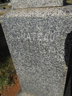
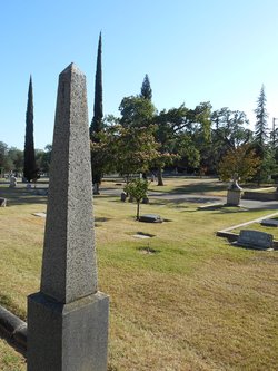
John M. Chateau
| Birth | : | 4 Aug 1867 San Francisco County, California, USA |
| Death | : | 19 May 1910 Placer County, California, USA |
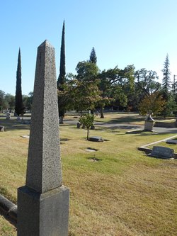
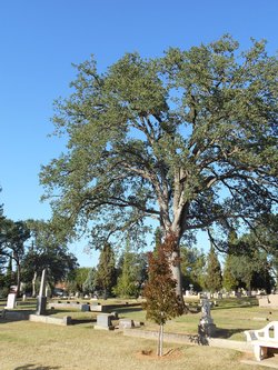
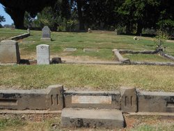
| Burial | : | Rocklin Cemetery, Rocklin, Placer County, USA |
| Coordinate | : | 38.7827670, -121.2337980 |
| Description | : | John M. Chateau Roseville Register Thursday, May 26, 1910 Laid at Rest The funeral of John M. Chateau took place on Sunday afternoon, May 22, from his late residence, the Rev. J. P. Macaulay, pastor of the Methodist Church, officiating. There was a large attendance of relatives and friends to pay the last sad rite to one who was greatly loved in life and is now deeply mourned in death. The deceased was born in San Francisco, Aug. 4, 1867, being one of four children born to Eugene and Mary Chateau. Of his father's family, three survive him: Eugene Chateau, the father; Mrs. Mary E.... Read More |
frequently asked questions (FAQ):
-
Where is John M. Chateau's memorial?
John M. Chateau's memorial is located at: Rocklin Cemetery, Rocklin, Placer County, USA.
-
When did John M. Chateau death?
John M. Chateau death on 19 May 1910 in Placer County, California, USA
-
Where are the coordinates of the John M. Chateau's memorial?
Latitude: 38.7827670
Longitude: -121.2337980
Family Members:
Parent
Spouse
Siblings
Children
Flowers:
Nearby Cemetories:
1. Rocklin Cemetery
Rocklin, Placer County, USA
Coordinate: 38.7827670, -121.2337980
2. Shepherd of the Sierra Memorial Garden
Loomis, Placer County, USA
Coordinate: 38.7890800, -121.1944200
3. Roseville Public Cemetery District
Roseville, Placer County, USA
Coordinate: 38.7606010, -121.2707977
4. Boothill Cemetery
Roseville, Placer County, USA
Coordinate: 38.7598730, -121.2712130
5. Whitney Family Mausoleum
Rocklin, Placer County, USA
Coordinate: 38.8256500, -121.2477000
6. Prosser Family Cemetery
Loomis, Placer County, USA
Coordinate: 38.8071900, -121.1285600
7. Stewarts Flat Cemetery
Penryn, Placer County, USA
Coordinate: 38.8447360, -121.1507950
8. Mansur Family Cemetery
Loomis, Placer County, USA
Coordinate: 38.8139600, -121.1214000
9. Sylvan Cemetery
Citrus Heights, Sacramento County, USA
Coordinate: 38.7001534, -121.2904587
10. School House Park Cemetery
Roseville, Placer County, USA
Coordinate: 38.7893180, -121.3578670
11. Folsom Prison Cemetery
Folsom, Sacramento County, USA
Coordinate: 38.6952860, -121.1636690
12. Mount Vernon Memorial Park
Fair Oaks, Sacramento County, USA
Coordinate: 38.6800003, -121.2566986
13. Newcastle Cemetery
Newcastle, Placer County, USA
Coordinate: 38.8708880, -121.1444060
14. Calvary Catholic Cemetery and Mausoleum
Sacramento, Sacramento County, USA
Coordinate: 38.6937180, -121.3233109
15. Young Wo Cemetery
Folsom, Sacramento County, USA
Coordinate: 38.6733400, -121.1835000
16. Lincoln Cemetery
Lincoln, Placer County, USA
Coordinate: 38.8864310, -121.3020500
17. Rattlesnake Bar Graveyard
Auburn, Placer County, USA
Coordinate: 38.8163050, -121.0895100
18. Lakeside Memorial Lawn Cemetery
Folsom, Sacramento County, USA
Coordinate: 38.6715300, -121.1841000
19. Saint John the Baptist Catholic Church Cemetery
Folsom, Sacramento County, USA
Coordinate: 38.6721900, -121.1803000
20. F.O.E. 929 Cemetery
Folsom, Sacramento County, USA
Coordinate: 38.6717010, -121.1801010
21. China Mission-Chung Wah Chinese Cemetery
Folsom, Sacramento County, USA
Coordinate: 38.6698410, -121.1851790
22. Sierra Hills Pet Cemetery
Sacramento, Sacramento County, USA
Coordinate: 38.6863500, -121.3305300
23. Sierra Hills Memorial Park
Sacramento, Sacramento County, USA
Coordinate: 38.6843987, -121.3281021
24. Gold Hill Cemetery
Gold Hill, Placer County, USA
Coordinate: 38.9025000, -121.1802200

