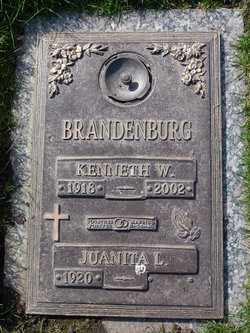
| Birth | : | 27 Jun 1943 Lamar, Barton County, Missouri, USA |
| Death | : | 7 Dec 2017 California, USA |
| Burial | : | Shepherd of the Sierra Memorial Garden, Loomis, Placer County, USA |
| Coordinate | : | 38.7890800, -121.1944200 |
| Description | : | Per her obituary, three-month-old La Rita and her mother moved to California while La Rita's father was in the military. La Rita attended the College of San Mateo and San Francisco State College, eventually earning a teaching degree. On August 22, 1964, she had married Ron Culver, and they moved to Sacramento where La Rita was hired by the Rio Linda Unified School District. Retiring in 2001, she and Ron enjoyed traveling the world. La Rita was survived by her husband, son Eric, daughter Colleen, sister Cheryl, brother bill, as well as eight grandchildren. . |
frequently asked questions (FAQ):
-
Where is La Rita Brandenburg Culver's memorial?
La Rita Brandenburg Culver's memorial is located at: Shepherd of the Sierra Memorial Garden, Loomis, Placer County, USA.
-
When did La Rita Brandenburg Culver death?
La Rita Brandenburg Culver death on 7 Dec 2017 in California, USA
-
Where are the coordinates of the La Rita Brandenburg Culver's memorial?
Latitude: 38.7890800
Longitude: -121.1944200
Family Members:
Parent
Flowers:
Nearby Cemetories:
1. Shepherd of the Sierra Memorial Garden
Loomis, Placer County, USA
Coordinate: 38.7890800, -121.1944200
2. Rocklin Cemetery
Rocklin, Placer County, USA
Coordinate: 38.7827670, -121.2337980
3. Prosser Family Cemetery
Loomis, Placer County, USA
Coordinate: 38.8071900, -121.1285600
4. Whitney Family Mausoleum
Rocklin, Placer County, USA
Coordinate: 38.8256500, -121.2477000
5. Mansur Family Cemetery
Loomis, Placer County, USA
Coordinate: 38.8139600, -121.1214000
6. Stewarts Flat Cemetery
Penryn, Placer County, USA
Coordinate: 38.8447360, -121.1507950
7. Roseville Public Cemetery District
Roseville, Placer County, USA
Coordinate: 38.7606010, -121.2707977
8. Boothill Cemetery
Roseville, Placer County, USA
Coordinate: 38.7598730, -121.2712130
9. Rattlesnake Bar Graveyard
Auburn, Placer County, USA
Coordinate: 38.8163050, -121.0895100
10. Newcastle Cemetery
Newcastle, Placer County, USA
Coordinate: 38.8708880, -121.1444060
11. Folsom Prison Cemetery
Folsom, Sacramento County, USA
Coordinate: 38.6952860, -121.1636690
12. Mormon Island Relocation Cemetery
El Dorado Hills, El Dorado County, USA
Coordinate: 38.6986084, -121.1093521
13. Gold Hill Cemetery
Gold Hill, Placer County, USA
Coordinate: 38.9025000, -121.1802200
14. Young Wo Cemetery
Folsom, Sacramento County, USA
Coordinate: 38.6733400, -121.1835000
15. Ophir Cemetery
Placer County, USA
Coordinate: 38.8928870, -121.1273790
16. Sylvan Cemetery
Citrus Heights, Sacramento County, USA
Coordinate: 38.7001534, -121.2904587
17. Saint John the Baptist Catholic Church Cemetery
Folsom, Sacramento County, USA
Coordinate: 38.6721900, -121.1803000
18. Lakeside Memorial Lawn Cemetery
Folsom, Sacramento County, USA
Coordinate: 38.6715300, -121.1841000
19. F.O.E. 929 Cemetery
Folsom, Sacramento County, USA
Coordinate: 38.6717010, -121.1801010
20. Mount Vernon Memorial Park
Fair Oaks, Sacramento County, USA
Coordinate: 38.6800003, -121.2566986
21. China Mission-Chung Wah Chinese Cemetery
Folsom, Sacramento County, USA
Coordinate: 38.6698410, -121.1851790
22. Maidu Indian Burial Grounds
Auburn, Placer County, USA
Coordinate: 38.8744350, -121.0777290
23. School House Park Cemetery
Roseville, Placer County, USA
Coordinate: 38.7893180, -121.3578670
24. Lincoln Cemetery
Lincoln, Placer County, USA
Coordinate: 38.8864310, -121.3020500


