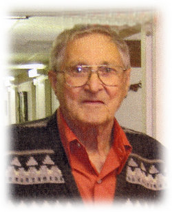
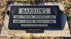
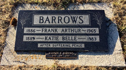
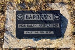
Madison Eugene Barrows
| Birth | : | 1919 Cardston, Claresholm Census Division, Alberta, Canada |
| Death | : | 12 Mar 2010 Milk River, Lethbridge Census Division, Alberta, Canada |
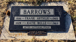
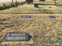
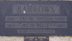
| Burial | : | Stile Cop Cemetery, Rugeley, Cannock Chase District, England |
| Coordinate | : | 52.7423710, -1.9448220 |
| Description | : | Madison Barrows MADISON EUGENE BARROWS, beloved husband of the late Bertha Deginstein Barrows of Coutts, passed away at Milk River on Friday, March 12, 2010 at the age of 91 years. He is survived by a step-daughter, Lorna (Joe) O'Hara of Foremost; and four sons: Madison (Sandra) Barrows of Etzikom, Frank (Linda) Barrows of Coutts, Valen Barrows of Milk River, and Corwynn (Marilyn) of Coutts. He leaves behind 13 grandchildren, 15 great grandchildren, two sisters: Eloise Ives of Edmonton and Audrey McAlpine of Cut Bank, Montana, and one brother, Jimmy Barrows of Edmonton. Madison was born and raised in Warner. He married... Read More |
frequently asked questions (FAQ):
-
Where is Madison Eugene Barrows's memorial?
Madison Eugene Barrows's memorial is located at: Stile Cop Cemetery, Rugeley, Cannock Chase District, England.
-
When did Madison Eugene Barrows death?
Madison Eugene Barrows death on 12 Mar 2010 in Milk River, Lethbridge Census Division, Alberta, Canada
-
Where are the coordinates of the Madison Eugene Barrows's memorial?
Latitude: 52.7423710
Longitude: -1.9448220
Family Members:
Parent
Spouse
Siblings
Children
Flowers:
Nearby Cemetories:
1. Stile Cop Cemetery
Rugeley, Cannock Chase District, England
Coordinate: 52.7423710, -1.9448220
2. St. Michael's Churchyard
Brereton, Cannock Chase District, England
Coordinate: 52.7451169, -1.9228718
3. St. Augustine's Churchyard
Rugeley, Cannock Chase District, England
Coordinate: 52.7644253, -1.9345868
4. The Old Chancel
Rugeley, Cannock Chase District, England
Coordinate: 52.7648400, -1.9355010
5. Rugeley Cemetery
Rugeley, Cannock Chase District, England
Coordinate: 52.7650720, -1.9370440
6. Hawkesyard Priory
Rugeley, Cannock Chase District, England
Coordinate: 52.7439175, -1.9032955
7. St John the Baptist Churchyard
Armitage with Handsacre, Lichfield District, England
Coordinate: 52.7458638, -1.8851159
8. Christ Church Gentleshaw
Rugeley, Cannock Chase District, England
Coordinate: 52.7050151, -1.9264458
9. St. James the Great Churchyard
Longdon, Lichfield District, England
Coordinate: 52.7250710, -1.8800360
10. St. Peter's Churchyard
Hednesford, Cannock Chase District, England
Coordinate: 52.7050630, -1.9918330
11. Our Lady of Lourdes Churchyard
Hednesford, Cannock Chase District, England
Coordinate: 52.7051311, -1.9969935
12. Cannock Chase German Military Cemetery
Cannock, Cannock Chase District, England
Coordinate: 52.7370580, -2.0265050
13. Cannock Chase War Cemetery
Cannock, Cannock Chase District, England
Coordinate: 52.7370710, -2.0266340
14. St. Michael and All Angels Church
Colwich, Stafford Borough, England
Coordinate: 52.7876070, -1.9853500
15. St John's Church Cemetery
Burntwood, Lichfield District, England
Coordinate: 52.6901000, -1.9349300
16. Saint Mary's Abbey
Colwich, Stafford Borough, England
Coordinate: 52.7900000, -1.9895000
17. St John Churchyard
Heath Hayes, Cannock Chase District, England
Coordinate: 52.6914160, -1.9846280
18. Chase and District Memorial Park
Burntwood, Lichfield District, England
Coordinate: 52.6817140, -1.9339150
19. Cannock Cemetery
Cannock, Cannock Chase District, England
Coordinate: 52.7008790, -2.0288950
20. St. Michael & All Angels Churchyard
Hamstall Ridware, Lichfield District, England
Coordinate: 52.7716100, -1.8447300
21. St Stephen Churchyard
Great Haywood, Stafford Borough, England
Coordinate: 52.8004360, -2.0049890
22. St Matthew's Hospital Burial Ground
Burntwood, Lichfield District, England
Coordinate: 52.6804500, -1.8937800
23. Christchurch Cemetery
Burntwood, Lichfield District, England
Coordinate: 52.6787639, -1.8969201
24. St. Anne Churchyard Chasetown
Burntwood, Lichfield District, England
Coordinate: 52.6693850, -1.9381720

