


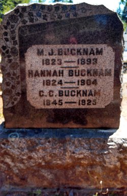
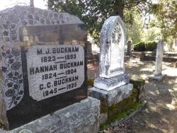
Magnus Junson Bucknam
| Birth | : | 1823 New Hampshire, USA |
| Death | : | 1893 California, USA |
| Burial | : | Georgetown Pioneer Cemetery, Georgetown, El Dorado County, USA |
| Coordinate | : | 38.9068108, -120.8430862 |
| Description | : | Mountain Democrat 6 Sep 1879 North Side Items Bucknam Ranch "Owned by M. J. Bucknam, father of William A. Bucknam, late candidate of the W. P. C. and N. C. P. parties. Here I was received as a welcome guest and treated as such by the unobtrusive but ever polite and courteous Mrs. Bucknam, as also by her handsome and accomplished daughter, Miss Hattie. Miss Hattie, after receiving all the care and training fond and devolted parents could bestow, in order to further complete her education like many other protestant young ladies she was placed in the College of Notre Dome, in Marysville,... Read More |
frequently asked questions (FAQ):
-
Where is Magnus Junson Bucknam's memorial?
Magnus Junson Bucknam's memorial is located at: Georgetown Pioneer Cemetery, Georgetown, El Dorado County, USA.
-
When did Magnus Junson Bucknam death?
Magnus Junson Bucknam death on 1893 in California, USA
-
Where are the coordinates of the Magnus Junson Bucknam's memorial?
Latitude: 38.9068108
Longitude: -120.8430862
Family Members:
Spouse
Children


Flowers:


Nearby Cemetories:
1. Georgetown Pioneer Cemetery
Georgetown, El Dorado County, USA
Coordinate: 38.9068108, -120.8430862
2. Georgia Slide Cemetery
Georgetown, El Dorado County, USA
Coordinate: 38.9218063, -120.8377838
3. Carmelite Monastery Cemetery
Georgetown, El Dorado County, USA
Coordinate: 38.9273300, -120.8173840
4. Greenwood Pioneer Cemetery
Greenwood, El Dorado County, USA
Coordinate: 38.8985786, -120.9099274
5. Georgetown-Renke Cemetery Annex
Georgetown, El Dorado County, USA
Coordinate: 38.8964610, -120.9116240
6. Spanish Dry Diggings Cemetery
Greenwood, El Dorado County, USA
Coordinate: 38.9431600, -120.9158000
7. Alabama Flat Cemetery
Garden Valley, El Dorado County, USA
Coordinate: 38.8413660, -120.8770510
8. Josephine Mine Cemetery
Volcanoville, El Dorado County, USA
Coordinate: 38.9798000, -120.7892170
9. Todd Valley Cemetery
Placer County, USA
Coordinate: 38.9970900, -120.8541000
10. Spring Garden Indian Cemetery
Foresthill, Placer County, USA
Coordinate: 38.9998620, -120.9049310
11. Kelsey Cemetery
Kelsey, El Dorado County, USA
Coordinate: 38.7949791, -120.8200073
12. Foresthill Community Cemetery
Foresthill, Placer County, USA
Coordinate: 39.0184500, -120.8114700
13. Saint John's Catholic Churchyard
Coloma, El Dorado County, USA
Coordinate: 38.7975311, -120.8919678
14. James Marshall Monument and Gravesite
Coloma, El Dorado County, USA
Coordinate: 38.7963104, -120.8953781
15. Pioneer Cemetery
Coloma, El Dorado County, USA
Coordinate: 38.7943192, -120.8894577
16. Uniontown Cemetery
Lotus, El Dorado County, USA
Coordinate: 38.7994003, -120.9111023
17. Saint Joseph Catholic Cemetery
Foresthill, Placer County, USA
Coordinate: 39.0240200, -120.8068800
18. Indian Creek Cemetery
Coloma, El Dorado County, USA
Coordinate: 38.7974230, -120.9104530
19. Yankee Jims Cemetery
Foresthill, Placer County, USA
Coordinate: 39.0292511, -120.8614349
20. Esoteric Fraternity Cemetery
Applegate, Placer County, USA
Coordinate: 38.9946190, -120.9687490
21. Stoney Bar Cemetery
Foresthill, Placer County, USA
Coordinate: 39.0114980, -120.7408060
22. Chili Bar Toll House Cemetery
Placerville, El Dorado County, USA
Coordinate: 38.7700530, -120.8177660
23. Dickinson Family Cemetery
Placerville, El Dorado County, USA
Coordinate: 38.7970450, -120.7269010
24. Nelsonville Cemetery
Placerville, El Dorado County, USA
Coordinate: 38.7894490, -120.7380720