

Margaretta “Maggie” Koerber Aust
| Birth | : | 11 Oct 1876 Germany |
| Death | : | 5 Sep 1920 Osawatomie, Miami County, Kansas, USA |
| Burial | : | Folsom Prison Cemetery, Folsom, Sacramento County, USA |
| Coordinate | : | 38.6952860, -121.1636690 |
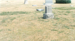
| Plot | : | Sect. 3, Lot 48, Grave # 5 |
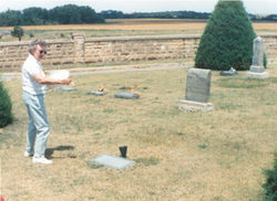
| Description | : | Margaretta "Maggie" Koeber was the eldest of two daughters of John Koerber and Hannah (Pruner) Koerber. She was born on October 11, 1876 in Germany, possibly near Berlin. She had a younger sister Anna Barbara Koerber (who later was the wife of Silas Orin Sage). Anna was also born in Gemany in 1879. The Koerber family came to the US in 1884. They went first to Kansas or Nebraska, where John died during one of their first winters of frostbite of one of his feet. Afterward, Hannah, Maggie, and Anna moved to Lewis County, Washington. ... Read More |
frequently asked questions (FAQ):
-
Where is Margaretta “Maggie” Koerber Aust's memorial?
Margaretta “Maggie” Koerber Aust's memorial is located at: Folsom Prison Cemetery, Folsom, Sacramento County, USA.
-
When did Margaretta “Maggie” Koerber Aust death?
Margaretta “Maggie” Koerber Aust death on 5 Sep 1920 in Osawatomie, Miami County, Kansas, USA
-
Where are the coordinates of the Margaretta “Maggie” Koerber Aust's memorial?
Latitude: 38.6952860
Longitude: -121.1636690
Family Members:
Parent
Spouse
Siblings

Children

Flowers:


Nearby Cemetories:
1. Folsom Prison Cemetery
Folsom, Sacramento County, USA
Coordinate: 38.6952860, -121.1636690
2. Saint John the Baptist Catholic Church Cemetery
Folsom, Sacramento County, USA
Coordinate: 38.6721900, -121.1803000
3. F.O.E. 929 Cemetery
Folsom, Sacramento County, USA
Coordinate: 38.6717010, -121.1801010
4. Young Wo Cemetery
Folsom, Sacramento County, USA
Coordinate: 38.6733400, -121.1835000
5. Lakeside Memorial Lawn Cemetery
Folsom, Sacramento County, USA
Coordinate: 38.6715300, -121.1841000
6. China Mission-Chung Wah Chinese Cemetery
Folsom, Sacramento County, USA
Coordinate: 38.6698410, -121.1851790
7. Mormon Island Relocation Cemetery
El Dorado Hills, El Dorado County, USA
Coordinate: 38.6986084, -121.1093521
8. Mount Vernon Memorial Park
Fair Oaks, Sacramento County, USA
Coordinate: 38.6800003, -121.2566986
9. Clarksville Cemetery
Clarksville, El Dorado County, USA
Coordinate: 38.6546707, -121.0615387
10. Railroad House Cemetery
Clarksville, El Dorado County, USA
Coordinate: 38.6575699, -121.0516129
11. Shepherd of the Sierra Memorial Garden
Loomis, Placer County, USA
Coordinate: 38.7890800, -121.1944200
12. Sylvan Cemetery
Citrus Heights, Sacramento County, USA
Coordinate: 38.7001534, -121.2904587
13. Fair Oaks Cemetery
Fair Oaks, Sacramento County, USA
Coordinate: 38.6501167, -121.2792000
14. Fair Oaks United Methodist Church Memorial Garden
Fair Oaks, Sacramento County, USA
Coordinate: 38.6396300, -121.2744600
15. Rocklin Cemetery
Rocklin, Placer County, USA
Coordinate: 38.7827670, -121.2337980
16. Boothill Cemetery
Roseville, Placer County, USA
Coordinate: 38.7598730, -121.2712130
17. Roseville Public Cemetery District
Roseville, Placer County, USA
Coordinate: 38.7606010, -121.2707977
18. Morrison Ranch Family Cemetery
Clarksville, El Dorado County, USA
Coordinate: 38.6552887, -121.0368500
19. Rust Family Gravesite
Cameron Park, El Dorado County, USA
Coordinate: 38.6980160, -121.0207130
20. Prosser Family Cemetery
Loomis, Placer County, USA
Coordinate: 38.8071900, -121.1285600
21. Green Valley Cemetery
Rescue, El Dorado County, USA
Coordinate: 38.6993790, -121.0081406
22. Mansur Family Cemetery
Loomis, Placer County, USA
Coordinate: 38.8139600, -121.1214000
23. Calvary Catholic Cemetery and Mausoleum
Sacramento, Sacramento County, USA
Coordinate: 38.6937180, -121.3233109
24. Kilgore Cemetery
Rancho Cordova, Sacramento County, USA
Coordinate: 38.5978012, -121.2683029