
Minna Louisa Aust
| Birth | : | 26 Jan 1908 Ellis, Ellis County, Kansas, USA |
| Death | : | 9 Jul 1909 Ellis, Ellis County, Kansas, USA |
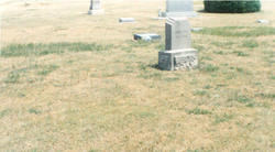
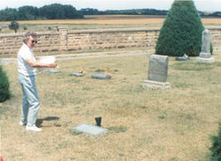
| Burial | : | Folsom Prison Cemetery, Folsom, Sacramento County, USA |
| Coordinate | : | 38.6952860, -121.1636690 |
| Plot | : | Sect. 3, Lot 38, # 5 |
| Description | : | Minna Louisa, or "Louise" as she was known, was the daughter of Jacob and Margaretta (Koerber) Aust (Formerly known as Ast). She was the twin sister of Jacob Ludwig, and also had 6 elder brothers and sisters: Rosa, William John, Margaret Elizabeth, Earnest, Ida L., and Henrietta. She also had a half brother Frank Aust, and 3 half sisters: Emma, Ella, and Minnie Aust. Louise was baptized at the Christ Lutheran Church in Ellis on February 16, 1908. Tragically, she died accidentally by hanging herself on a rope swing in her yard one year to the... Read More |
frequently asked questions (FAQ):
-
Where is Minna Louisa Aust's memorial?
Minna Louisa Aust's memorial is located at: Folsom Prison Cemetery, Folsom, Sacramento County, USA.
-
When did Minna Louisa Aust death?
Minna Louisa Aust death on 9 Jul 1909 in Ellis, Ellis County, Kansas, USA
-
Where are the coordinates of the Minna Louisa Aust's memorial?
Latitude: 38.6952860
Longitude: -121.1636690
Family Members:
Parent

Siblings


Flowers:


Nearby Cemetories:
1. Folsom Prison Cemetery
Folsom, Sacramento County, USA
Coordinate: 38.6952860, -121.1636690
2. Saint John the Baptist Catholic Church Cemetery
Folsom, Sacramento County, USA
Coordinate: 38.6721900, -121.1803000
3. F.O.E. 929 Cemetery
Folsom, Sacramento County, USA
Coordinate: 38.6717010, -121.1801010
4. Young Wo Cemetery
Folsom, Sacramento County, USA
Coordinate: 38.6733400, -121.1835000
5. Lakeside Memorial Lawn Cemetery
Folsom, Sacramento County, USA
Coordinate: 38.6715300, -121.1841000
6. China Mission-Chung Wah Chinese Cemetery
Folsom, Sacramento County, USA
Coordinate: 38.6698410, -121.1851790
7. Mormon Island Relocation Cemetery
El Dorado Hills, El Dorado County, USA
Coordinate: 38.6986084, -121.1093521
8. Mount Vernon Memorial Park
Fair Oaks, Sacramento County, USA
Coordinate: 38.6800003, -121.2566986
9. Clarksville Cemetery
Clarksville, El Dorado County, USA
Coordinate: 38.6546707, -121.0615387
10. Railroad House Cemetery
Clarksville, El Dorado County, USA
Coordinate: 38.6575699, -121.0516129
11. Shepherd of the Sierra Memorial Garden
Loomis, Placer County, USA
Coordinate: 38.7890800, -121.1944200
12. Sylvan Cemetery
Citrus Heights, Sacramento County, USA
Coordinate: 38.7001534, -121.2904587
13. Fair Oaks Cemetery
Fair Oaks, Sacramento County, USA
Coordinate: 38.6501167, -121.2792000
14. Fair Oaks United Methodist Church Memorial Garden
Fair Oaks, Sacramento County, USA
Coordinate: 38.6396300, -121.2744600
15. Rocklin Cemetery
Rocklin, Placer County, USA
Coordinate: 38.7827670, -121.2337980
16. Boothill Cemetery
Roseville, Placer County, USA
Coordinate: 38.7598730, -121.2712130
17. Roseville Public Cemetery District
Roseville, Placer County, USA
Coordinate: 38.7606010, -121.2707977
18. Morrison Ranch Family Cemetery
Clarksville, El Dorado County, USA
Coordinate: 38.6552887, -121.0368500
19. Rust Family Gravesite
Cameron Park, El Dorado County, USA
Coordinate: 38.6980160, -121.0207130
20. Prosser Family Cemetery
Loomis, Placer County, USA
Coordinate: 38.8071900, -121.1285600
21. Green Valley Cemetery
Rescue, El Dorado County, USA
Coordinate: 38.6993790, -121.0081406
22. Mansur Family Cemetery
Loomis, Placer County, USA
Coordinate: 38.8139600, -121.1214000
23. Calvary Catholic Cemetery and Mausoleum
Sacramento, Sacramento County, USA
Coordinate: 38.6937180, -121.3233109
24. Kilgore Cemetery
Rancho Cordova, Sacramento County, USA
Coordinate: 38.5978012, -121.2683029