
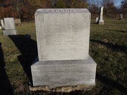

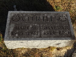
Mary M Jones Vorhis
| Birth | : | 30 Dec 1806 Hamilton County, Ohio, USA |
| Death | : | 20 Dec 1894 Troy, Davis County, Iowa, USA |
| Burial | : | St. Nicholas' Churchyard, Great Munden, East Hertfordshire District, England |
| Coordinate | : | 51.8996010, -0.0316180 |
frequently asked questions (FAQ):
-
Where is Mary M Jones Vorhis's memorial?
Mary M Jones Vorhis's memorial is located at: St. Nicholas' Churchyard, Great Munden, East Hertfordshire District, England.
-
When did Mary M Jones Vorhis death?
Mary M Jones Vorhis death on 20 Dec 1894 in Troy, Davis County, Iowa, USA
-
Where are the coordinates of the Mary M Jones Vorhis's memorial?
Latitude: 51.8996010
Longitude: -0.0316180
Family Members:
Spouse

Children


Flowers:


Nearby Cemetories:
1. St. Nicholas' Churchyard
Great Munden, East Hertfordshire District, England
Coordinate: 51.8996010, -0.0316180
2. St Edmund of Canterbury and the English Martyrs
Old Hall Green, East Hertfordshire District, England
Coordinate: 51.8799220, -0.0110510
3. All Saints Churchyard
Little Munden, East Hertfordshire District, England
Coordinate: 51.8795770, -0.0625920
4. Puckeridge Chapel
Northchurch, Dacorum Borough, England
Coordinate: 51.8890720, 0.0106480
5. St. Mary the Virgin-Westmill
St Albans, St Albans District, England
Coordinate: 51.9262000, -0.0098000
6. St Mary the Virgin Churchyard
Braughing, East Hertfordshire District, England
Coordinate: 51.9078420, 0.0282310
7. St. Mary's Churchyard
Standon, East Hertfordshire District, England
Coordinate: 51.8813515, 0.0273820
8. St Lawrence Churchyard
Ardeley, East Hertfordshire District, England
Coordinate: 51.9274000, -0.0989000
9. St John the Evangelist Churchyard
High Cross, East Hertfordshire District, England
Coordinate: 51.8500010, -0.0213550
10. St Peter Churchyard
Benington, East Hertfordshire District, England
Coordinate: 51.8956030, -0.1167310
11. St Bartholomew's Church Churchyard
Buntingford, East Hertfordshire District, England
Coordinate: 51.9525530, -0.0089720
12. Holy Trinity Churchyard
Buntingford, East Hertfordshire District, England
Coordinate: 51.9540854, -0.0541753
13. St John the Baptist Churchyard
Cottered, East Hertfordshire District, England
Coordinate: 51.9458000, -0.0846000
14. Little Hormead St Mary Churchyard
Hormead, East Hertfordshire District, England
Coordinate: 51.9428430, 0.0331630
15. Hare Street Benson Grounds
Buntingford, East Hertfordshire District, England
Coordinate: 51.9492640, 0.0221120
16. St. Mary the Virgin Churchyard
Walkern, East Hertfordshire District, England
Coordinate: 51.9226300, -0.1211300
17. Thundridge Old Churchyard
Thundridge, East Hertfordshire District, England
Coordinate: 51.8378330, -0.0156530
18. Great Hormead St Nicholas Churchyard
Hormead, East Hertfordshire District, England
Coordinate: 51.9469500, 0.0353300
19. St. Mary Parish Churchyard
Thundridge, East Hertfordshire District, England
Coordinate: 51.8366590, -0.0291820
20. Ss Mary and Andrew Churchyard
Watton-at-Stone, East Hertfordshire District, England
Coordinate: 51.8533290, -0.1102500
21. St Giles Churchyard
Wyddial, East Hertfordshire District, England
Coordinate: 51.9673270, -0.0010730
22. St Mary's Churchyard
Albury, East Hertfordshire District, England
Coordinate: 51.9026500, 0.0852920
23. St. Mary's Churchyard
Aston, East Hertfordshire District, England
Coordinate: 51.8875600, -0.1536200
24. St Mary the Virgin Churchyard
Stapleford, East Hertfordshire District, England
Coordinate: 51.8349710, -0.0973140