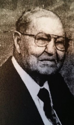
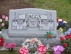
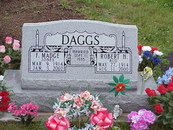
Robert Harold “Bud” Daggs
| Birth | : | 27 May 1914 Scotland County, Missouri, USA |
| Death | : | 11 Aug 2000 Memphis, Scotland County, Missouri, USA |
| Burial | : | Evergreen Cemetery, Southgate, Campbell County, USA |
| Coordinate | : | 39.0667000, -84.4721985 |
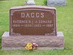
| Description | : | Find A Grave contributor Peggy Dochterman submitted this obituary. Robert Harold "Bud" Daggs, 86, of Memphis, Missouri, died August 11, 2000, at Scotland County Memorial Hospital in Memphis, Missouri. Bud, was the son of J. Edward and Patience B. Stonebraker Daggs, was born May 27, 1914, in Scotland County, Missouri. He graduated from Granger High School with the class of 1932. On September 11, 1935, he was united in marriage to Madge Jones at Keokuk, Iowa, in a double wedding ceremony with high school classmates, Edward and Ila French Struble. Madge survives. They had two children, Larry and Kay. Madge and Bud, life-long farmers and... Read More |
frequently asked questions (FAQ):
-
Where is Robert Harold “Bud” Daggs's memorial?
Robert Harold “Bud” Daggs's memorial is located at: Evergreen Cemetery, Southgate, Campbell County, USA.
-
When did Robert Harold “Bud” Daggs death?
Robert Harold “Bud” Daggs death on 11 Aug 2000 in Memphis, Scotland County, Missouri, USA
-
Where are the coordinates of the Robert Harold “Bud” Daggs's memorial?
Latitude: 39.0667000
Longitude: -84.4721985
Family Members:
Parent
Spouse
Siblings
Children
Flowers:
Nearby Cemetories:
1. Evergreen Cemetery
Southgate, Campbell County, USA
Coordinate: 39.0667000, -84.4721985
2. Saint John German Protestant Cemetery
Wilder, Campbell County, USA
Coordinate: 39.0478440, -84.4854430
3. Mount Saint Martins Cemetery (Defunct)
Newport, Campbell County, USA
Coordinate: 39.0860570, -84.4845320
4. Saint Josephs Cemetery
Wilder, Campbell County, USA
Coordinate: 39.0469017, -84.4841995
5. Cote Brilliante World War II Memorial
Newport, Campbell County, USA
Coordinate: 39.0885220, -84.4754710
6. Saint Stephen Cemetery
Fort Thomas, Campbell County, USA
Coordinate: 39.0511017, -84.4503021
7. Buena Vista Cemetery
Covington, Kenton County, USA
Coordinate: 39.0595200, -84.5040000
8. Old Newport Cemetery
Newport, Campbell County, USA
Coordinate: 39.0877100, -84.4940800
9. Cathedral Basilica of the Assumption
Covington, Kenton County, USA
Coordinate: 39.0781120, -84.5081700
10. Madison Street Burying Ground
Newport, Campbell County, USA
Coordinate: 39.0922790, -84.4948560
11. Saint Johns Cemetery
Wilder, Campbell County, USA
Coordinate: 39.0347170, -84.4750830
12. Linden Grove Cemetery
Covington, Kenton County, USA
Coordinate: 39.0738983, -84.5152969
13. Mother of God Church
Covington, Kenton County, USA
Coordinate: 39.0839600, -84.5125700
14. Trinity Episcopal Church Memorial Garden
Covington, Kenton County, USA
Coordinate: 39.0873540, -84.5106140
15. Johns Hill Cemetery
Wilder, Campbell County, USA
Coordinate: 39.0299988, -84.4738998
16. Craig Street Burying Ground
Covington, Kenton County, USA
Coordinate: 39.0840890, -84.5151330
17. Asbury Methodist Church Cemetery
Highland Heights, Campbell County, USA
Coordinate: 39.0304527, -84.4519882
18. Mother Of God Cemetery
Kenton Vale, Kenton County, USA
Coordinate: 39.0480995, -84.5171967
19. McCrackin Gravesite
Cincinnati, Hamilton County, USA
Coordinate: 39.0964090, -84.5082230
20. Potter Field Cemetery
Highland Heights, Campbell County, USA
Coordinate: 39.0252991, -84.4552994
21. Christ Church Cathedral Columbarium
Cincinnati, Hamilton County, USA
Coordinate: 39.1009690, -84.5073790
22. Wesleyan Chapel Methodist Church Cemetery
Cincinnati, Hamilton County, USA
Coordinate: 39.1022390, -84.5073540
23. First Presbyterian Church Cemetery
Cincinnati, Hamilton County, USA
Coordinate: 39.1005310, -84.5102830
24. Sisters of Notre Dame Cemetery
Park Hills, Kenton County, USA
Coordinate: 39.0637530, -84.5303120

