
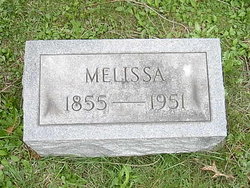
Susan Melissa Hall Loftus
| Birth | : | 16 Dec 1855 Jefferson, Ashtabula County, Ohio, USA |
| Death | : | 5 Dec 1951 Jefferson, Ashtabula County, Ohio, USA |
| Burial | : | Lakeside Memorial Lawn Cemetery, Folsom, Sacramento County, USA |
| Coordinate | : | 38.6715300, -121.1841000 |
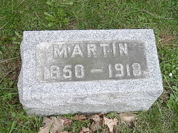
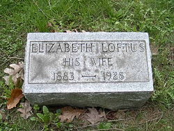
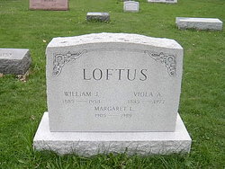
| Description | : | Susan Melissa Hall was born on December 15, 1855 in Jefferson, Ashtabula County, Ohio. She married Martin Loftus on June 28, 1871 in Ashtabula County. Together they had 10 children. Melissa is buried next to her husband in Oakdale Cemetery, Ashtabula County, Ohio. For futher information on this family group feel free to contact [email protected] |
frequently asked questions (FAQ):
-
Where is Susan Melissa Hall Loftus's memorial?
Susan Melissa Hall Loftus's memorial is located at: Lakeside Memorial Lawn Cemetery, Folsom, Sacramento County, USA.
-
When did Susan Melissa Hall Loftus death?
Susan Melissa Hall Loftus death on 5 Dec 1951 in Jefferson, Ashtabula County, Ohio, USA
-
Where are the coordinates of the Susan Melissa Hall Loftus's memorial?
Latitude: 38.6715300
Longitude: -121.1841000
Family Members:
Spouse
Children

Flowers:


Nearby Cemetories:
1. Lakeside Memorial Lawn Cemetery
Folsom, Sacramento County, USA
Coordinate: 38.6715300, -121.1841000
2. Young Wo Cemetery
Folsom, Sacramento County, USA
Coordinate: 38.6733400, -121.1835000
3. China Mission-Chung Wah Chinese Cemetery
Folsom, Sacramento County, USA
Coordinate: 38.6698410, -121.1851790
4. Saint John the Baptist Catholic Church Cemetery
Folsom, Sacramento County, USA
Coordinate: 38.6721900, -121.1803000
5. F.O.E. 929 Cemetery
Folsom, Sacramento County, USA
Coordinate: 38.6717010, -121.1801010
6. Folsom Prison Cemetery
Folsom, Sacramento County, USA
Coordinate: 38.6952860, -121.1636690
7. Mount Vernon Memorial Park
Fair Oaks, Sacramento County, USA
Coordinate: 38.6800003, -121.2566986
8. Mormon Island Relocation Cemetery
El Dorado Hills, El Dorado County, USA
Coordinate: 38.6986084, -121.1093521
9. Fair Oaks Cemetery
Fair Oaks, Sacramento County, USA
Coordinate: 38.6501167, -121.2792000
10. Fair Oaks United Methodist Church Memorial Garden
Fair Oaks, Sacramento County, USA
Coordinate: 38.6396300, -121.2744600
11. Sylvan Cemetery
Citrus Heights, Sacramento County, USA
Coordinate: 38.7001534, -121.2904587
12. Clarksville Cemetery
Clarksville, El Dorado County, USA
Coordinate: 38.6546707, -121.0615387
13. Kilgore Cemetery
Rancho Cordova, Sacramento County, USA
Coordinate: 38.5978012, -121.2683029
14. Railroad House Cemetery
Clarksville, El Dorado County, USA
Coordinate: 38.6575699, -121.0516129
15. Calvary Catholic Cemetery and Mausoleum
Sacramento, Sacramento County, USA
Coordinate: 38.6937180, -121.3233109
16. Boothill Cemetery
Roseville, Placer County, USA
Coordinate: 38.7598730, -121.2712130
17. Roseville Public Cemetery District
Roseville, Placer County, USA
Coordinate: 38.7606010, -121.2707977
18. Sierra Hills Memorial Park
Sacramento, Sacramento County, USA
Coordinate: 38.6843987, -121.3281021
19. Sierra Hills Pet Cemetery
Sacramento, Sacramento County, USA
Coordinate: 38.6863500, -121.3305300
20. Morrison Ranch Family Cemetery
Clarksville, El Dorado County, USA
Coordinate: 38.6552887, -121.0368500
21. Rocklin Cemetery
Rocklin, Placer County, USA
Coordinate: 38.7827670, -121.2337980
22. Shepherd of the Sierra Memorial Garden
Loomis, Placer County, USA
Coordinate: 38.7890800, -121.1944200
23. Carmichael Presbyterian Church Columbarium
Carmichael, Sacramento County, USA
Coordinate: 38.6179500, -121.3324500
24. Rust Family Gravesite
Cameron Park, El Dorado County, USA
Coordinate: 38.6980160, -121.0207130