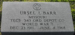
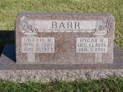
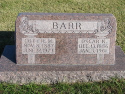
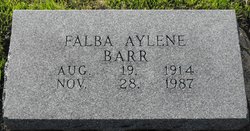
Ursel LaVerle Barr
| Birth | : | 23 Dec 1911 Shelby County, Missouri, USA |
| Death | : | 4 Jun 1968 Clarence, Shelby County, Missouri, USA |
| Burial | : | Sawyer-Drew Cemetery, Eaton Center, Carroll County, USA |
| Coordinate | : | 43.9022200, -71.0453300 |
| Plot | : | BUNN Block 1 Row 3 Lot 42s |
| Description | : | Occupation: Mechanic & Parts Mgr. MO d/c 23194 (All above posted by Pam Witherow) ------------------------------------------------- (All below posted by Lewis Wetzel) Clarence Courier, Clarence, Shelby, Missouri, Wednesday, November 13, 2013, page 11. Yesteryears 70 Years Ago, November 24, 1943, The Independent Courier. Pfc. Ursel L. Barr, oldest son of Mr. and Mrs. O. K. Barr, was inducted March 17, 1943 at Ft. Leavenworth, Kansas. He received training at Fort Francis E. Warren, Wyo., and was transferred to Normoyle, San Antonio, Texas when he received training on motor maintenance. Last month he was sent to New York, N.Y. and... Read More |
frequently asked questions (FAQ):
-
Where is Ursel LaVerle Barr's memorial?
Ursel LaVerle Barr's memorial is located at: Sawyer-Drew Cemetery, Eaton Center, Carroll County, USA.
-
When did Ursel LaVerle Barr death?
Ursel LaVerle Barr death on 4 Jun 1968 in Clarence, Shelby County, Missouri, USA
-
Where are the coordinates of the Ursel LaVerle Barr's memorial?
Latitude: 43.9022200
Longitude: -71.0453300
Family Members:
Parent
Spouse
Siblings
Children
Flowers:
Nearby Cemetories:
1. Sawyer-Drew Cemetery
Eaton Center, Carroll County, USA
Coordinate: 43.9022200, -71.0453300
2. Ward-Stuart Cemetery
Eaton, Carroll County, USA
Coordinate: 43.8995300, -71.0391100
3. Drew-Kenneson Cemetery
Eaton Center, Carroll County, USA
Coordinate: 43.9038890, -71.0572220
4. Flood Cemetery
Eaton Center, Carroll County, USA
Coordinate: 43.8988890, -71.0333330
5. Garland Cemetery
Eaton, Carroll County, USA
Coordinate: 43.9111500, -71.0320300
6. Snowville Cemetery
Eaton Center, Carroll County, USA
Coordinate: 43.9109250, -71.0617630
7. Brooks Cemetery
Eaton, Carroll County, USA
Coordinate: 43.8860600, -71.0409300
8. Bachelder Cemetery
Eaton, Carroll County, USA
Coordinate: 43.9140200, -71.0643600
9. Littlefield-Bean Cemetery
Eaton Center, Carroll County, USA
Coordinate: 43.9205560, -71.0372220
10. Perkins Cemetery
Eaton, Carroll County, USA
Coordinate: 43.9115300, -71.0160000
11. Jenness-Leavitt Cemetery
Eaton, Carroll County, USA
Coordinate: 43.8804900, -71.0565000
12. Thompson-Stuart Cemetery
Eaton, Carroll County, USA
Coordinate: 43.9221000, -71.0274000
13. Palmer Cemetery
Eaton, Carroll County, USA
Coordinate: 43.8973200, -71.0803000
14. Hatch Perkins Cemetery
Eaton Center, Carroll County, USA
Coordinate: 43.9181000, -71.0170000
15. Eaton Center Cemetery
Eaton Center, Carroll County, USA
Coordinate: 43.9087000, -71.0801000
16. Elwell Cemetery
Eaton, Carroll County, USA
Coordinate: 43.8905200, -71.0819300
17. Fernald Cemetery
Eaton, Carroll County, USA
Coordinate: 43.8825600, -71.0159200
18. Jones Cemetery
Eaton, Carroll County, USA
Coordinate: 43.9310600, -71.0595400
19. Currier-Wilkinson Cemetery
Eaton, Carroll County, USA
Coordinate: 43.8708500, -71.0433400
20. Thurston-Meserve Cemetery
Eaton, Carroll County, USA
Coordinate: 43.9105100, -71.0027800
21. Frank Hart Cemetery
Eaton Center, Carroll County, USA
Coordinate: 43.9145100, -71.0039600
22. Glines Hill Cemetery
Eaton, Carroll County, USA
Coordinate: 43.9105500, -71.0889300
23. Kenneson Cemetery
Eaton, Carroll County, USA
Coordinate: 43.9014700, -70.9997600
24. Allen Cemetery
Eaton, Carroll County, USA
Coordinate: 43.8698200, -71.0591800

